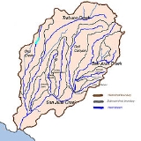
Trampas Canyon
Encyclopedia
Trampas Canyon is a short tributary of San Juan Creek
in southern Orange County
the U.S. state
of California
.
It rises in forks on steep slopes of the southern Santa Ana Mountains
(33.2918°N 117.3536°W), and flows north to where it is dammed by Trampas Canyon Dam (USGS San Clemente Quad 7½"). Trampas Canyon 1795-006 Dam (33.4983594°N 117.5875478°W)
forms a small lake that branches into four forks running east-west. Exiting the dam, the creek flows north and turns slightly to the west, where it joins San Juan Creek on the left bank, near the confluence of Cañada Gobernadora
(33.3053°N 117.3458°W). Trampas Canyon Creek is ephemeral
and only flows during storm events or while Trampas Canyon Dam is releasing, and is not a primary tributary of San Juan Creek.
A study was prepared in 1999 by the City of San Juan Capistrano, and it was found that a failure of the earthen Trampas Canyon Dam would do more damage to the lower course of San Juan Creek than for a 100 year flood. A failure would cause a floodwave over 0.5 mile (0.80467 km) wide to rush down the lower 4.7 miles (7.6 km) of San Juan Creek to Doheny State Beach
, flooding parts of San Juan Capistrano and Dana Point
. A 100 year flood would cause a slightly smaller inundation.
San Juan Creek
San Juan Creek, also called the San Juan River, is a stream in Orange County, California that consists of a catchment basin encompassing . Its mainstem rises in the Santa Ana Mountains, in the Trabuco Ranger District of the Cleveland National Forest...
in southern Orange County
Orange County, California
Orange County is a county in the U.S. state of California. Its county seat is Santa Ana. As of the 2010 census, its population was 3,010,232, up from 2,846,293 at the 2000 census, making it the third most populous county in California, behind Los Angeles County and San Diego County...
the U.S. state
U.S. state
A U.S. state is any one of the 50 federated states of the United States of America that share sovereignty with the federal government. Because of this shared sovereignty, an American is a citizen both of the federal entity and of his or her state of domicile. Four states use the official title of...
of California
California
California is a state located on the West Coast of the United States. It is by far the most populous U.S. state, and the third-largest by land area...
.
It rises in forks on steep slopes of the southern Santa Ana Mountains
Santa Ana Mountains
The Santa Ana Mountains are a short peninsular mountain range along the coast of Southern California in the United States. They extend for approximately 36 mi southeast of the Los Angeles Basin largely along the border between Orange and Riverside counties.- Geography :The range starts in the...
(33.2918°N 117.3536°W), and flows north to where it is dammed by Trampas Canyon Dam (USGS San Clemente Quad 7½"). Trampas Canyon 1795-006 Dam (33.4983594°N 117.5875478°W)
forms a small lake that branches into four forks running east-west. Exiting the dam, the creek flows north and turns slightly to the west, where it joins San Juan Creek on the left bank, near the confluence of Cañada Gobernadora
Cañada Gobernadora
Cañada Gobernadora is a tributary to San Juan Creek, about long, in southern Orange County in the U.S. state of California...
(33.3053°N 117.3458°W). Trampas Canyon Creek is ephemeral
Ephemeral
Ephemeral things are transitory, existing only briefly. Typically the term is used to describe objects found in nature, although it can describe a wide range of things....
and only flows during storm events or while Trampas Canyon Dam is releasing, and is not a primary tributary of San Juan Creek.
A study was prepared in 1999 by the City of San Juan Capistrano, and it was found that a failure of the earthen Trampas Canyon Dam would do more damage to the lower course of San Juan Creek than for a 100 year flood. A failure would cause a floodwave over 0.5 mile (0.80467 km) wide to rush down the lower 4.7 miles (7.6 km) of San Juan Creek to Doheny State Beach
Doheny State Beach
Doheny State Beach, protected as part of the California Department of Parks and Recreation, is a beach on the Pacific coast of Orange County, in Dana Point, Southern California....
, flooding parts of San Juan Capistrano and Dana Point
Dana Point, California
-Climate:Dana Point enjoys a mild climate where temperatures tend to average around the 60's. The warmest month of the year is August with an average temperature of 79 degrees Fahrenheit. The coldest month is December with an average minimum temperature of 44 degrees Fahrenheit.-2010:The 2010...
. A 100 year flood would cause a slightly smaller inundation.

