.gif)
Torre (Serra da Estrela)
Encyclopedia
Torre is a monument that marks the highest point of Mainland Portugal, and the second most elevated of the Portuguese Republic (only Mount Pico
, in the Azores
, is higher). This point is not a distinctive mountain summit, but rather the highest point in a mountain range. Torre has an unusual feature of being a summit that is accessible by paved road, the Regional Road 339 (R 339), formerly National Road 339 (N 339).
It is located in a mountain range named Serra da Estrela, on the border between the municipalities of Seia
, District of Guarda
and Covilhã
, District of Castelo Branco
. This tower also gives its name to the locality where it is situated, the highest place of that mountain range.
 The actual elevation of this area is 1,993 metres (6,637 feet), according to measures realized by the Instituto Geográfico do Exército (a military organization). Right in the highest point of the mountain range, situated in the middle of a roundabout
, near a road that connects the cities of Seia
and Covilhã
, a geodesic mark that shows the highest point in Serra da Estrela (called Torre), was built.
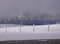
Near Torre, there are a restaurant, stores with typical products of this region, like the Serra da Estrela cheese
, and a ski center called Vodafone Ski Resort
, situated in the municipality of Seia. However, the nearest urban area of this place is the city of Covilhã, 20 km (12.4 mi) away, and the nearest accommodations are situated in the village of Penhas da Saúde
, 10 minutes away.
Mount Pico
Mount Pico is a stratovolcano and the highest point on Pico Island in the Azores. It reaches an altitude of 2,351 meters above sea level, which makes it the highest point in Portugal and also in the Mid-Atlantic Ridge...
, in the Azores
Azores
The Archipelago of the Azores is composed of nine volcanic islands situated in the middle of the North Atlantic Ocean, and is located about west from Lisbon and about east from the east coast of North America. The islands, and their economic exclusion zone, form the Autonomous Region of the...
, is higher). This point is not a distinctive mountain summit, but rather the highest point in a mountain range. Torre has an unusual feature of being a summit that is accessible by paved road, the Regional Road 339 (R 339), formerly National Road 339 (N 339).
It is located in a mountain range named Serra da Estrela, on the border between the municipalities of Seia
Seia
Seia Municipality is located in Guarda District in Portugal. It has a total area of 435.7 km² and a total population of 27,574 inhabitants. Its urban population is about 7,000...
, District of Guarda
Guarda (district)
The district of Guarda is located in the Centro Region of Portugal, except Vila Nova de Foz Côa, which is in the Norte Region. The district capital and most populous city is Guarda.-Municipalities:The district is contains 14 municipalities:...
and Covilhã
Covilhã
Covilhã is a city in Covilha Municipality in Centro region, Portugal. The city proper has 36,723 inhabitants, and the municipality has an area of 555.6 km² with a total population of 53,501, being composed of 31 parishes. It is located in the Cova da Beira subregion, in the district of...
, District of Castelo Branco
Castelo Branco (district)
Castelo Branco District is located in Central Portugal, the district capital is Castelo Branco, which is now also the most populous city, although the city of Covilhã was once the largest city....
. This tower also gives its name to the locality where it is situated, the highest place of that mountain range.

Roundabout
A roundabout is the name for a road junction in which traffic moves in one direction around a central island. The word dates from the early 20th century. Roundabouts are common in many countries around the world...
, near a road that connects the cities of Seia
Seia
Seia Municipality is located in Guarda District in Portugal. It has a total area of 435.7 km² and a total population of 27,574 inhabitants. Its urban population is about 7,000...
and Covilhã
Covilhã
Covilhã is a city in Covilha Municipality in Centro region, Portugal. The city proper has 36,723 inhabitants, and the municipality has an area of 555.6 km² with a total population of 53,501, being composed of 31 parishes. It is located in the Cova da Beira subregion, in the district of...
, a geodesic mark that shows the highest point in Serra da Estrela (called Torre), was built.
Near Torre, there are a restaurant, stores with typical products of this region, like the Serra da Estrela cheese
Serra da Estrela cheese
Serra da Estrela is a cheese from the cold and mountainous region of Serra da Estrela in Portugal, which has been granted PDO status in the European Union...
, and a ski center called Vodafone Ski Resort
Vodafone Ski Resort
Vodafone Ski Resort is a ski resort located in a mountain range named Serra da Estrela, in the municipality of Seia, parish of Loriga, Portugal.-Description:...
, situated in the municipality of Seia. However, the nearest urban area of this place is the city of Covilhã, 20 km (12.4 mi) away, and the nearest accommodations are situated in the village of Penhas da Saúde
Penhas da Saúde
Penhas da Saúde is a village in the municipality of Covilhã, Portugal. This mountain village sits right in the heart of Serra da Estrela, nestled within the scenic mountain range, at an altitude of 1,500 metres...
, 10 minutes away.

