
Tornadoes of 2005
Encyclopedia
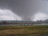
This page documents the tornadoes and tornado outbreaks of 2005, primarily (but not entirely) in the United States
. Most tornadoes form in the U.S., although some events may take place internationally, particularly in parts of neighboring southern Canada during the summer season.
The third quarter of 2005 was dominated by the tropics, and many of the tornadoes were related to the many hurricanes and tropical storms of the 2005 Atlantic hurricane season
. Several of the tornadoes were destructive.
November was clearly the most active month for tornado activity in the US, with four significant - and completely separate - tornado events, as the wind pattern shifted and the warm tropical Gulf of Mexico
added fuel to the fire when cold fronts passed southward, initiating the development of tornado outbreaks. December was much quieter as colder Arctic air became entrenched and the cold fronts became far less active.
There were officially 1,264 tornadoes reported in the US in 2005.
and Shiselweni
regions of Swaziland
. Thirty people were killed, though it is unknown how many of these deaths are directly attributable to the tornado.
; one in the Natomas neighborhood and one between Southport and Woodland
.
, destroying vehicles and power poles. Two strong tornadoes, an F2 and an F3, struck the town of Ralls
about 2.5 hours later, causing almost $800,000 in damage.
and Fergus
areas in Southern Ontario
, Canada. The storms morphed into heavy rain cells when reaching Toronto
. The Insurance Bureau of Canada has estimated that insured losses where the highest in the province's history, exceeding $500 million canadian dollar
s, two and a half times Ontario's losses during 1998 ice storm
and the second largest loss event in Canadian history.
United States
The United States of America is a federal constitutional republic comprising fifty states and a federal district...
. Most tornadoes form in the U.S., although some events may take place internationally, particularly in parts of neighboring southern Canada during the summer season.
Synopsis
The first half of 2005 was fairly slow when it comes to tornadoes. There were no major outbreaks in the first half of 2005, which is rather unusual. The inactivity in what is normally the peak months can be related to a stable low-pressure system that blocked the parade of storms from moving eastward.The third quarter of 2005 was dominated by the tropics, and many of the tornadoes were related to the many hurricanes and tropical storms of the 2005 Atlantic hurricane season
2005 Atlantic hurricane season
The 2005 Atlantic hurricane season was the most active Atlantic hurricane season in recorded history, repeatedly shattering numerous records. The impact of the season was widespread and ruinous with an estimated 3,913 deaths and record damage of about $159.2 billion...
. Several of the tornadoes were destructive.
November was clearly the most active month for tornado activity in the US, with four significant - and completely separate - tornado events, as the wind pattern shifted and the warm tropical Gulf of Mexico
Gulf of Mexico
The Gulf of Mexico is a partially landlocked ocean basin largely surrounded by the North American continent and the island of Cuba. It is bounded on the northeast, north and northwest by the Gulf Coast of the United States, on the southwest and south by Mexico, and on the southeast by Cuba. In...
added fuel to the fire when cold fronts passed southward, initiating the development of tornado outbreaks. December was much quieter as colder Arctic air became entrenched and the cold fronts became far less active.
There were officially 1,264 tornadoes reported in the US in 2005.
January
There were 33 tornadoes reported in the US in January. A total of 30 tornadoes were confirmed.January 7
January 8 (Hawaii)
January 8–11 (California)
January 12–14
First killer event of the year, four people were killed.January 28
A storm produced strong winds, severe hail, and an F1 tornado in the southern ManziniManzini District
Manzini is a district of Swaziland, located in the center-west of the country. It has an area of 5,068 km² and a population of 292,000 , and is divided into 16 tinkhundla. Its administrative center is Manzini. It borders all three other districts: Hhohho in the north, Lubombo in the east, and...
and Shiselweni
Shiselweni
Shiselweni is a district of Swaziland, located in the southwest of the country. It has an area of 3,790 km² and a population of 217,000 , and is divided into 14 tinkhundla. Its administrative center is Nhlangano. It borders Lubombo District in the northeast and Manzini District in the northwest....
regions of Swaziland
Swaziland
Swaziland, officially the Kingdom of Swaziland , and sometimes called Ngwane or Swatini, is a landlocked country in Southern Africa, bordered to the north, south and west by South Africa, and to the east by Mozambique...
. Thirty people were killed, though it is unknown how many of these deaths are directly attributable to the tornado.
February
There were 10 tornadoes reported in the US in February. A total of 9 tornadoes were confirmedFebruary 19
February 21
Two tornadoes hit near Sacramento, CaliforniaSacramento, California
Sacramento is the capital city of the U.S. state of California and the county seat of Sacramento County. It is located at the confluence of the Sacramento River and the American River in the northern portion of California's expansive Central Valley. With a population of 466,488 at the 2010 census,...
; one in the Natomas neighborhood and one between Southport and Woodland
Woodland, California
Woodland is the county seat of Yolo County, California, located approximately northwest of Sacramento, and is a part of the Sacramento - Arden-Arcade - Roseville Metropolitan Statistical Area. The population was 55,468 at the 2010 census.Woodland's origins trace back to 1850 when California...
.
February 23
February 26
February 27
May 12
A small outbreak of nine tornadoes occurred in Texas. The majority of the tornadoes were rated F0, however, three of them were significant. An F2 tornado struck the town of South PlainsSouth Plains, Texas
South Plains is an unincorporated community in northern Floyd County, Texas, United States. It lies along State Highway 207 north of the city of Floydada, the county seat of Floyd County. Its elevation is 3,215 feet...
, destroying vehicles and power poles. Two strong tornadoes, an F2 and an F3, struck the town of Ralls
Ralls, Texas
Ralls is an agricultural community in Crosby County, West Texas, United States, named after John Robinson Ralls, who, with the help of W.E. McLaughlin, laid out the townsite in July 1911...
about 2.5 hours later, causing almost $800,000 in damage.
August 19
A series of thunderstorms on the afternoon of August 19, 2005, spawned tornadoes damaging homes in the Conestoga LakeConestoga Lake
Conestoga Lake or Conestogo Lake may refer to one of two lakes:*Conestogo Lake, Ontario, Canada. A reservoir with a flood control dam....
and Fergus
Fergus, Ontario
Fergus is the largest community in Centre Wellington, a township within Wellington County in Ontario, Canada. It lies on the Grand River about 25 km north of Guelph.-History:...
areas in Southern Ontario
Southern Ontario
Southern Ontario is a region of the province of Ontario, Canada that lies south of the French River and Algonquin Park. Depending on the inclusion of the Parry Sound and Muskoka districts, its surface area would cover between 14 to 15% of the province. It is the southernmost region of...
, Canada. The storms morphed into heavy rain cells when reaching Toronto
Toronto
Toronto is the provincial capital of Ontario and the largest city in Canada. It is located in Southern Ontario on the northwestern shore of Lake Ontario. A relatively modern city, Toronto's history dates back to the late-18th century, when its land was first purchased by the British monarchy from...
. The Insurance Bureau of Canada has estimated that insured losses where the highest in the province's history, exceeding $500 million canadian dollar
Canadian dollar
The Canadian dollar is the currency of Canada. As of 2007, the Canadian dollar is the 7th most traded currency in the world. It is abbreviated with the dollar sign $, or C$ to distinguish it from other dollar-denominated currencies...
s, two and a half times Ontario's losses during 1998 ice storm
North American ice storm of 1998
The North American ice storm of 1998 was a massive combination of five smaller successive ice storms which combined to strike a relatively narrow swath of land from eastern Ontario to southern Quebec to Nova Scotia in Canada, and bordering areas from northern New York to central Maine in the...
and the second largest loss event in Canadian history.
August 28–31: Hurricane Katrina
November 5–6
November 12
November 15
November 27–28
External links
- Monthly Tornado Stats (SPC)
- Annual Severe Weather Report Summary 2005 (SPC)
- U.S. tornadoes in 2005 - Tornado History Project
- Tornado project tornadoes of 2005
- Storm Data "2005 Annual Summaries" (NCDC)