
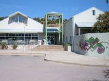
Tijeras, New Mexico
Encyclopedia
Tijeras is a village in Bernalillo County
, New Mexico
, United States
. The population was 474 at the 2000 census. It is part of the Albuquerque
Metropolitan Statistical Area
.
, leading to the west, toward Albuquerque
, and Cedro Canyon, leading to the south, toward the Manzano Mountains
. New Mexico State Highway 14 leads north from the village, toward Cedar Crest
, Sandia Crest
, Madrid
and Santa Fe
.
According to the United States Census Bureau
, the village has a total area of 0.9 square miles (2.3 km²), all of it land.
of 2000, there were 474 people, 191 households, and 131 families residing in the village. The population density
was 559.5 people per square mile (215.3/km²). There were 210 housing units at an average density of 247.9 per square mile (95.4/km²). The racial makeup of the village was 65.82% White, 1.05% Native American, 0.21% Asian, 28.06% from other races
, and 4.85% from two or more races. Hispanic or Latino of any race were 56.33% of the population.
There were 191 households out of which 33.5% had children under the age of 18 living with them, 52.9% were married couples
living together, 10.5% had a female householder with no husband present, and 31.4% were non-families. 24.6% of all households were made up of individuals and 9.4% had someone living alone who was 65 years of age or older. The average household size was 2.48 and the average family size was 3.02.
In the village the population was spread out with 26.8% under the age of 18, 7.2% from 18 to 24, 28.5% from 25 to 44, 27.2% from 45 to 64, and 10.3% who were 65 years of age or older. The median age was 39 years. For every 100 females there were 107.0 males. For every 100 females age 18 and over, there were 111.6 males.
The median income for a household in the village was $34,167, and the median income for a family was $46,250. Males had a median income of $31,750 versus $25,179 for females. The per capita income
for the village was $18,836. About 9.6% of families and 9.5% of the population were below the poverty line, including 5.4% of those under age 18 and 20.0% of those age 65 or over.
Bernalillo County, New Mexico
-2010:Whereas according to the 2010 U.S. Census Bureau:*69.4% White*3.0% Black*4.8% Native American*2.3% Asian*0.1% Native Hawaiian or Pacific Islander*4.4% Two or more races*16.0% Other races*47.9% Hispanic or Latino -2000:...
, New Mexico
New Mexico
New Mexico is a state located in the southwest and western regions of the United States. New Mexico is also usually considered one of the Mountain States. With a population density of 16 per square mile, New Mexico is the sixth-most sparsely inhabited U.S...
, United States
United States
The United States of America is a federal constitutional republic comprising fifty states and a federal district...
. The population was 474 at the 2000 census. It is part of the Albuquerque
Albuquerque, New Mexico
Albuquerque is the largest city in the state of New Mexico, United States. It is the county seat of Bernalillo County and is situated in the central part of the state, straddling the Rio Grande. The city population was 545,852 as of the 2010 Census and ranks as the 32nd-largest city in the U.S. As...
Metropolitan Statistical Area
Albuquerque metropolitan area
The Albuquerque Metropolitan Statistical Area is a metropolitan area in central New Mexico centered on the city of Albuquerque that covers four counties - Bernalillo, Sandoval, Torrance, and Valencia. As of the 2000 census, the MSA had a population of 729,649...
.
Geography
Tijeras is located at 35°5′15"N 106°22′38"W (35.087550, -106.377354), at the junction of Tijeras CanyonTijeras Canyon
Tijeras Canyon is a prominent canyon in the central part of the US state of New Mexico. Tijeras Canyon is often referred to by locals as the I-40 Canyon after the major highway that traverses it, linking Albuquerque and points east. It separates the Sandia Mountains to the north from the Manzano...
, leading to the west, toward Albuquerque
Albuquerque, New Mexico
Albuquerque is the largest city in the state of New Mexico, United States. It is the county seat of Bernalillo County and is situated in the central part of the state, straddling the Rio Grande. The city population was 545,852 as of the 2010 Census and ranks as the 32nd-largest city in the U.S. As...
, and Cedro Canyon, leading to the south, toward the Manzano Mountains
Manzano Mountains
The Manzano Mountains are a small mountain range in the central part of the US State of New Mexico. They are oriented north-south and are about 40 miles long. The center of the range lies about 25 miles southeast of Albuquerque, and the northern foothills are just a few miles east of the edge of...
. New Mexico State Highway 14 leads north from the village, toward Cedar Crest
Cedar Crest, New Mexico
Cedar Crest is a census-designated place in Bernalillo County, New Mexico, United States. The population was 1,060 at the 2000 census. It is part of the Albuquerque Metropolitan Statistical Area.-Geography:...
, Sandia Crest
Sandia Mountains
The Sandia Mountains name posu gai hoo-oo, "where water slides down arroyo") are a mountain range located in Bernalillo and Sandoval counties, immediately to the east of the city of Albuquerque in New Mexico in the southwestern United States. The range is largely within the Cibola National...
, Madrid
Madrid, New Mexico
Madrid is a census-designated place in Santa Fe County, New Mexico, United States. It is part of the Santa Fe, New Mexico Metropolitan Statistical Area. The population was 149 at the 2000 census. Today Madrid has become an artists community with galleries lining Route 14...
and Santa Fe
Santa Fe, New Mexico
Santa Fe is the capital of the U.S. state of New Mexico. It is the fourth-largest city in the state and is the seat of . Santa Fe had a population of 67,947 in the 2010 census...
.
According to the United States Census Bureau
United States Census Bureau
The United States Census Bureau is the government agency that is responsible for the United States Census. It also gathers other national demographic and economic data...
, the village has a total area of 0.9 square miles (2.3 km²), all of it land.
Demographics
As of the censusCensus
A census is the procedure of systematically acquiring and recording information about the members of a given population. It is a regularly occurring and official count of a particular population. The term is used mostly in connection with national population and housing censuses; other common...
of 2000, there were 474 people, 191 households, and 131 families residing in the village. The population density
Population density
Population density is a measurement of population per unit area or unit volume. It is frequently applied to living organisms, and particularly to humans...
was 559.5 people per square mile (215.3/km²). There were 210 housing units at an average density of 247.9 per square mile (95.4/km²). The racial makeup of the village was 65.82% White, 1.05% Native American, 0.21% Asian, 28.06% from other races
Race (United States Census)
Race and ethnicity in the United States Census, as defined by the Federal Office of Management and Budget and the United States Census Bureau, are self-identification data items in which residents choose the race or races with which they most closely identify, and indicate whether or not they are...
, and 4.85% from two or more races. Hispanic or Latino of any race were 56.33% of the population.
There were 191 households out of which 33.5% had children under the age of 18 living with them, 52.9% were married couples
Marriage
Marriage is a social union or legal contract between people that creates kinship. It is an institution in which interpersonal relationships, usually intimate and sexual, are acknowledged in a variety of ways, depending on the culture or subculture in which it is found...
living together, 10.5% had a female householder with no husband present, and 31.4% were non-families. 24.6% of all households were made up of individuals and 9.4% had someone living alone who was 65 years of age or older. The average household size was 2.48 and the average family size was 3.02.
In the village the population was spread out with 26.8% under the age of 18, 7.2% from 18 to 24, 28.5% from 25 to 44, 27.2% from 45 to 64, and 10.3% who were 65 years of age or older. The median age was 39 years. For every 100 females there were 107.0 males. For every 100 females age 18 and over, there were 111.6 males.
The median income for a household in the village was $34,167, and the median income for a family was $46,250. Males had a median income of $31,750 versus $25,179 for females. The per capita income
Per capita income
Per capita income or income per person is a measure of mean income within an economic aggregate, such as a country or city. It is calculated by taking a measure of all sources of income in the aggregate and dividing it by the total population...
for the village was $18,836. About 9.6% of families and 9.5% of the population were below the poverty line, including 5.4% of those under age 18 and 20.0% of those age 65 or over.