

Tazewell, Virginia
Encyclopedia
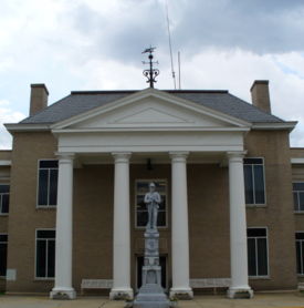
Tazewell is a town in Tazewell County
, Virginia
, USA
. The population was 4,206 at the 2000 census. It is part of the Bluefield
, WV
-VA micropolitan area
, which has a population of 107,578. It is the county seat
of Tazewell County
.
Originally named Jeffersonville, Tazewell is situated near the headwaters of the Clinch River
. It is one of the smallest towns in the United States
to once own a street car.
According to the United States Census Bureau
, the town has a total area of 4.0 square miles (10.5 km2), all of it land.
of 2000, there were 4,206 people, 1,650 households, and 1,098 families residing in the town. The population density
was 1,040.1 people per square mile (402.0/km2). There were 1,804 housing units at an average density of 446.1 per square mile (172.4/km2). The racial makeup of the town was 88.78% White, 9.32% African American, 0.17% Native American, 0.52% Asian, 0.36% from other races
, and 0.86% from two or more races. Hispanic or Latino of any race were 0.62% of the population.
 There were 1,650 households out of which 26.1% had children under the age of 18 living with them, 51.7% were married couples
living together, 11.8% had a female householder with no husband present, and 33.4% were non-families. 31.2% of all households were made up of individuals and 15.6% had someone living alone who was 65 years of age or older. The average household size was 2.25 and the average family size was 2.81.
In the town the population was spread out with 18.6% under the age of 18, 8.1% from 18 to 24, 26.3% from 25 to 44, 25.3% from 45 to 64, and 21.7% who were 65 years of age or older. The median age was 43 years. For every 100 females there were 92.1 males. For every 100 females age 18 and over, there were 87.3 males.
The median income for a household in the town was $28,510, and the median income for a family was $37,792. Males had a median income of $35,912 versus $22,664 for females. The per capita income
for the town was $15,468. About 11.6% of families and 20.6% of the population were below the poverty line, including 20.7% of those under age 18 and 27.8% of those age 65 or over.
Tazewell County, Virginia
As of the census of 2000, there were 44,598 people, 18,277 households and 13,232 families residing in the county. The population density was 86 people per square mile . There were 20,390 housing units at an average density of 39 per square mile...
, Virginia
Virginia
The Commonwealth of Virginia , is a U.S. state on the Atlantic Coast of the Southern United States. Virginia is nicknamed the "Old Dominion" and sometimes the "Mother of Presidents" after the eight U.S. presidents born there...
, USA
United States
The United States of America is a federal constitutional republic comprising fifty states and a federal district...
. The population was 4,206 at the 2000 census. It is part of the Bluefield
Bluefield, West Virginia
Bluefield is a city in Mercer County, West Virginia, United States. The population was 10,447 at the 2010 census. It is also the core city of the Bluefield WV-VA micropolitan area which has a population of 107,342.-Geography & Climate:...
, WV
West Virginia
West Virginia is a state in the Appalachian and Southeastern regions of the United States, bordered by Virginia to the southeast, Kentucky to the southwest, Ohio to the northwest, Pennsylvania to the northeast and Maryland to the east...
-VA micropolitan area
Bluefield micropolitan area
The Bluefield Micropolitan Statistical Area, as defined by the United States Census Bureau, is an area consisting of two counties – one in West Virginia and one in Virginia – anchored by the city of Bluefield, West Virginia....
, which has a population of 107,578. It is the county seat
County seat
A county seat is an administrative center, or seat of government, for a county or civil parish. The term is primarily used in the United States....
of Tazewell County
Tazewell County, Virginia
As of the census of 2000, there were 44,598 people, 18,277 households and 13,232 families residing in the county. The population density was 86 people per square mile . There were 20,390 housing units at an average density of 39 per square mile...
.
Originally named Jeffersonville, Tazewell is situated near the headwaters of the Clinch River
Clinch River
The Clinch River rises in Southwest Virginia near Tazewell, Virginia and flows southwest through the Great Appalachian Valley, gathering various tributaries including the Powell River before joining the Tennessee River in East Tennessee.-Course:...
. It is one of the smallest towns in the United States
United States
The United States of America is a federal constitutional republic comprising fifty states and a federal district...
to once own a street car.
Geography
Tazewell is located at 37.126938°N 81.519455°W (37.126938, -81.519455).According to the United States Census Bureau
United States Census Bureau
The United States Census Bureau is the government agency that is responsible for the United States Census. It also gathers other national demographic and economic data...
, the town has a total area of 4.0 square miles (10.5 km2), all of it land.
Demographics
As of the censusCensus
A census is the procedure of systematically acquiring and recording information about the members of a given population. It is a regularly occurring and official count of a particular population. The term is used mostly in connection with national population and housing censuses; other common...
of 2000, there were 4,206 people, 1,650 households, and 1,098 families residing in the town. The population density
Population density
Population density is a measurement of population per unit area or unit volume. It is frequently applied to living organisms, and particularly to humans...
was 1,040.1 people per square mile (402.0/km2). There were 1,804 housing units at an average density of 446.1 per square mile (172.4/km2). The racial makeup of the town was 88.78% White, 9.32% African American, 0.17% Native American, 0.52% Asian, 0.36% from other races
Race (United States Census)
Race and ethnicity in the United States Census, as defined by the Federal Office of Management and Budget and the United States Census Bureau, are self-identification data items in which residents choose the race or races with which they most closely identify, and indicate whether or not they are...
, and 0.86% from two or more races. Hispanic or Latino of any race were 0.62% of the population.
Marriage
Marriage is a social union or legal contract between people that creates kinship. It is an institution in which interpersonal relationships, usually intimate and sexual, are acknowledged in a variety of ways, depending on the culture or subculture in which it is found...
living together, 11.8% had a female householder with no husband present, and 33.4% were non-families. 31.2% of all households were made up of individuals and 15.6% had someone living alone who was 65 years of age or older. The average household size was 2.25 and the average family size was 2.81.
In the town the population was spread out with 18.6% under the age of 18, 8.1% from 18 to 24, 26.3% from 25 to 44, 25.3% from 45 to 64, and 21.7% who were 65 years of age or older. The median age was 43 years. For every 100 females there were 92.1 males. For every 100 females age 18 and over, there were 87.3 males.
The median income for a household in the town was $28,510, and the median income for a family was $37,792. Males had a median income of $35,912 versus $22,664 for females. The per capita income
Per capita income
Per capita income or income per person is a measure of mean income within an economic aggregate, such as a country or city. It is calculated by taking a measure of all sources of income in the aggregate and dividing it by the total population...
for the town was $15,468. About 11.6% of families and 20.6% of the population were below the poverty line, including 20.7% of those under age 18 and 27.8% of those age 65 or over.