Talgua
Encyclopedia

Municipality
A municipality is essentially an urban administrative division having corporate status and usually powers of self-government. It can also be used to mean the governing body of a municipality. A municipality is a general-purpose administrative subdivision, as opposed to a special-purpose district...
in the Honduran
Honduras
Honduras is a republic in Central America. It was previously known as Spanish Honduras to differentiate it from British Honduras, which became the modern-day state of Belize...
department of Lempira.
History
Talgua was originally founded in the colonial period in the place called "Las Mercedes" village. Also it was known as a village where Lenca Indians dwelled, by Pedro de AlvaradoPedro de Alvarado
Pedro de Alvarado y Contreras was a Spanish conquistador and governor of Guatemala. He participated in the conquest of Cuba, in Juan de Grijalva's exploration of the coasts of Yucatan and the Gulf of Mexico, and in the conquest of Mexico led by Hernan Cortes...
and his troops. In the administration of president Ramon Villeda Morales, on January 2, 1963, the capital was moved from Talagua to San Antonio de Pedernales. The old church is preserved as a relic.
Geography
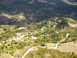
It is located right on top a small hill on the side of a river. But there are high mountains around its capital and some of these belong to CopánCopán
Copán is an archaeological site of the Maya civilization located in the Copán Department of western Honduras, not far from the border with Guatemala. It was the capital city of a major Classic period kingdom from the 5th to 9th centuries AD...
department. The weather is hot because of the elevation from sea level and the vegetation, which consists of dry sub tropical forest. Some pine trees are seen on the highest hills.
Boundaries
Its boundaries are:- North : CopánCopánCopán is an archaeological site of the Maya civilization located in the Copán Department of western Honduras, not far from the border with Guatemala. It was the capital city of a major Classic period kingdom from the 5th to 9th centuries AD...
department - South : Las FloresLas Flores, LempiraLas Flores is a municipality in the Honduran department of Lempira.Las Flores is one of the municipalities of the Lempira department. It is located at 17 km from Gracias on the paved road that leads to Santa Rosa de Copán. The town is 200 meters away from the paved road.- History :The very...
municipality - East : Las FloresLas Flores, LempiraLas Flores is a municipality in the Honduran department of Lempira.Las Flores is one of the municipalities of the Lempira department. It is located at 17 km from Gracias on the paved road that leads to Santa Rosa de Copán. The town is 200 meters away from the paved road.- History :The very...
municipality - West : CopánCopánCopán is an archaeological site of the Maya civilization located in the Copán Department of western Honduras, not far from the border with Guatemala. It was the capital city of a major Classic period kingdom from the 5th to 9th centuries AD...
department
- Surface Extents: 82 km²

Resources
Talgua is of the poorest municipalities of the department. Due to its elevation from sea level is not possible to have coffee plantations, therefore the main economic activities are beans and corn crops, followed by commerce of groceries and other home supplies. Cattle raising is for local consumption only. Since it is near a river, some people obtain aggregates for concrete from it. Also it has electricity and mobile communication coverage.Population
Mestizos are up to 80 % of the population, the remaining percent consists of indigenous Lenca communities.- Population: There were 8,399 people in 2001, and it is expected to have about 9,768 in 2008.
- Villages: 14
- Settlements: 50

