
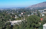
Talgar
Encyclopedia
Talgar Mountains

The Talgar mountains are peculiar of vertical zonality, that specified a wide variety of landscapes. The high-mountainous nival glacial band occupies altitudes of 3000 m and more above sea level and is characterized by sharp tops and steep stony declines. It is the place of formation of glaciers whose tongues penetrate into spur valleys of the head rivers. The basic type of vegetation is alpine meadows, rich in edelweiss
Edelweiss
Edelweiss , Leontopodium alpinum, is a well-known European mountain flower, belonging to the sunflower family.-Names:The common name comes from German edel, meaning "noble", and weiß "white", thus signifying "noble whiteness".The scientific name Leontopodium is a Latin adaptation of Greek...
es, alpine poppies, daisies and original high-mountain sedge bogs. Pik Talgar
Pik Talgar
Pik Talgar is a northern peak in the Tian Shan mountain range in Kazakhstan, named after Talgar river and city. It is the highest peak of the Trans-Ili Alatau. Due to its close proximity to the former capital of Kazakhstan, Almaty, it is a popular mountaineering destination.-External links:*...
is the highest peak of the Talgar mountains and Zailiisky Alatau as well. Its highest point reaches 4,979 metres above sea level. The peak is located about 10 km from the center of Talgar.
The sub-alpine chord (2400–3000 m) of the Talgar mountains is characterized by dominant high-grass meadows and steppe with juniper bushes on southern stony slopes. The erosive relief of the middle part of the mountains occupies absolute altitudes in a range of 1700 up to 3000 m. Gorges and narrow valleys up to 700 m. deep with steep slopes are most typical here. The relief of the given chord is notable for intensive by slope processes: talus, downfalls and rockfalls. Bush-meadow-coniferous forest chord has a composite vegetative overlying strata. Northern slopes are occupied by endemic fir-trees of Schrenk, while southern by bushes of dogrose. Also there are aspen forests, and sometimes birch woods. Bushes and small-leaved wood band (1400–1600 m) is located in a submontane part. It was affected by anthropogenic factor, which has changed a tentative vegetative overlying strata. The groves of Siverse apple-tree and wild apricot are remained. On southern slopes rosaries are widely spread.
In general the territory is a young mountain land. Thus, Talgar mountains are notable for catastrophic cyclic natural processes such as earthquakes, mudflows, and snow avalanches.
Climate
The town lies within the hot summer continental climate zone (Koppen Dsa), and experiences four distinct seasons with hot, dry summers and mild winters. Average annual temperature is 7.7-8.7°C. In July, typically the warmest month, high temperatures average 22.4 °C and low temperatures 19.3 °C. In January, typically the coldest month, high temperatures average -3.7 °C with low temperatures averaging −7.4 °C. First autumn frosts take place in the middle of October, last spring frosts in the end of April.Talgar’s yearly precipitation averages 463–779 mm. Spring is typically the rainiest season, with short-lived rainfall and thunderstorms more common than prolonged rainy periods. Winter precipitation tends to be more snow than rain.
External links
- http://www.e-talgar.com/
- http://www.talgar.kz/
- http://www.talgar.narod.ru/
- http://www.almaty-reg.kz/almaty/region/talgar.phtml