

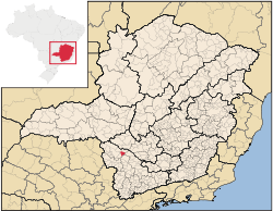
São José da Barra
Encyclopedia
Minas Gerais
Minas Gerais is one of the 26 states of Brazil, of which it is the second most populous, the third richest, and the fourth largest in area. Minas Gerais is the Brazilian state with the largest number of Presidents of Brazil, the current one, Dilma Rousseff, being one of them. The capital is the...
. Its population as of 2007 was 6,701 people living in a total area of 312 km². The city belongs to the meso-region of Sul e Sudoeste de Minas and to the micro-region of Passos
Passos, Minas Gerais
Passos is a Brazilian municipality located in the southwest of the state of Minas Gerais. Its population as of 2007 was 122,765 people living in a total area of 1,339 km². The city belongs to the meso-region of Sul e Sudoeste de Minas and to the micro-region of Passos...
. It became a municipality in 1948. The important hydroelectric plant of Furnas is located here.
Location
The city center of São José da Barra is located at an elevation of 695 meters in the valley of the Rio Grande, a short distance northeast of regional center, PassosPassos, Minas Gerais
Passos is a Brazilian municipality located in the southwest of the state of Minas Gerais. Its population as of 2007 was 122,765 people living in a total area of 1,339 km². The city belongs to the meso-region of Sul e Sudoeste de Minas and to the micro-region of Passos...
. Neighboring municipalities are: São João Batista do Glória
São João Batista do Glória
São João Batista do Glória is a Brazilian municipality located in the southwest of the state of Minas Gerais. Its population as of 2007 was 6,828 people living in a total area of 553 km². The city belongs to the meso-region of Sul e Sudoeste de Minas and to the micro-region of Passos...
and Capitólio
Capitólio
Capitólio is a Brazilian municipality located in the southwest of the state of Minas Gerais. Its population as of 2007 was 7,634 people living in a total area of 522 km². The city belongs to the meso-region of Sul e Sudoeste de Minas and to the micro-region of Passos...
(N), Guapé (E), Carmo do Rio Claro
Carmo do Rio Claro
Carmo do Rio Claro is a city and municipality located in the south-west of Minas Gerais state, Brazil. The distance to the state capital, Belo Horizonte is 374 km....
(SE), Alpinópolis
Alpinópolis
Alpinópolis is a Brazilian municipality located in the southwest of the state of Minas Gerais. As of 2007, its population was 17,821 people and its area was of 458 km². The city is located in the Southwestern region of Minas Gerais and the micro-region of Passos. It became a municipality in 1938...
(S), and Passos
Passos, Minas Gerais
Passos is a Brazilian municipality located in the southwest of the state of Minas Gerais. Its population as of 2007 was 122,765 people living in a total area of 1,339 km². The city belongs to the meso-region of Sul e Sudoeste de Minas and to the micro-region of Passos...
(W).
Distances
- Belo HorizonteBelo HorizonteBelo Horizonte is the capital of and largest city in the state of Minas Gerais, located in the southeastern region of Brazil. It is the third largest metropolitan area in the country...
: 320 km - PiumhiPiumhiPiumhi is a Brazilian municipality located in the west of the state of Minas Gerais. Its population as of 2007 was 30,984 people living in a total area of 902 km². The city belongs to the meso-region of Oeste de Minas and Alto Paranaíba and to the micro-region of Piumhi...
: 63 km - PassosPassos, Minas GeraisPassos is a Brazilian municipality located in the southwest of the state of Minas Gerais. Its population as of 2007 was 122,765 people living in a total area of 1,339 km². The city belongs to the meso-region of Sul e Sudoeste de Minas and to the micro-region of Passos...
: 26 km - AlpinópolisAlpinópolisAlpinópolis is a Brazilian municipality located in the southwest of the state of Minas Gerais. As of 2007, its population was 17,821 people and its area was of 458 km². The city is located in the Southwestern region of Minas Gerais and the micro-region of Passos. It became a municipality in 1938...
: 17 km
History
The city is also known as Nova Barra since it used to lie on the banks of the Rio Grande, where that river was joined by the Rio Sapucaí. When Furnas was built this old settlement was flooded and a new one was built.Economic Activities
Services, energy production from the Furnas dam, and agriculture are the main economic activities. The GDP in 2005 was approximately R$434 million, with 82 million reais from taxes, 33 million reais from services, 300 million reais from industry, and 18 million reais from agriculture. The biggest employer was energy production with 250 workers in 2005. In the rural area there were 204 producers on 16,000 hectares of land. Approximately 1400 persons were occupied in agriculture. The main crops are coffee, beans, and corn. There were 9,000 head of cattle, of which 3,500 were milk cows (2006). The poultry industry is substantial.There were 2 banks (2007). In the vehicle fleet there were 782 automobiles, 69 trucks, 82 pickup trucks, 24 buses, and 220 motorcycles (2007).
Health and Education
In the health sector there were 5 health clinics (2005). Educational needs of 1,670 students were attended to by 5 primary schools, 2 middle schools, and 4 pre-primary schools.- Municipal Human Development IndexHuman Development IndexThe Human Development Index is a composite statistic used to rank countries by level of "human development" and separate "very high human development", "high human development", "medium human development", and "low human development" countries...
: 0.793 (2000) - State ranking: 64 out of 853 municipalities as of 2000
- National ranking: 735 out of 5,138 municipalities as of 2000
- Literacy rate: 90%
- Life expectancy: 74 (average of males and females)
In 2000 the per capita monthly income of R$278.00 was above the state average of R$276.00 and below the national average of R$297.00. Poços de Caldas
Poços de Caldas
Poços de Caldas is a city and municipality in south-western Minas Gerais state, Brazil, in the microregion of the same name. Its estimated population in 2009 was 151,449 inhabitants...
had the highest per capita monthly income in 2000 with R$435.00. The lowest was Setubinha
Setubinha
Setubinha is a municipality in the northeast of the Brazilian state of Minas Gerais. As of 2007 the population was 10,834 in a total area of 536 km². The elevation is 729 metres. It is part of the IBGE statistical microregion of Teófilo Otoni...
with R$73.00.
The highest ranking municipality in Minas Gerais in 2000 was Poços de Caldas
Poços de Caldas
Poços de Caldas is a city and municipality in south-western Minas Gerais state, Brazil, in the microregion of the same name. Its estimated population in 2009 was 151,449 inhabitants...
with 0.841, while the lowest was Setubinha
Setubinha
Setubinha is a municipality in the northeast of the Brazilian state of Minas Gerais. As of 2007 the population was 10,834 in a total area of 536 km². The elevation is 729 metres. It is part of the IBGE statistical microregion of Teófilo Otoni...
with 0.568. Nationally the highest was São Caetano do Sul
São Caetano do Sul
São Caetano do Sul is a city in São Paulo state in Brazil, located in the Greater São Paulo Metropolitan Area. It is the city with the highest per capita income in Brazil and it also has the highest Human Development Index .-Geography:São Caetano do Sul is located on a plateau that is part of the...
in São Paulo with 0.919, while the lowest was Setubinha. In more recent statistics (considering 5,507 municipalities) Manari in the state of Pernambuco
Pernambuco
Pernambuco is a state of Brazil, located in the Northeast region of the country. To the north are the states of Paraíba and Ceará, to the west is Piauí, to the south are Alagoas and Bahia, and to the east is the Atlantic Ocean. There are about of beaches, some of the most beautiful in the...
has the lowest rating in the country—0,467—putting it in last place.