

Piumhi
Encyclopedia
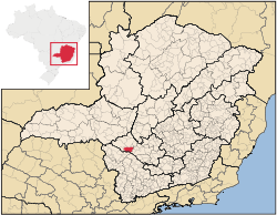
Minas Gerais
Minas Gerais is one of the 26 states of Brazil, of which it is the second most populous, the third richest, and the fourth largest in area. Minas Gerais is the Brazilian state with the largest number of Presidents of Brazil, the current one, Dilma Rousseff, being one of them. The capital is the...
. Its population as of 2007 was 30,984 people living in a total area of 902 km². The city belongs to the meso-region of Oeste de Minas and Alto Paranaíba and to the micro-region of Piumhi. It became a municipality in 1868.
The name
The origin of the word "pium-i" is indigenous and it means either "river of many fish" or "water of many flies".On older maps the city is referred to as Piui and is referred to as such by Citybrazil. The official name given by IBGE and by the city government site is Piumhi.
Location
The city center of Piumhi is located at an elevation of 922 meters, just off state highway MG-050. Neighboring municipalities are: BambuíBambuí
Bambuí is a Brazilian municipality located in the west of the state of Minas Gerais. Its population as of 2007 was 21,850 people living in a total area of 1,455 km². The city belongs to the meso-region of Oeste de Minas and to the micro-region of Piumhi...
(N), Doresópolis
Doresópolis
Doresópolis is a Brazilian municipality located in the west of the state of Minas Gerais. Its population as of 2007 was 1,492 people living in a total area of 153 km². The city belongs to the meso-region of Oeste de Minas and to the micro-region of Piumhi. It became a municipality in...
(NE), São Roque de Minas
São Roque de Minas
São Roque de Minas is a Brazilian municipality located in the west of the state of Minas Gerais. Its population as of 2007 was 6,141 people living in a total area of 2,100 km². The city belongs to the meso-region of Oeste de Minas and to the micro-region of Piumhi...
(S and SE), and Sacramento
Sacramento, Minas Gerais
Sacramento is a Brazilian municipality located in the west of the state of Minas Gerais. Its population as of 2007 was 22,159 people living in a total area of 3,071 km². The city belongs to the meso-region of Triângulo Mineiro and Alto Paranaíba and to the micro-region of Araxá...
(W). The great reservoir of Furnas lies a short distance to the south and the National Park of Serra da Canastra, with the source of the São Francisco River
São Francisco River
The São Francisco is a river in Brazil. With a length of , it is the longest river that runs entirely in Brazilian territory, and the fourth longest in South America and overall in Brazil...
, lies 50 km to the west.
Communications and Distances
Piumhi is connected to PassosPassos
-People:* Cristiano Ávalos dos Passos* John Dos Passos* Márcio Emerson Passos de Albuquerque, a Brazilian footballer* Rosa Passos* Vítor Hugo Gomes Passos, a Portuguese footballer-Brazil:* Passos, Minas Gerais, a municipality in the State of Minas Gerais...
, in the southwest, and Formiga
Formiga
Formiga is a and municipality in central-west Minas Gerais state, Brazil. The population of the municipality in 2007 is 64,585. The area of the municipality is 1,504 km². It is located in the statistical meso-region of Centro-Oeste de Minas and the statistical micro-region of Formiga...
, in the east, by state highway MG-050. The nearest railroad station is in Formiga
Formiga
Formiga is a and municipality in central-west Minas Gerais state, Brazil. The population of the municipality in 2007 is 64,585. The area of the municipality is 1,504 km². It is located in the statistical meso-region of Centro-Oeste de Minas and the statistical micro-region of Formiga...
. The distance to Belo Horizonte
Belo Horizonte
Belo Horizonte is the capital of and largest city in the state of Minas Gerais, located in the southeastern region of Brazil. It is the third largest metropolitan area in the country...
is 264 km.
Micro-region of Piumhi
Piumi is also a statistical micro-region including BambuíBambuí
Bambuí is a Brazilian municipality located in the west of the state of Minas Gerais. Its population as of 2007 was 21,850 people living in a total area of 1,455 km². The city belongs to the meso-region of Oeste de Minas and to the micro-region of Piumhi...
, Córrego Danta
Córrego Danta
Córrego Danta is a town located in the state of Minas Gerais, Brazil.Córrego Danta was once the district of another city, Luz, until it became autonomous on January 1, 1949...
, Doresópolis
Doresópolis
Doresópolis is a Brazilian municipality located in the west of the state of Minas Gerais. Its population as of 2007 was 1,492 people living in a total area of 153 km². The city belongs to the meso-region of Oeste de Minas and to the micro-region of Piumhi. It became a municipality in...
, Iguatama
Iguatama
Iguatama is a Brazilian municipality located in the west of the state of Minas Gerais. Its population as of 2007 was 7,632 people living in a total area of 627 km². The city belongs to the meso-region of Oeste de Minas and to the micro-region of Piumhi. It became a municipality in...
, Medeiros
Medeiros, Minas Gerais
Medeiros is a Brazilian municipality located in the west of the state of Minas Gerais. Its population as of 2007 was 3,238 people living in a total area of 939 km². The city belongs to the meso-region of Oeste de Minas and to the micro-region of Piumhi...
, Piumhi, São Roque de Minas
São Roque de Minas
São Roque de Minas is a Brazilian municipality located in the west of the state of Minas Gerais. Its population as of 2007 was 6,141 people living in a total area of 2,100 km². The city belongs to the meso-region of Oeste de Minas and to the micro-region of Piumhi...
, Tapiraí
Tapiraí, Minas Gerais
For the municipality in São Paulo see Tapiraí.Tapiraí is a Brazilian municipality located in the west of the state of Minas Gerais. Its population as of 2007 was 1,841 people living in a total area of 412 km². The city belongs to the meso-region of Oeste de Minas and to the micro-region of...
, and Vargem Bonita
Vargem Bonita
Vargem Bonita is a Brazilian municipality located in the west of the state of Minas Gerais. Its population as of 2007 was 2,098 people living in a total area of 409 km². The city belongs to the meso-region of Oeste de Minas and to the micro-region of Piumhi...
.
Economic activities
Services are the most important economic activity. The GDP in 2005 was approximately R$327 million, with 32 million reais from taxes, 195 million reais from services, 26 million reais from industry, and 73 million reais from agriculture. There were 1,021 rural producers on 68,000 hectares of land. 317 farms had tractors (2006). Approximately 4,800 persons were dependent on agriculture. The main crops are coffee (8,940 hectares in 2006), rice, beans, and corn. There were 42,000 head of cattle (2006), one quarter of which were raised for milk and cheese production.There were 4 banks (2007) and 6,106 automobiles (2007), giving a ratio of 5 inhabitants per automobile.
Working population in 2005
- Workers in 135 transformation industries: 583
- Workers in 740 units of commerce: 2,303
- Workers in 62 units of food and lodging: 163
Health and education
In the health sector there were 13 public health clinics (2005) and 1 hospital with 118 beds. Patients with more serious health conditions are transported to Araxá or to Uberaba, which are connected by good roads. Educational needs of 6,500 students were met by 14 primary schools, 5 middle schools, and 12 pre-primary schools.- Municipal Human Development IndexHuman Development IndexThe Human Development Index is a composite statistic used to rank countries by level of "human development" and separate "very high human development", "high human development", "medium human development", and "low human development" countries...
: 0.800 (2000) - State ranking: 39 out of 853 municipalities as of 2000
- National ranking: 568 out of 5,138 municipalities as of 2000
- Literacy rate: 90%
- Life expectancy: 74 (average of males and females)
In 2000 the per capita monthly income of R$337.00 was above the state and national average of R$276.00 and R$297.00 respectively.
The highest ranking municipality in Minas Gerais in 2000 was Poços de Caldas
Poços de Caldas
Poços de Caldas is a city and municipality in south-western Minas Gerais state, Brazil, in the microregion of the same name. Its estimated population in 2009 was 151,449 inhabitants...
with 0.841, while the lowest was Setubinha
Setubinha
Setubinha is a municipality in the northeast of the Brazilian state of Minas Gerais. As of 2007 the population was 10,834 in a total area of 536 km². The elevation is 729 metres. It is part of the IBGE statistical microregion of Teófilo Otoni...
with 0.568. Nationally the highest was São Caetano do Sul
São Caetano do Sul
São Caetano do Sul is a city in São Paulo state in Brazil, located in the Greater São Paulo Metropolitan Area. It is the city with the highest per capita income in Brazil and it also has the highest Human Development Index .-Geography:São Caetano do Sul is located on a plateau that is part of the...
in São Paulo with 0.919, while the lowest was Setubinha. In more recent statistics (considering 5,507 municipalities) Manari in the state of Pernambuco
Pernambuco
Pernambuco is a state of Brazil, located in the Northeast region of the country. To the north are the states of Paraíba and Ceará, to the west is Piauí, to the south are Alagoas and Bahia, and to the east is the Atlantic Ocean. There are about of beaches, some of the most beautiful in the...
has the lowest rating in the country—0,467—putting it in last place.