
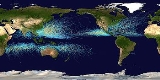
Storm track
Encyclopedia
Storm tracks are the relatively narrow zones in the Atlantic
and Pacific along which most Atlantic or Pacific extratropical cyclone
s travel.
 The storm tracks begin in the westernmost parts of Atlantic and Pacific, where the large temperature contrasts between land and sea cause cyclone
s to form, particularly in winter. Surface friction
cause these cyclones to quickly fill up and decay as soon as they reach land at the eastern end of the basins, accounting for the easternmost edges of the storm tracks.
Another example of a storm track is the circumpolar storm track in the Antarctic
, however land-sea contrasts play no role in its formation.
Given a grid point field of geopotential height
, storm tracks can be visualized by contouring its average standard deviation
, after the data has been band-pass filtered.
Atlantic Ocean
The Atlantic Ocean is the second-largest of the world's oceanic divisions. With a total area of about , it covers approximately 20% of the Earth's surface and about 26% of its water surface area...
and Pacific along which most Atlantic or Pacific extratropical cyclone
Cyclone
In meteorology, a cyclone is an area of closed, circular fluid motion rotating in the same direction as the Earth. This is usually characterized by inward spiraling winds that rotate anticlockwise in the Northern Hemisphere and clockwise in the Southern Hemisphere of the Earth. Most large-scale...
s travel.
Cyclone
In meteorology, a cyclone is an area of closed, circular fluid motion rotating in the same direction as the Earth. This is usually characterized by inward spiraling winds that rotate anticlockwise in the Northern Hemisphere and clockwise in the Southern Hemisphere of the Earth. Most large-scale...
s to form, particularly in winter. Surface friction
Friction
Friction is the force resisting the relative motion of solid surfaces, fluid layers, and/or material elements sliding against each other. There are several types of friction:...
cause these cyclones to quickly fill up and decay as soon as they reach land at the eastern end of the basins, accounting for the easternmost edges of the storm tracks.
Another example of a storm track is the circumpolar storm track in the Antarctic
Antarctic
The Antarctic is the region around the Earth's South Pole, opposite the Arctic region around the North Pole. The Antarctic comprises the continent of Antarctica and the ice shelves, waters and island territories in the Southern Ocean situated south of the Antarctic Convergence...
, however land-sea contrasts play no role in its formation.
Given a grid point field of geopotential height
Geopotential height
Geopotential height is a vertical coordinate referenced to Earth's mean sea level — an adjustment to geometric height using the variation of gravity with latitude and elevation. Thus it can be considered a "gravity-adjusted height"...
, storm tracks can be visualized by contouring its average standard deviation
Standard deviation
Standard deviation is a widely used measure of variability or diversity used in statistics and probability theory. It shows how much variation or "dispersion" there is from the average...
, after the data has been band-pass filtered.