
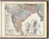
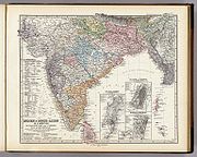
Stielers Handatlas
Encyclopedia
Atlas
An atlas is a collection of maps; it is typically a map of Earth or a region of Earth, but there are atlases of the other planets in the Solar System. Atlases have traditionally been bound into book form, but today many atlases are in multimedia formats...
of the last three decades of the 19th and the first half of the 20th century. Published by Justus Perthes
Justus Perthes
Justus Perthes Publishers in Gotha, Germany was established in 1785. Justus Perthes was Publisher of geographic atlases, ‘’Petermann’s Geographische Mitteilungen’’ and also the Almanach de Gotha,...
of Gotha (established 1785 and still existing there) it went through ten editions from 1816 to 1944. As with many 19th century publications, an edition was issued in parts; for example, the eighth edition was issued in 32 monthly parts.
The first edition, by Stieler and Christian Gottlieb Reichard
Christian Gottlieb Reichard
Christian Gottlieb Reichard was a German cartographer born in Schleiz, Thuringia. He studied law in Leipzig and subsequently became a city official in Bad Lobenstein....
(1758–1837) was published beginning in 1817 and completed in 1823 (50 maps). After Stieler's death Friedrich von Stülpnagel (1786–1865) edited the second (1845–47) and third (1852–54) editions (both 83 maps); a fourth edition appeared 1862-64, a fifth 1866-68 (each 84 maps).
However, it was not until the sixth edition (1871–75, 90 maps), edited by August Petermann (1822–78), Hermann Berghaus
Hermann Berghaus
Hermann Berghaus was a German cartographer.-Biography:He was a nephew of Heinrich Berghaus. During most of his life, he was cartographer in the Geographical Institute of Justus Perthes at Gotha. His best known work is a chart of the world which went through at least 11 editions...
(1828–1890) and Carl Vogel (1828–1897), that the work reached the high scientific level and the unsurpassed relief Stieler's Atlas is famous for. A seventh edition was issued 1879-82; an eighth 1888-91 (both 95 maps) under the direction of Hermann Berghaus, Vogel and Hermann Habenicht (1844–1917). Although the printing industry had already changed to lithography
Lithography
Lithography is a method for printing using a stone or a metal plate with a completely smooth surface...
for some time, some maps in Stieler's Atlas were still reproduced by copper-plate printing on hand presses with hand colouring into the 1890s.
The ninth edition (1901–05), edited by Habenicht, with one hundred maps, just double the number of the first edition, was the first one printed on cylinder machines by means of lithography, which halved the price and made the Stieler accessible to a broad public. Hermann Haack (1872–1966) edited the tenth (centenary) edition (1920–25, 108 maps), with an index to 320,000 entries being the most comprehensive world atlas of modern times. English versions of the ninth and tenth editions appeared as "Stieler's Atlas of Modern Geography", and editions with similar titles were also issued in French, Italian and Spanish. An international edition (1934–1940) remained with 84 of the 114 maps planned incomplete due to wartime circumstances. The work was engraved on 432 copper plates which have been preserved.
External links
- DavidRumsey.com The 1875 6th Edition Handatlas, and many other maps and atlases, are viewable online
- maproom.org 1891 8th Edition Handatlas
- handatlas.de Web archive of the great German Hand-Atlases. Stielers of all decades online.