

Steptoe, Washington
Encyclopedia
Unincorporated area
In law, an unincorporated area is a region of land that is not a part of any municipality.To "incorporate" in this context means to form a municipal corporation, a city, town, or village with its own government. An unincorporated community is usually not subject to or taxed by a municipal government...
in Whitman County
Whitman County, Washington
Whitman County is a county located in the U.S. state of Washington. As of the 2010 census, the population was 44,776, with the majority living in its largest city, Pullman, home to Washington State University, the state's land-grant university. The county seat is at Colfax.Whitman County was...
, Washington, United States
United States
The United States of America is a federal constitutional republic comprising fifty states and a federal district...
. Steptoe is 11 miles north of the county seat, Colfax
Colfax, Washington
Colfax is the county seat of Whitman County, Washington, United States.The population was 2,805 at the 2010 census.It is situated amidst wheat-covered hills in a valley at the confluence of the north and south forks of the Palouse River. U.S...
and is 43 miles south of Spokane
Spokane, Washington
Spokane is a city located in the Northwestern United States in the state of Washington. It is the largest city of Spokane County of which it is also the county seat, and the metropolitan center of the Inland Northwest region...
. It is named after Colonel Edward Steptoe
Edward Steptoe
Edward Jenner Steptoe was an officer in the United States Army who served in the Mexican-American War and the Indian Wars. He is primarily remembered for his defeat at the Battle of Pine Creek during the Spokane-Coeur d'Alene-Paloos War. It was at Pine Creek where Steptoe and 164 men were ambushed...
for a battle located north of Steptoe near Rosalia, Washington
Rosalia, Washington
Rosalia is a town in Whitman County, Washington, U.S.A. It is an agricultural community in the Palouse region, at an elevation of 2238 feet above sea level. Its population was 550 at the 2010 census.-History:...
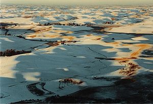
. Steptoe has an elementary school consisting of students 1st through 8th grade, a post office (zip code 99174), a gas station catering to the local community. Local tourist attractions include Steptoe Butte
Steptoe Butte
Steptoe Butte is a quartzite island jutting out of the silty loess of the Palouse hills in Whitman County, Washington. It is contained by Steptoe Butte State Park. The rock that forms the butte is over 400 million years old, in contrast with the 15–7 million year old Columbia River basalts that...
. Steptoe's main roads include U.S. Route 195 and State Route 23
State Route 23 (Washington)
State Route 23, also known as SR 23, is a state highway in the U.S. state of Washington. Originating at an intersection with U.S. Route 195 in Steptoe, SR 23 extends in a roughly northwestern direction for about before terminating at SR 28 in Harrington.-Major intersections:-External links:*...
. The 2010 census placed the population at 180.