
.gif)
State Highway 42 (Oklahoma)
Encyclopedia
State highway
State highway, state road or state route can refer to one of three related concepts, two of them related to a state or provincial government in a country that is divided into states or provinces :#A...
in Washita County, Oklahoma
Washita County, Oklahoma
Washita County is a county located in the U.S. state of Oklahoma. As of 2000, the population was 11,508. Its county seat is New Cordell. It was formerly located in Cloud Chief, Oklahoma....
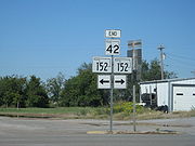
. It is 1.4 miles (2¼ km) long and connects State Highway 152
State Highway 152 (Oklahoma)
State Highway 152 is a state highway running through west-central Oklahoma. At a length of 149.6 miles , it is the longest three-digit state highway in Oklahoma. It runs from State Highway 152 at the Texas State Line to Interstate 44 near Will Rogers World Airport in Oklahoma City...
to Dill City
Dill City, Oklahoma
Dill City is a town in Washita County, Oklahoma, United States. The population was 562 at the 2010 census.-Geography:Dill City is located at ....
. It has no lettered spur routes.