
.gif)
State Highway 15 (Oklahoma)
Encyclopedia
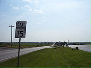
State Highway 15 is the name for two once-connected state highway
s in Oklahoma
. One begins at the Texas
state line and runs for 47.1 miles (75.8 km) through Woodward
; the other runs for 62.4 miles (100.4 km) between U.S. Highway 64/U.S. Highway 412 and State Highway 18
north of Pawnee
. SH-15 has no lettered spur routes.
between Catesby
and Shattuck
. It runs east for seven miles (11.2 km) to US-283, which it overlaps into Shattuck. In Shattuck, SH-15 splits off to the northeast, heading through Gage
and Fargo
, before ending in Woodward
.
 The eastern SH-15 picks up a US-64/412 south of Garber, and begins concurrent
with State Highway 74
heading northbound. It splits from SH-74 to head through Billings
and has an interchange with Interstate 35 at milemarker 203. It then has a five-mile (8.0 km) concurrency with U.S. Highway 77. After leaving US-77, it passes through Red Rock
, and has a 4 miles (6.4 km) concurrency with US-177, and splits off just north of the intersection with the Cimarron Turnpike
. It bridges Sooner Lake and runs for 15 more miles (24 more km) before ending at State Highway 18
north of Pawnee.
State highway
State highway, state road or state route can refer to one of three related concepts, two of them related to a state or provincial government in a country that is divided into states or provinces :#A...
s in Oklahoma
Oklahoma
Oklahoma is a state located in the South Central region of the United States of America. With an estimated 3,751,351 residents as of the 2010 census and a land area of 68,667 square miles , Oklahoma is the 28th most populous and 20th-largest state...
. One begins at the Texas
Texas
Texas is the second largest U.S. state by both area and population, and the largest state by area in the contiguous United States.The name, based on the Caddo word "Tejas" meaning "friends" or "allies", was applied by the Spanish to the Caddo themselves and to the region of their settlement in...
state line and runs for 47.1 miles (75.8 km) through Woodward
Woodward, Oklahoma
Woodward is a city in and the county seat of Woodward County, Oklahoma, United States. It is the largest city in a nine-county area. The population was 12,051 at the 2010 census....
; the other runs for 62.4 miles (100.4 km) between U.S. Highway 64/U.S. Highway 412 and State Highway 18
State Highway 18 (Oklahoma)
State Highway 18, abbreviated as SH-18 or OK-18, is a highway maintained by the U.S. state of Oklahoma. It was once one of the longest state highways in the Oklahoma road system, but now has a total length of .-Route description:...
north of Pawnee
Pawnee, Oklahoma
Pawnee is a city in Pawnee County, Oklahoma, United States. The population was 2,230 at the 2000 census. It is the county seat of Pawnee County.-Geography:Pawnee is located at...
. SH-15 has no lettered spur routes.
Western section
The western SH-15 begins at the Texas state line, connecting to Texas' State Highway 15State Highway 15 (Texas)
State Highway 15, or SH 15, runs from the Texas-Oklahoma boundary 6 miles east of Follett to US 54 in Stratford.In 1955, SH 117 was redesignated as SH 15 for its entire route from the Texas/Oklahoma state line in Lipscomb County through the northeast Panhandle to an intersection with U.S. Highway...
between Catesby
Catesby, Oklahoma
Catesby is an unincorporated community located in Ellis County, Oklahoma. Named for Catesby ap Roger Jones, the town was founded on July 1, 1902. The post office was opened by Ella M. Rose on February 18, 1902...
and Shattuck
Shattuck, Oklahoma
Shattuck is a town in Ellis County, Oklahoma, United States. The population was 1,356 at the 2010 census.-Geography:Shattuck is located at .According to the United States Census Bureau, the town has a total area of , all of it land....
. It runs east for seven miles (11.2 km) to US-283, which it overlaps into Shattuck. In Shattuck, SH-15 splits off to the northeast, heading through Gage
Gage, Oklahoma
Gage is a town in Ellis County, Oklahoma, United States. The population was 442 at the 2010 census.-Geography:Gage is located at ....
and Fargo
Fargo, Oklahoma
Fargo is a town in Ellis County, Oklahoma, United States. The population was 364 at the 2010 census. Fargo, like many towns in the region, has never fully recovered from the Dust Bowl years.-Geography:Fargo is located at ....
, before ending in Woodward
Woodward, Oklahoma
Woodward is a city in and the county seat of Woodward County, Oklahoma, United States. It is the largest city in a nine-county area. The population was 12,051 at the 2010 census....
.
Eastern section
Concurrency (road)
A concurrency, overlap, or coincidence in a road network is an instance of one physical road bearing two or more different highway, motorway, or other route numbers...
with State Highway 74
State Highway 74 (Oklahoma)
State Highway 74, usually abbreviated as SH-74 or OK-74 is the numbering of two different highways maintained by the U.S. state of Oklahoma. These highways were once a single major north–south route, connecting Oklahoma City to more rural parts of the state...
heading northbound. It splits from SH-74 to head through Billings
Billings, Oklahoma
Billings is a town in Noble County, Oklahoma, United States. The population was 436 at the 2000 census.-Geography:Billings is located at .According to the United States Census Bureau, the town has a total area of , all of it land.-Demographics:...
and has an interchange with Interstate 35 at milemarker 203. It then has a five-mile (8.0 km) concurrency with U.S. Highway 77. After leaving US-77, it passes through Red Rock
Red Rock, Oklahoma
Red Rock is a town in Noble County, Oklahoma, United States. The population was 293 at the 2000 census...
, and has a 4 miles (6.4 km) concurrency with US-177, and splits off just north of the intersection with the Cimarron Turnpike
Cimarron Turnpike
The Cimarron Turnpike is a toll road in north-central Oklahoma. Opened to traffic in 1975, the route runs , from a junction with Interstate 35 north of Perry, to Westport, just west of Tulsa. The route also consists of a spur which runs from the mainline southwest to a junction with US-177 north...
. It bridges Sooner Lake and runs for 15 more miles (24 more km) before ending at State Highway 18
State Highway 18 (Oklahoma)
State Highway 18, abbreviated as SH-18 or OK-18, is a highway maintained by the U.S. state of Oklahoma. It was once one of the longest state highways in the Oklahoma road system, but now has a total length of .-Route description:...
north of Pawnee.