
St. Norbert, Manitoba
Encyclopedia
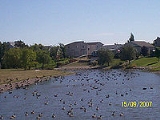
St. Norbert is a bilingual (French and English) neighbourhood in the southernmost part of Winnipeg, Manitoba, Canada
. While outside the Perimeter Highway, (the beltway that surrounds most of Winnipeg), it is still part of the city. The population is just over 5,000. Each summer, the community is home to the St. Norbert Farmers' Market, drawing large crowds from Winnipeg and the surrounding area. Other attractions include the St. Norbert Provincial Heritage Park, and the St. Norbert Arts and Cultural Centre. St. Norbert is the closest community to the Red River Floodway gates.
St. Norbert is also the name of a much bigger city ward in Winnipeg, which includes much of the Fort Garry South neighbourhood cluster and a small part of St. Vital
. It is represented by a member of Winnipeg City Council
.
and the Ojibwa, who were drawn to this region because of its hunting and fishing opportunities. The community bordered on two rivers - the Red and LaSalle - and a bison trail ran from the south bank of the La Salle River to bison hunting grounds nearly 50 kilometres away.
St. Norbert’s prime location along major trade and transportation routes proved advantageous. With the arrival of the French, the Scots, and other Europeans, and with the growth of the Métis
population, St. Norbert developed into a permanent community. The Pembina Trail (now Pembina Highway) passed through St. Norbert as it routed travellers from Upper Fort Garry (present day downtown Winnipeg, and the primary southern outpost of the Hudson’s Bay Company) to St. Paul, Minnesota – the nearest railhead.
The settlement was elevated to the status of parish in 1857 and given the name St. Norbert in honour of the first bishop
of St. Boniface, Bishop Joseph-Norbert Provencher. The first parish priest, Father Jean-Marie Lestanc, was followed by Father Charles Mestre in 1860, then by Father Noël-Joseph Ritchot in 1862.
On October 19, 1869, a public meeting was held at St. Norbert Roman Catholic Church. At that meeting, the Comite national des Métis was formed, with Louis Riel
as secretary. The first act of the Committee was an erection of a barrier across the Pembina Trail to keep out unwanted emissaries of the Canadian Government.
When Asile Ritchot closed its doors in 1948, the building was taken over by the Oblate Fathers
, and used as a seminary. In 1970, the X-Kalay foundation (now called the Behavioral Health Foundation) took over the building and currently operates a successful halfway house
for the support and rehabilitation of individuals with drug or alcohol issues.
Canada
Canada is a North American country consisting of ten provinces and three territories. Located in the northern part of the continent, it extends from the Atlantic Ocean in the east to the Pacific Ocean in the west, and northward into the Arctic Ocean...
. While outside the Perimeter Highway, (the beltway that surrounds most of Winnipeg), it is still part of the city. The population is just over 5,000. Each summer, the community is home to the St. Norbert Farmers' Market, drawing large crowds from Winnipeg and the surrounding area. Other attractions include the St. Norbert Provincial Heritage Park, and the St. Norbert Arts and Cultural Centre. St. Norbert is the closest community to the Red River Floodway gates.
St. Norbert is also the name of a much bigger city ward in Winnipeg, which includes much of the Fort Garry South neighbourhood cluster and a small part of St. Vital
St. Vital
St. Vital is a provincial electoral division in the Canadian province of Manitoba.-Historical riding:The original St. Vital riding was established at the time of the province's creation in 1870, as one of twelve "francophone" constituencies...
. It is represented by a member of Winnipeg City Council
Winnipeg City Council
The Winnipeg City Council is the governing body of the city of Winnipeg, Manitoba, Canada.Members represent wards throughout the city, and are known as councillors.-2006-2010:Council elected in the 2006 election:-2010-2014:...
.
History
The original inhabitants of what is now St. Norbert were First Nations peoples, including the Assiniboine, the Creeand the Ojibwa, who were drawn to this region because of its hunting and fishing opportunities. The community bordered on two rivers - the Red and LaSalle - and a bison trail ran from the south bank of the La Salle River to bison hunting grounds nearly 50 kilometres away.
St. Norbert’s prime location along major trade and transportation routes proved advantageous. With the arrival of the French, the Scots, and other Europeans, and with the growth of the Métis
Métis people (Canada)
The Métis are one of the Aboriginal peoples in Canada who trace their descent to mixed First Nations parentage. The term was historically a catch-all describing the offspring of any such union, but within generations the culture syncretised into what is today a distinct aboriginal group, with...
population, St. Norbert developed into a permanent community. The Pembina Trail (now Pembina Highway) passed through St. Norbert as it routed travellers from Upper Fort Garry (present day downtown Winnipeg, and the primary southern outpost of the Hudson’s Bay Company) to St. Paul, Minnesota – the nearest railhead.
The settlement was elevated to the status of parish in 1857 and given the name St. Norbert in honour of the first bishop
of St. Boniface, Bishop Joseph-Norbert Provencher. The first parish priest, Father Jean-Marie Lestanc, was followed by Father Charles Mestre in 1860, then by Father Noël-Joseph Ritchot in 1862.
On October 19, 1869, a public meeting was held at St. Norbert Roman Catholic Church. At that meeting, the Comite national des Métis was formed, with Louis Riel
Louis Riel
Louis David Riel was a Canadian politician, a founder of the province of Manitoba, and a political and spiritual leader of the Métis people of the Canadian prairies. He led two resistance movements against the Canadian government and its first post-Confederation Prime Minister, Sir John A....
as secretary. The first act of the Committee was an erection of a barrier across the Pembina Trail to keep out unwanted emissaries of the Canadian Government.
Aisle Ritchot
Visible from Pembina highway, one of the most recognizable landmarks in St. Norbert is a large three-story building marked by a huge centre dome. Begun in the 1870s, the first building on the site was the home of politician and businessman Monsieur Joseph Lemay. The building eventually came into the possession of the local church, and in 1903, Father Noël-Joseph Ritchot arranged the donation of the building and 80 acres (323,748.8 m²) of surrounding land to les Soeurs de Misericorde (Sisters of Mercy). The Sisters called the building Aisle Ritchot and operated an orphanage there from 1904 to 1948. In 1911, a large expansion was begun. The new brick building was three stories tall, and featured the landmark centre dome.When Asile Ritchot closed its doors in 1948, the building was taken over by the Oblate Fathers
Missionary Oblates of Mary Immaculate
The Missionary Oblates of Mary Immaculate is a missionary religious congregation in the Catholic Church. It was founded on January 25, 1816 by Saint Eugene de Mazenod, a French priest born in Aix-en-Provence in the south of France on August 1, 1782. The congregation was given recognition by Pope...
, and used as a seminary. In 1970, the X-Kalay foundation (now called the Behavioral Health Foundation) took over the building and currently operates a successful halfway house
Halfway house
The purpose of a halfway house, also called a recovery house or sober house, is generally to allow people to begin the process of reintegration with society, while still providing monitoring and support; this is generally believed to reduce the risk of recidivism or relapse when compared to a...
for the support and rehabilitation of individuals with drug or alcohol issues.