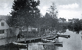
Spicket River
Encyclopedia
The Spicket River is a 17.7 miles (28.5 km) river
located in New Hampshire
and Massachusetts
in the United States
. It is a tributary
of the Merrimack River
, part of the Gulf of Maine
watershed
. It is sometimes spelled "Spickett".
 The Spicket River begins at the outlet of Island Pond
in Derry, New Hampshire
, and flows south into Salem, New Hampshire
, passing through the Arlington Mill Reservoir
. The river continues through Salem, encountering copious suburb
an development, and enters the city of Methuen, Massachusetts
, where it drops nearly 100 feet over a series of dams on its way to the Merrimack River in Lawrence
.
River
A river is a natural watercourse, usually freshwater, flowing towards an ocean, a lake, a sea, or another river. In a few cases, a river simply flows into the ground or dries up completely before reaching another body of water. Small rivers may also be called by several other names, including...
located in New Hampshire
New Hampshire
New Hampshire is a state in the New England region of the northeastern United States of America. The state was named after the southern English county of Hampshire. It is bordered by Massachusetts to the south, Vermont to the west, Maine and the Atlantic Ocean to the east, and the Canadian...
and Massachusetts
Massachusetts
The Commonwealth of Massachusetts is a state in the New England region of the northeastern United States of America. It is bordered by Rhode Island and Connecticut to the south, New York to the west, and Vermont and New Hampshire to the north; at its east lies the Atlantic Ocean. As of the 2010...
in the United States
United States
The United States of America is a federal constitutional republic comprising fifty states and a federal district...
. It is a tributary
Tributary
A tributary or affluent is a stream or river that flows into a main stem river or a lake. A tributary does not flow directly into a sea or ocean...
of the Merrimack River
Merrimack River
The Merrimack River is a river in the northeastern United States. It rises at the confluence of the Pemigewasset and Winnipesaukee rivers in Franklin, New Hampshire, flows southward into Massachusetts, and then flows northeast until it empties into the Atlantic Ocean at Newburyport...
, part of the Gulf of Maine
Gulf of Maine
The Gulf of Maine is a large gulf of the Atlantic Ocean on the east coast of North America.It is delineated by Cape Cod at the eastern tip of Massachusetts in the southwest and Cape Sable at the southern tip of Nova Scotia in the northeast. It includes the entire coastlines of the U.S...
watershed
Drainage basin
A drainage basin is an extent or an area of land where surface water from rain and melting snow or ice converges to a single point, usually the exit of the basin, where the waters join another waterbody, such as a river, lake, reservoir, estuary, wetland, sea, or ocean...
. It is sometimes spelled "Spickett".

Island Pond (Derry, New Hampshire)
Island Pond is a water body located in Rockingham County in southern New Hampshire, United States, in the towns of Derry, Hampstead and Atkinson...
in Derry, New Hampshire
Derry, New Hampshire
-Climate:-Demographics:As of the census of 2010, there were 33,109 people, 12,537 households, and 8,767 families residing in the town. The population density was 924.8 people per square mile . There were 13,277 housing units at an average density of 143.2/km²...
, and flows south into Salem, New Hampshire
Salem, New Hampshire
Salem is a town in Rockingham County, New Hampshire, United States. The population was 28,776 at the 2010 census. Salem is a marketing and distributing center north of Boston, with a major amusement attraction, Canobie Lake Park, and a large shopping mall, the Mall at Rockingham Park.- History :The...
, passing through the Arlington Mill Reservoir
Arlington Mill Reservoir
Arlington Mill Reservoir, known locally as Arlington Pond, is a impoundment located in Rockingham County in southern New Hampshire, United States, in the town of Salem. It is located along the Spicket River, a small stream that flows south to the Merrimack River in Lawrence, Massachusetts....
. The river continues through Salem, encountering copious suburb
Suburb
The word suburb mostly refers to a residential area, either existing as part of a city or as a separate residential community within commuting distance of a city . Some suburbs have a degree of administrative autonomy, and most have lower population density than inner city neighborhoods...
an development, and enters the city of Methuen, Massachusetts
Methuen, Massachusetts
Methuen is a city in Essex County, Massachusetts, United States. The population was 43,789 at the 2000 census.-History:Methuen was first settled in 1642 and was officially incorporated in 1726; it is named for the British diplomat Sir Paul Methuen. Methuen was originally part of Haverhill,...
, where it drops nearly 100 feet over a series of dams on its way to the Merrimack River in Lawrence
Lawrence, Massachusetts
Lawrence is a city in Essex County, Massachusetts, United States on the Merrimack River. According to the 2010 U.S. Census, the city had a total population of 76,377. Surrounding communities include Methuen to the north, Andover to the southwest, and North Andover to the southeast. It and Salem are...
.

