
South Dakota Highway 9
Encyclopedia
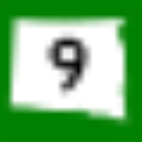
South Dakota Highway 9 was a short state route in Marshall County
. It was one of only two known single digit state highway numbers used in South Dakota
.
. Around 1935, that route was realigned east from Britton
to what is now South Dakota Highway 27
. The old route became Highway 9, and linked up with the corresponding North Dakota Highway 9
.
SD 9 was dropped around 1950, and is currently unnumbered.
Marshall County, South Dakota
As of the census of 2000, there were 4,576 people, 1,844 households, and 1,252 families residing in the county. The population density was 6 people per square mile . There were 2,562 housing units at an average density of 3 per square mile...
. It was one of only two known single digit state highway numbers used in South Dakota
South Dakota
South Dakota is a state located in the Midwestern region of the United States. It is named after the Lakota and Dakota Sioux American Indian tribes. Once a part of Dakota Territory, South Dakota became a state on November 2, 1889. The state has an area of and an estimated population of just over...
.
History
When highways were first numbered in the 1920s, this route was the northern end of South Dakota Highway 25South Dakota Highway 25
South Dakota Highway 25 is a state route that runs north to south across a large portion of South Dakota. It is divided into two segments:* The main segment begins at the North Dakota border, with the junction of North Dakota Highway 18 north of Claire City. Its southern terminus is at the...
. Around 1935, that route was realigned east from Britton
Britton, South Dakota
Britton is a city in and the county seat of Marshall County, South Dakota, United States. The population was 1,241 at the 2010 census.A weekly newspaper, the Britton Journal, is published in Britton.-Geography:...
to what is now South Dakota Highway 27
South Dakota Highway 27
South Dakota Highway 27 is a state route located in northeast South Dakota. It begins at the North Dakota border near Havana, North Dakota, and terminates at a junction with U.S. Highway 12 southeast of Andover, South Dakota...
. The old route became Highway 9, and linked up with the corresponding North Dakota Highway 9
North Dakota Highway 9
North Dakota Highway 9 is a highway in eastern North Dakota. It follows a zigzag pattern from U.S. Route 52 at Melville to North Dakota Highway 1 outside of Rogers.-External links:* by Chris Geelhart* by Mark O'Neil...
.
SD 9 was dropped around 1950, and is currently unnumbered.