Skjomen
Encyclopedia


Ofoten
Ofoten is a district in North Norway, consisting of the municipalities Tysfjord, Ballangen, Evenes, Tjeldsund, Narvik and Lødingen. It is named after the main fjord Ofotfjord, which is at the center of this landscape...
district in northern Norway, located just south of the city Narvik
Narvik
is the third largest city and municipality in Nordland county, Norway by population. Narvik is located on the shores of the Narvik Fjord . The municipality is part of the Ofoten traditional region of North Norway, inside the arctic circle...
. A sheltered valley named Skjomdalen goes from the head of the fjord.
The name Skjomen was originally Skieffa or Skievva in the 15th century. This is a samic
Northern Sami
Northern or North Sami is the most widely spoken of all Sami languages. The speaking area of Northern Sami covers the northern parts of Norway, Sweden and Finland...
word believed to mean "Sea". The Sami
Sami people
The Sami people, also spelled Sámi, or Saami, are the arctic indigenous people inhabiting Sápmi, which today encompasses parts of far northern Sweden, Norway, Finland, the Kola Peninsula of Russia, and the border area between south and middle Sweden and Norway. The Sámi are Europe’s northernmost...
is a nomadic people living among others in the mountains of Sweden and Norway in the wintertime and traveling to the sea at springtime. In this case traveling to Skieffa (sea) or Skjomen.
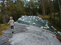
Skjomen has a site of about 80 rock carvings near the sea. It's believed that the rock carvings were made by the Fosna-Hensbacka culture
Fosna-Hensbacka culture
The Fosna/Hensbacka ,or , were two very similar Late Palaeolithic/early Mesolithic cultures in Scandinavia, and are often subsumed under the name Fosna-Hensbacka culture. This complex includes the Komsa culture that, notwithstanding different types of tools, is also considered to be a part of the...
a mesolithic
Mesolithic
The Mesolithic is an archaeological concept used to refer to certain groups of archaeological cultures defined as falling between the Paleolithic and the Neolithic....
culture ca. 5000 BC. The rock carvings were discovered in the 1930s.
The village of Skjomen is inhabited by approximately 400 people. The population is spread out over several very small communities, with the largest - Elvegård as a service centre.
For a short period, German battleship Tirpitz
German battleship Tirpitz
Tirpitz was the second of two s built for the German Kriegsmarine during World War II. Named after Grand Admiral Alfred von Tirpitz, the architect of the Imperial Navy, the ship was laid down at the Kriegsmarinewerft in Wilhelmshaven in November 1936 and launched two and a half years later in April...
hid beneath the extremely steep mountains surrounding the fjord
Fjord
Geologically, a fjord is a long, narrow inlet with steep sides or cliffs, created in a valley carved by glacial activity.-Formation:A fjord is formed when a glacier cuts a U-shaped valley by abrasion of the surrounding bedrock. Glacial melting is accompanied by rebound of Earth's crust as the ice...
to avoid attack by allied
Allies of World War II
The Allies of World War II were the countries that opposed the Axis powers during the Second World War . Former Axis states contributing to the Allied victory are not considered Allied states...
warplanes during World War II
World War II
World War II, or the Second World War , was a global conflict lasting from 1939 to 1945, involving most of the world's nations—including all of the great powers—eventually forming two opposing military alliances: the Allies and the Axis...
.
One of the world's northernmost 18 hole golf
Golf
Golf is a precision club and ball sport, in which competing players use many types of clubs to hit balls into a series of holes on a golf course using the fewest number of strokes....
courses is right by the fjord.
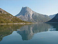
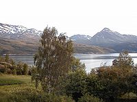
Skjomen is known for its scenic landscape with high, steep mountains and clear water.
Skjomtind, Reintind and Klubbviktind are three of the many beautiful mountains around the fjord. There is also the glacier
Glacier
A glacier is a large persistent body of ice that forms where the accumulation of snow exceeds its ablation over many years, often centuries. At least 0.1 km² in area and 50 m thick, but often much larger, a glacier slowly deforms and flows due to stresses induced by its weight...
Frostisen
Frostisen
The glacier Frostisen is one of the larger plateau glaciers in Norway. Frostisen covers an area of about , and is above sea level at its highest point and above sea level at its lowest point. It lies near Skjomen, a fjord branch of Ofotfjorden in the Ofoten district in northern Norway, located...
which is one of the larger plateau glaciers in Norway. Frostisen covers an area of about 25 km², and is 1710 meters above sea level at its highest point and 840 meters above sea level at its lowest point.
The highest point of Skjomen is Storsteinfjell with a height of 1894 m.
The E6
European route E6
European route E 6 is the designation for the main north-south road in Norway, and the west coast of Sweden, running from the southern tip of Sweden, at Trelleborg, into Norway and through almost all of the country north to Finnmark. The route ends close to the Norwegian border with Russia...
highway crosses the Skjomen fjord over the Skjomen Bridge
Skjomen Bridge
Skjomen Bridge is a suspension bridge that crosses the fjord Skjomen near the town of Narvik in Nordland county, Norway. The bridge is 711 metres long, the main span is 525 metres, and the maximum clearance to the sea is 35 metres. The bridge has nine spans....
.

External links
- Narvikgolf, the golf course
- Fremover, article from the local newspaper, Fremover, about the origin of the name Skjomen
- Skjomen, pictures from the mountains of Skjomen
- Google Map, Google map of Skjomen
- Large field of stone age rock carvings in Skjomen (Norw)

