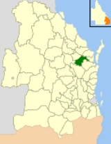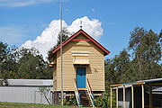
Shire of Woocoo
Encyclopedia

Wide Bay-Burnett
Wide Bay-Burnett is a region of the Australian state of Queensland, located between 170 and 400 kilometres north of the state capital, Brisbane. The area's population growth has exceeded the state average over the past 20 years, and it is forecast to grow to more than 430,000 by 2031...
region of Queensland
Queensland
Queensland is a state of Australia, occupying the north-eastern section of the mainland continent. It is bordered by the Northern Territory, South Australia and New South Wales to the west, south-west and south respectively. To the east, Queensland is bordered by the Coral Sea and Pacific Ocean...
, Australia
Australia
Australia , officially the Commonwealth of Australia, is a country in the Southern Hemisphere comprising the mainland of the Australian continent, the island of Tasmania, and numerous smaller islands in the Indian and Pacific Oceans. It is the world's sixth-largest country by total area...
, containing the rural residential area to the west of the town of Maryborough
Maryborough, Queensland
Maryborough is a city located on the Mary River in South East Queensland, Australia, approximately north of the state capital, Brisbane. The city is serviced by the Bruce Highway, and has a population of approximately 22,000 . It is closely tied to its neighbour city Hervey Bay which is...
, and surrounding countryside. The City covered an area of 2007.9 square kilometres (775.3 sq mi), and existed as a local government entity from 1914 until 2008, when it was amalgamated with the City of Maryborough
City of Maryborough (Queensland)
The City of Maryborough was a Local Government Area located in the Wide Bay-Burnett region of Queensland, Australia, containing the urban locality of Maryborough as well as the southern half of Fraser Island...
, City of Hervey Bay
City of Hervey Bay
The City of Hervey Bay was a Local Government Area located in the Wide Bay-Burnett region of Queensland, Australia, containing the urban centre of Hervey Bay as well as the northern half of Fraser Island...
and the 1st and 2nd divisions of the Shire of Tiaro
Shire of Tiaro
The Shire of Tiaro was a Local Government Area located in the Wide Bay-Burnett region of Queensland, Australia, between the regional cities of Gympie and Hervey Bay about north of the state capital, Brisbane...
to form the Fraser Coast Region.
Industry in the shire consisted of beef cattle, sugar, timber and light industry servicing Maryborough.
History
Woocoo was proclaimed a shire under the Local Authorities Act 1902 on 4 December 1914, with its centre of administration at BrooweenaBrooweena, Queensland
Brooweena is a town in the Wide Bay region of Queensland, Australia. The town is located in the Fraser Coast Regional Council local government area, north of the state capital, Brisbane....
. It had previously been part of the Shire of Tiaro
Shire of Tiaro
The Shire of Tiaro was a Local Government Area located in the Wide Bay-Burnett region of Queensland, Australia, between the regional cities of Gympie and Hervey Bay about north of the state capital, Brisbane...
, and also included parts of the Shires of Antigua and Howard. The shire was named for Mount Woocoo, which itself was probably named for the local Aboriginal
Indigenous Australians
Indigenous Australians are the original inhabitants of the Australian continent and nearby islands. The Aboriginal Indigenous Australians migrated from the Indian continent around 75,000 to 100,000 years ago....
word for "echidna
Echidna
Echidnas , also known as spiny anteaters, belong to the family Tachyglossidae in the monotreme order of egg-laying mammals. There are four extant species, which, together with the platypus, are the only surviving members of that order and are the only extant mammals that lay eggs...
". It held its first meeting on 30 January 1915.
On 27 March 1976, the Shire of Woocoo grew by 1269 square kilometres (489.96 sq mi) when the Shire of Burrum was renamed Shire of Hervey Bay
City of Hervey Bay
The City of Hervey Bay was a Local Government Area located in the Wide Bay-Burnett region of Queensland, Australia, containing the urban centre of Hervey Bay as well as the northern half of Fraser Island...
and recast as a local government area centred on the Hervey Bay urban area. The Local Government (Maryborough and Woocoo) Regulation 1993, which took effect on 31 March 1994, resulted in Maryborough
City of Maryborough (Queensland)
The City of Maryborough was a Local Government Area located in the Wide Bay-Burnett region of Queensland, Australia, containing the urban locality of Maryborough as well as the southern half of Fraser Island...
's annexation of about 700 square kilometres (270.3 sq mi) of Woocoo's area. At this time, Woocoo was resubdivided into three divisions each electing two councillors.
On 15 March 2008, under the Local Government (Reform Implementation) Act 2007 passed by the Parliament of Queensland
Parliament of Queensland
The Parliament of Queensland is the legislature of Queensland, Australia. According to the state's constitution, the Parliament consists of the Queen and the Legislative Assembly. It is the only unicameral state parliament in the country, the upper chamber, the Legislative Council, having been...
on 10 August 2007, Woocoo merged with the City of Hervey Bay
City of Hervey Bay
The City of Hervey Bay was a Local Government Area located in the Wide Bay-Burnett region of Queensland, Australia, containing the urban centre of Hervey Bay as well as the northern half of Fraser Island...
, City of Maryborough
City of Maryborough (Queensland)
The City of Maryborough was a Local Government Area located in the Wide Bay-Burnett region of Queensland, Australia, containing the urban locality of Maryborough as well as the southern half of Fraser Island...
and part of Tiaro
Shire of Tiaro
The Shire of Tiaro was a Local Government Area located in the Wide Bay-Burnett region of Queensland, Australia, between the regional cities of Gympie and Hervey Bay about north of the state capital, Brisbane...
to form the Fraser Coast Region.
Towns and localities
- Aramara
- Bidwill
- Boompa
- BrooweenaBrooweena, QueenslandBrooweena is a town in the Wide Bay region of Queensland, Australia. The town is located in the Fraser Coast Regional Council local government area, north of the state capital, Brisbane....
- Dunmora
- Grahams Creek
- Mungar
- Oakhurst
- Owanyilla
- Tinana South
- Yengarie
Population
| Year | Population |
|---|---|
| 1933 | 777 |
| 1947 | 750 |
| 1954 | 660 |
| 1961 | 640 |
| 1966 | 567 |
| 1971 | 491 |
| 1976 | 3,412 |
| 1981 | 4,456 |
| 1986 | 2,700 |
| 1991 | 3,429 |
| 1996 | 2,902 |
| 2001 | 2,964 |
| 2006 | 3,351 |
- The population for the 1976 boundaries was 2,938.
- The 1991 census population of the revised Woocoo area was 2,562.

