
Seaforth, Minnesota
Encyclopedia
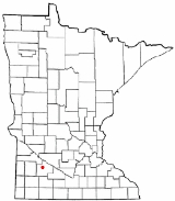
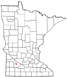
Seaforth is a city in Redwood County
, Minnesota
, United States
. The population was 86 at the 2010 census.
 According to the United States Census Bureau
, the city has a total area of 1 square miles (2.6 km²), all of it land. The Redwood River
flows through the northeastern corner of the city.
Seaforth is located along County Highway 7, which runs between Minnesota State Highways 19
and 67
to the north and 68
to the south.
of 2000, there were 77 people, 37 households, and 20 families residing in the city. The population density
was 76.3 people per square mile (29.4/km²). There were 41 housing units at an average density of 40.6 per square mile (15.7/km²). The racial makeup of the city was 100.00% White.
There were 37 households out of which 18.9% had children under the age of 18 living with them, 45.9% were married couples
living together, 8.1% had a female householder with no husband present, and 45.9% were non-families. 40.5% of all households were made up of individuals and 13.5% had someone living alone who was 65 years of age or older. The average household size was 2.08 and the average family size was 2.90.
In the city the population was spread out with 22.1% under the age of 18, 1.3% from 18 to 24, 24.7% from 25 to 44, 28.6% from 45 to 64, and 23.4% who were 65 years of age or older. The median age was 46 years. For every 100 females there were 92.5 males. For every 100 females age 18 and over, there were 87.5 males.
The median income for a household in the city was $27,143, and the median income for a family was $26,875. Males had a median income of $29,375 versus $22,500 for females. The per capita income
for the city was $15,089. There were 9.5% of families and 9.4% of the population living below the poverty line, including 66.7% of under eighteens and none of those over 64.
Redwood County, Minnesota
As of the census of 2000, there were 16,815 people, 6,674 households, and 4,524 families residing in the county. The population density was 19 people per square mile . There were 7,230 housing units at an average density of 8 per square mile...
, Minnesota
Minnesota
Minnesota is a U.S. state located in the Midwestern United States. The twelfth largest state of the U.S., it is the twenty-first most populous, with 5.3 million residents. Minnesota was carved out of the eastern half of the Minnesota Territory and admitted to the Union as the thirty-second state...
, United States
United States
The United States of America is a federal constitutional republic comprising fifty states and a federal district...
. The population was 86 at the 2010 census.
Geography
United States Census Bureau
The United States Census Bureau is the government agency that is responsible for the United States Census. It also gathers other national demographic and economic data...
, the city has a total area of 1 square miles (2.6 km²), all of it land. The Redwood River
Redwood River
The Redwood River is a tributary of the Minnesota River, 127 miles long, in southwestern Minnesota in the United States. Via the Minnesota River, it is part of the watershed of the Mississippi River, draining an area of 705 square miles in an agricultural region...
flows through the northeastern corner of the city.
Seaforth is located along County Highway 7, which runs between Minnesota State Highways 19
Minnesota State Highway 19
Minnesota State Highway 19 is a highway in southwest and southeast Minnesota, which runs from South Dakota Highway 30 at the South Dakota state line near Ivanhoe and continues east to its eastern terminus at its intersection with U.S...
and 67
Minnesota State Highway 67
Minnesota State Highway 67 is a highway in southwest Minnesota, which runs from its intersection with U.S. Highway 75 in Oshkosh Township near Canby and continues east and southeast to its eastern terminus at its intersection with State Highway 68 in Morgan....
to the north and 68
Minnesota State Highway 68
Minnesota State Highway 68 is a highway in southwest and south-central Minnesota, which runs from South Dakota Highway 22 at the South Dakota state line near Canby, and continues east to its eastern terminus at its intersection with U.S...
to the south.
Demographics
As of the censusCensus
A census is the procedure of systematically acquiring and recording information about the members of a given population. It is a regularly occurring and official count of a particular population. The term is used mostly in connection with national population and housing censuses; other common...
of 2000, there were 77 people, 37 households, and 20 families residing in the city. The population density
Population density
Population density is a measurement of population per unit area or unit volume. It is frequently applied to living organisms, and particularly to humans...
was 76.3 people per square mile (29.4/km²). There were 41 housing units at an average density of 40.6 per square mile (15.7/km²). The racial makeup of the city was 100.00% White.
There were 37 households out of which 18.9% had children under the age of 18 living with them, 45.9% were married couples
Marriage
Marriage is a social union or legal contract between people that creates kinship. It is an institution in which interpersonal relationships, usually intimate and sexual, are acknowledged in a variety of ways, depending on the culture or subculture in which it is found...
living together, 8.1% had a female householder with no husband present, and 45.9% were non-families. 40.5% of all households were made up of individuals and 13.5% had someone living alone who was 65 years of age or older. The average household size was 2.08 and the average family size was 2.90.
In the city the population was spread out with 22.1% under the age of 18, 1.3% from 18 to 24, 24.7% from 25 to 44, 28.6% from 45 to 64, and 23.4% who were 65 years of age or older. The median age was 46 years. For every 100 females there were 92.5 males. For every 100 females age 18 and over, there were 87.5 males.
The median income for a household in the city was $27,143, and the median income for a family was $26,875. Males had a median income of $29,375 versus $22,500 for females. The per capita income
Per capita income
Per capita income or income per person is a measure of mean income within an economic aggregate, such as a country or city. It is calculated by taking a measure of all sources of income in the aggregate and dividing it by the total population...
for the city was $15,089. There were 9.5% of families and 9.4% of the population living below the poverty line, including 66.7% of under eighteens and none of those over 64.