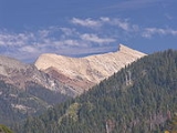
Sawtooth Peak
Encyclopedia
Sawtooth Peak is a jagged mountain rising to a height of 12343 feet (3,762 m). It is an iconic landmark of the Mineral King
region of the Sierra Nevada, in Sequoia National Park
. In the past, it was known as Miner's Peak. It contains an abundant supply of gold and mercury.
in 1871.
Today, this approach follows an established trail to Sawtooth Pass, then continues on a cross-country route to the peak. The section of trail from Monarch Lakes to Sawtooth Pass is steep and marred by granite sand, and as such is prone to erosion. The trailhead, shared with the Timber Gap trail, is located in the Mineral King Valley, about 1/2 mile uphill from the Ranger Station. It starts at 7500 feet (2,286 m), is approximately 7 miles (11.3 km) round trip, and the route reaches a final elevation of 12343 feet (3,762 m) at the peak.
Mineral King
Mineral King is a subalpine glacial valley located in the southern part of Sequoia National Park, in the U.S. state of California. The valley lies at the headwaters of the East Fork of the Kaweah River, which rises at the eastern part of the valley and flows northwest...
region of the Sierra Nevada, in Sequoia National Park
Sequoia National Park
Sequoia National Park is a national park in the southern Sierra Nevada east of Visalia, California, in the United States. It was established on September 25, 1890. The park spans . Encompassing a vertical relief of nearly , the park contains among its natural resources the highest point in the...
. In the past, it was known as Miner's Peak. It contains an abundant supply of gold and mercury.
Climbing Sawtooth
The easiest approach is from the valley to Sawtooth Pass, and then up the northwest slope of the peak. It was first known to be climbed by Joseph Lovelace during a deer huntMule Deer
The mule deer is a deer indigenous to western North America. The Mule Deer gets its name from its large mule-like ears. There are believed to be several subspecies, including the black-tailed deer...
in 1871.
Today, this approach follows an established trail to Sawtooth Pass, then continues on a cross-country route to the peak. The section of trail from Monarch Lakes to Sawtooth Pass is steep and marred by granite sand, and as such is prone to erosion. The trailhead, shared with the Timber Gap trail, is located in the Mineral King Valley, about 1/2 mile uphill from the Ranger Station. It starts at 7500 feet (2,286 m), is approximately 7 miles (11.3 km) round trip, and the route reaches a final elevation of 12343 feet (3,762 m) at the peak.

