
Saratoga Gap Open Space Preserve
Encyclopedia
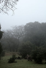
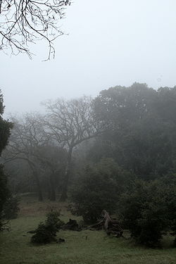
Saratoga Gap Open Space Preserve is a 1291-acre (5.224 km²) regional park
located near Saratoga Gap in the Santa Cruz Mountains
of Santa Clara County, California
. The preserve is owned and operated by the Midpeninsula Regional Open Space District
. The preserve contains about 2 miles (3 km) of hiking trails
, which are open to equestrians
and bicycle
s.
 Saratoga Gap contains elements of the Bay Area Ridge Trail
.
Elevations in the hillside area range from approximately 1,490 feet to 2,200 feet.
and State Route 35
, the NAD27 latitude and longitude are listed as 37°15′30"N 122°07′11"W. The location is on the border of the counties of Santa Clara
and Santa Cruz
.
Regional park
Regional park is a term used for an area of land preserved on account of its natural beauty, historic interest, recreational use or other reason, and under the administration of a form of local government.-Definition:...
located near Saratoga Gap in the Santa Cruz Mountains
Santa Cruz Mountains
The Santa Cruz Mountains, part of the Pacific Coast Ranges, are a mountain range in central California, United States. They form a ridge along the San Francisco Peninsula, south of San Francisco, separating the Pacific Ocean from San Francisco Bay and the Santa Clara Valley, and continuing south,...
of Santa Clara County, California
Santa Clara County, California
Santa Clara County is a county located at the southern end of the San Francisco Bay Area in the U.S. state of California. As of 2010 it had a population of 1,781,642. The county seat is San Jose. The highly urbanized Santa Clara Valley within Santa Clara County is also known as Silicon Valley...
. The preserve is owned and operated by the Midpeninsula Regional Open Space District
Midpeninsula Regional Open Space District
The Midpeninsula Regional Open Space District is a special-purpose district that manages over of open space in 25 preserves in the San Francisco Bay Area. It includes parts of Santa Clara, San Mateo and Santa Cruz Counties. The District was created by voter initiative in 1972...
. The preserve contains about 2 miles (3 km) of hiking trails
Trail
A trail is a path with a rough beaten or dirt/stone surface used for travel. Trails may be for use only by walkers and in some places are the main access route to remote settlements...
, which are open to equestrians
Equestrianism
Equestrianism more often known as riding, horseback riding or horse riding refers to the skill of riding, driving, or vaulting with horses...
and bicycle
Bicycle
A bicycle, also known as a bike, pushbike or cycle, is a human-powered, pedal-driven, single-track vehicle, having two wheels attached to a frame, one behind the other. A person who rides a bicycle is called a cyclist, or bicyclist....
s.
Bay Area Ridge Trail
The Bay Area Ridge Trail is a planned 550+-mile multi-use trail along the hill and mountain ridgelines ringing the San Francisco Bay Area, in Northern California. When complete, the trail will connect over 75 parks and open spaces. The trail is being designed to provide access for hikers,...
.
Elevations in the hillside area range from approximately 1,490 feet to 2,200 feet.
Saratoga Gap
The namesake of the preserve, Saratoga Gap is a feature of type gap listed as ID 232577 in the National Geographic Names Database. Located at the intersection of State Route 9California State Route 9
State Route 9 is mainly a rural and mountainous route in the U.S. state of California that travels 35 miles from SR 1 near Santa Cruz to SR 17 in Los Gatos, passing through the San Lorenzo Valley and the Saratoga Gap...
and State Route 35
California State Route 35
State Route 35 in the U.S. state of California, generally known as Skyline Boulevard, is a two-lane road running along the western ridge of Silicon Valley in California. It runs from Highway 17 to San Francisco at State Route 1. It provides scenic views of both the Santa Cruz Mountains, the...
, the NAD27 latitude and longitude are listed as 37°15′30"N 122°07′11"W. The location is on the border of the counties of Santa Clara
Santa Clara County, California
Santa Clara County is a county located at the southern end of the San Francisco Bay Area in the U.S. state of California. As of 2010 it had a population of 1,781,642. The county seat is San Jose. The highly urbanized Santa Clara Valley within Santa Clara County is also known as Silicon Valley...
and Santa Cruz
Santa Cruz County, California
Santa Cruz County is a county located on the Pacific coast of the U.S. state of California, on the California Central Coast. The county forms the northern coast of the Monterey Bay. . As of the 2010 U.S. Census, its population was 262,382. The county seat is Santa Cruz...
.
See also
- Big Basin Redwoods State ParkBig Basin Redwoods State ParkBig Basin Redwoods State Park is a state park in the U.S. state of California, located in Santa Cruz County, about northwest of Santa Cruz. The park contains almost all of the Waddell Creek watershed, which was formed by the seismic uplift of its rim, and the erosion of its center by the many...
- Boulder Creek, CaliforniaBoulder Creek, CaliforniaBoulder Creek is a census-designated place in Santa Cruz County, California, United States. The population was 4,923 at the 2010 census.-Geography:Boulder Creek is located at ....
- Castle Rock State ParkCastle Rock State Park (California)Castle Rock State Park is a state park of California, USA, located along the crest of the Santa Cruz Mountains. It embraces coast redwood, Douglas fir, and madrone forest, most of which has been left in its wild, natural state. Steep canyons are sprinkled with unusual rock formations that is a...
- Saratoga, CaliforniaSaratoga, CaliforniaSaratoga is a city in Santa Clara County, California, USA. It is located on the west side of the Santa Clara Valley, directly west of San Jose, in the San Francisco Bay area. The population was 29,926 at the 2010 census....