
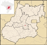
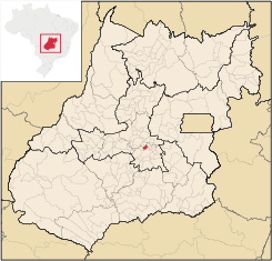
Santo Antônio de Goiás
Encyclopedia
| Santo Antônio de Goiás | |
|---|---|
| State | Goiás Goiás Goiás is a state of Brazil, located in the central part of the country. The name Goiás comes from the name of an indigenous community... |
| Area: | 132.8 km² |
| Population: | 3,893 (IBGE 2007) |
| Elevation: | 762 m above sea level |
| Postcode (CEP): | 75374-000 |
| Became a city: | 1990 |
| Distance to Goiânia Goiânia -Climate:The city has a tropical wet and dry climate with an average temperature of . There's a wet season, from October to April, and a dry one, from May to September. Annual rainfall is around 1,520 mm.... : |
42 km. |
| IBGE statistical microregion: | Goiânia Microregion Goiânia Microregion The Goiânia Microregion is a region in central Goiás state, Brazil. It includes 17 municipalities with a population of 2,032,305 in a total area of 6,848.00 km².... |
| Website: | none |
Town
A town is a human settlement larger than a village but smaller than a city. The size a settlement must be in order to be called a "town" varies considerably in different parts of the world, so that, for example, many American "small towns" seem to British people to be no more than villages, while...
and municipality
Municipality
A municipality is essentially an urban administrative division having corporate status and usually powers of self-government. It can also be used to mean the governing body of a municipality. A municipality is a general-purpose administrative subdivision, as opposed to a special-purpose district...
in central Goiás
Goiás
Goiás is a state of Brazil, located in the central part of the country. The name Goiás comes from the name of an indigenous community...
state, Brazil
Brazil
Brazil , officially the Federative Republic of Brazil , is the largest country in South America. It is the world's fifth largest country, both by geographical area and by population with over 192 million people...
, located just north of the state capital, Goiânia
Goiânia
-Climate:The city has a tropical wet and dry climate with an average temperature of . There's a wet season, from October to April, and a dry one, from May to September. Annual rainfall is around 1,520 mm....
.
- Distance from GoiâniaGoiânia-Climate:The city has a tropical wet and dry climate with an average temperature of . There's a wet season, from October to April, and a dry one, from May to September. Annual rainfall is around 1,520 mm....
: 42 km. with connections by way of GO-462.
Location
Neighboring municipalities are:- north: BrazabrantesBrazabrantesBrazabrantes is a small town and municipality in central Goiás state, Brazil.-Location:Brazabrantes is located 59 kilometers north of the important city of . Highway connections from the state capital of Goiânia are made by taking state highway GO-70 north to Goanira and then east to...
- south: GoiâniaGoiânia-Climate:The city has a tropical wet and dry climate with an average temperature of . There's a wet season, from October to April, and a dry one, from May to September. Annual rainfall is around 1,520 mm....
- east: NerópolisNerópolisNerópolis is a small city and municipality in central Goiás state, Brazil.-Location:The municipality is part of the metropolitan region of Goiânia, which is 42 kilometers to the west. It is nationally known as the city of garlic and sweets...
- west: GoianiraGoianiraGoianira is a small city and municipality in central Goiás state, Brazil, located 32 kilometers northwest of the state capital, Goiânia. The population was 24,110 in a total area of 200.4 km² . Goianira is becoming a major producer of shoes.Goianira is four kilometers east of highway BR-457 /...
Political Information
- Mayor: Lourival Vaz da Costa (January 2005)
- City council: 09
- Eligible voters: 2,859 (December/2007)
Santo Antônio was a district of Goianira
Goianira
Goianira is a small city and municipality in central Goiás state, Brazil, located 32 kilometers northwest of the state capital, Goiânia. The population was 24,110 in a total area of 200.4 km² . Goianira is becoming a major producer of shoes.Goianira is four kilometers east of highway BR-457 /...
until it was dismembered in 1990.
Demographic Information
- Population density: 29.31 inhab/km² (2007)
- Urban population: 3,508 (2007)
- Rural population: 385 (2007)
- Population growth: 3,28% from 2000 to 2007
Economic Information
The economy is based on subsistence agriculture, cattle raising, services, public administration, and small transformation industries.- Cattle herd: 17,500 head (2006)
- Main crops: bananas, sugarcane, rice (400 hectares), beans, manioc, oranges, lemons, tangerines, corn (800 hectares), tomatoes, and soybeans.
Education (2006)
- Schools: 3
- Classrooms: 26
- Teachers: 52
- Students: 1,258
- Higher education: none
- Adult literacy rate: 86.7% (2000) (national average was 86.4%)
Health (2007)
- Hospitals: 0
- Hospital beds: 0
- Ambulatory clinics: 3
- Infant mortality rate: 20.96 (2000) (national average was 33.0.
Municipal Human Development IndexHuman Development IndexThe Human Development Index is a composite statistic used to rank countries by level of "human development" and separate "very high human development", "high human development", "medium human development", and "low human development" countries...
- MHDI: 0.749
- State ranking: 79/242 municipalities
- National ranking: 1,904/5,507 municipalities
Frigoletto.com