

Santa Fe, Texas
Encyclopedia
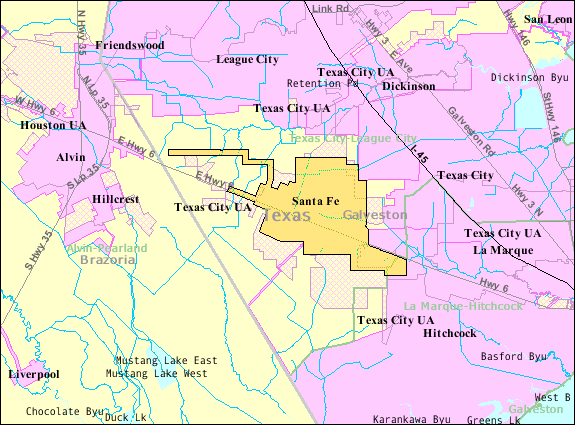
Santa Fe is a city in Galveston County
, Texas
, United States
. The town is named for the Santa Fe Railroad
(now part of BNSF Railway
) which runs through the town alongside State Highway 6
.
was built outside the area in 1877. Just over a century later in 1978, the residents there voted to become incorporated, and by the 1980s, Santa Fe annexed the towns of Arcadia and Alta Loma
.
The City of Santa Fe came to be when the neighboring City of Hitchcock tried to annex an area in eastern Alta Loma known as the Morningview neighborhood. After a 2-year struggle the residents of Alta Loma were given the chance to vote on becoming their own independent city. On January 21, 1978, Santa Fe incorporated Alta Loma into its city limits. To be in accordance with the laws of Texas, a certain number of residents was required, so a large part of the next town of Arcadia was also included. The new city's name, Santa Fe, was chosen after the Santa Fe Independent School District
which had been named for the railroad in the early 19th century.
On February 14, 1981, white supremacists traveled to the city to join local shrimpers in protesting the growing presence of Vietnamese shrimpers in the Gulf. That controversy, as well as similar conflicts in nearby port towns like Rockport, lead to the Supreme Court case Vietnamese Fishermen's Association v. Knights of the Ku Klux Klan, and also served as the basis for the 1985 Ed Harris film Alamo Bay
.
On June 19, 2000, the Supreme Court ruled
that the Santa Fe Independent School District
's policy of permitting "student-led, student-initiated" prayer at football games and other school events violated the Constitution's prohibitions against the establishment of state religion.
 Santa Fe is located at 29°22′50"N 95°6′15"W (29.380651, -95.104163).
According to the United States Census Bureau
, the city has a total area of 14 square miles (36.3 km²), all of it land.
of 2000, there were 9,548 people, 3,492 households, and 2,727 families residing in the city. The population density
was 682.5 people per square mile (263.5/km²). There were 3,723 housing units at an average density of 266.1 per square mile (102.7/km²). The racial makeup of the city was 94.92% White, 0.25% African American, 0.58% Native American, 0.23% Asian, 0.01% Pacific Islander, 2.94% from other races
, and 1.07% from two or more races. Hispanic or Latino of any race were 10.78% of the population. Historically, Santa Fe was known as a sundown town
.
There were 3,492 households out of which 37.6% had children under the age of 18 living with them, 62.5% were married couples
, 11.6% had a female householder with no husband present, and 21.9% were non-families. 18.4% of all households were made up of individuals and 7.5% had someone living alone who was 65 years of age or older. The average household size was 2.73 and the average family size was 3.10.
In the city the population was spread out with 28.1% under the age of 18, 7.9% from 18 to 24, 29.1% from 25 to 44, 23.9% from 45 to 64, and 11.1% who were 65 years of age or older. The median age was 36 years. For every 100 females there were 96.9 males. For every 100 females age 18 and over, there were 93.8 males.
The median income for a household in the city was $47,550, and the median income for a family was $54,253. Males had a median income of $40,445 versus $27,188 for females. The per capita income
for the city was $20,396. About 4.8% of families and 6.5% of the population were below the poverty line, including 8.5% of those under age 18 and 6.5% of those age 65 or over.
Santa Fe Post Office is located at 13002 Highway 6.
.
The schools in the city include:
All of Santa Fe is served by the College of the Mainland
.
army barracks in 1975. By 2011 the barracks became overwhelmed by the library's increasing size. A group of residents established a building committee and, with Moody Foundation
and Kempner Fund grants and donations from the community, purchased a 1920 square feet (178.4 m²) metal portable building on land leased from the Santa Fe Independent School District
. The portable was across Highway 6 from the barracks. After continuing growth of the library, in 1987 Mae S. Bruce presented a 6400 square feet (594.6 m²) brick structure to the city. The library moved to the structure and was renamed after Bruce.
Airports with scheduled commercial airline service for the area, located in Houston, are William P. Hobby Airport
and George Bush Intercontinental Airport
. Scholes International Airport in nearby Galveston is available for general aviation and non-scheduled commercial service.
Galveston County, Texas
Galveston County is a county located in the U.S. state of Texas within the Houston–Sugar Land–Baytown metropolitan area. As of the 2010 U.S. Census, the population was 291,309. Its county seat is Galveston. League City is the largest city in Galveston County in terms of population; between...
, Texas
Texas
Texas is the second largest U.S. state by both area and population, and the largest state by area in the contiguous United States.The name, based on the Caddo word "Tejas" meaning "friends" or "allies", was applied by the Spanish to the Caddo themselves and to the region of their settlement in...
, United States
United States
The United States of America is a federal constitutional republic comprising fifty states and a federal district...
. The town is named for the Santa Fe Railroad
Atchison, Topeka and Santa Fe Railway
The Atchison, Topeka and Santa Fe Railway , often abbreviated as Santa Fe, was one of the larger railroads in the United States. The company was first chartered in February 1859...
(now part of BNSF Railway
BNSF Railway
The BNSF Railway is a wholly owned subsidiary of Berkshire Hathaway Inc., and is headquartered in Fort Worth, Texas. It is one of seven North American Class I railroads and the second largest freight railroad network in North America, second only to the Union Pacific Railroad, its primary...
) which runs through the town alongside State Highway 6
State Highway 6 (Texas)
State Highway 6 runs from the Red River, the Texas–Oklahoma boundary, to northwest of Galveston. In the Houston area, it runs north to FM 1960, then northwest along US Highway 290 to Hempstead, and south to Westheimer Road and Addicks, and is known as Addicks Satsuma Road. In the...
.
History
The community grew after the Gulf, Colorado and Santa Fe RailwayGulf, Colorado and Santa Fe Railway
The Gulf, Colorado and Santa Fe Railway was a subsidiary of the Atchison, Topeka and Santa Fe Railway in eastern Texas and to Purcell, Oklahoma.- Nineteenth Century :...
was built outside the area in 1877. Just over a century later in 1978, the residents there voted to become incorporated, and by the 1980s, Santa Fe annexed the towns of Arcadia and Alta Loma
Alta Loma, Texas
Alta Loma, Texas , located in southwestern Galveston County, Texas, was an unincorporated area which became a part of Santa Fe, Texas in 1978.- External links :...
.
The City of Santa Fe came to be when the neighboring City of Hitchcock tried to annex an area in eastern Alta Loma known as the Morningview neighborhood. After a 2-year struggle the residents of Alta Loma were given the chance to vote on becoming their own independent city. On January 21, 1978, Santa Fe incorporated Alta Loma into its city limits. To be in accordance with the laws of Texas, a certain number of residents was required, so a large part of the next town of Arcadia was also included. The new city's name, Santa Fe, was chosen after the Santa Fe Independent School District
Santa Fe Independent School District
Santa Fe Independent School District is a public school district based in Santa Fe, Texas . In addition to Santa Fe, the district serves parts of League City, La Marque, Hitchcock, and Dickinson....
which had been named for the railroad in the early 19th century.
On February 14, 1981, white supremacists traveled to the city to join local shrimpers in protesting the growing presence of Vietnamese shrimpers in the Gulf. That controversy, as well as similar conflicts in nearby port towns like Rockport, lead to the Supreme Court case Vietnamese Fishermen's Association v. Knights of the Ku Klux Klan, and also served as the basis for the 1985 Ed Harris film Alamo Bay
Alamo Bay
Alamo Bay is a 1985 drama film about a Vietnam veteran who clashes with Vietnamese immigrants who move to his fictitious Texas bay hometown. The film was directed by Louis Malle, and stars Amy Madigan and Ed Harris. Future Texas A&M and Dallas Cowboys linebacker Dat Nguyen, who was 9 at the time...
.
On June 19, 2000, the Supreme Court ruled
Santa Fe Independent School Dist. v. Doe
Santa Fe Independent School Dist. v. Doe, 530 U.S. 290 , was a case heard before the United States Supreme Court. It ruled that a policy permitting student-led, student-initiated prayer at high school football games violates the Establishment Clause of the First Amendment. Oral arguments were heard...
that the Santa Fe Independent School District
Santa Fe Independent School District
Santa Fe Independent School District is a public school district based in Santa Fe, Texas . In addition to Santa Fe, the district serves parts of League City, La Marque, Hitchcock, and Dickinson....
's policy of permitting "student-led, student-initiated" prayer at football games and other school events violated the Constitution's prohibitions against the establishment of state religion.
Geography
According to the United States Census Bureau
United States Census Bureau
The United States Census Bureau is the government agency that is responsible for the United States Census. It also gathers other national demographic and economic data...
, the city has a total area of 14 square miles (36.3 km²), all of it land.
Demographics
As of the censusCensus
A census is the procedure of systematically acquiring and recording information about the members of a given population. It is a regularly occurring and official count of a particular population. The term is used mostly in connection with national population and housing censuses; other common...
of 2000, there were 9,548 people, 3,492 households, and 2,727 families residing in the city. The population density
Population density
Population density is a measurement of population per unit area or unit volume. It is frequently applied to living organisms, and particularly to humans...
was 682.5 people per square mile (263.5/km²). There were 3,723 housing units at an average density of 266.1 per square mile (102.7/km²). The racial makeup of the city was 94.92% White, 0.25% African American, 0.58% Native American, 0.23% Asian, 0.01% Pacific Islander, 2.94% from other races
Race (United States Census)
Race and ethnicity in the United States Census, as defined by the Federal Office of Management and Budget and the United States Census Bureau, are self-identification data items in which residents choose the race or races with which they most closely identify, and indicate whether or not they are...
, and 1.07% from two or more races. Hispanic or Latino of any race were 10.78% of the population. Historically, Santa Fe was known as a sundown town
Sundown town
A sundown town is a town that is or was purposely all-White. The term is widely used in the United States in areas from Ohio to Oregon and well into the South. The term came from signs that were allegedly posted stating that people of color had to leave the town by sundown...
.
There were 3,492 households out of which 37.6% had children under the age of 18 living with them, 62.5% were married couples
Marriage
Marriage is a social union or legal contract between people that creates kinship. It is an institution in which interpersonal relationships, usually intimate and sexual, are acknowledged in a variety of ways, depending on the culture or subculture in which it is found...
, 11.6% had a female householder with no husband present, and 21.9% were non-families. 18.4% of all households were made up of individuals and 7.5% had someone living alone who was 65 years of age or older. The average household size was 2.73 and the average family size was 3.10.
In the city the population was spread out with 28.1% under the age of 18, 7.9% from 18 to 24, 29.1% from 25 to 44, 23.9% from 45 to 64, and 11.1% who were 65 years of age or older. The median age was 36 years. For every 100 females there were 96.9 males. For every 100 females age 18 and over, there were 93.8 males.
The median income for a household in the city was $47,550, and the median income for a family was $54,253. Males had a median income of $40,445 versus $27,188 for females. The per capita income
Per capita income
Per capita income or income per person is a measure of mean income within an economic aggregate, such as a country or city. It is calculated by taking a measure of all sources of income in the aggregate and dividing it by the total population...
for the city was $20,396. About 4.8% of families and 6.5% of the population were below the poverty line, including 8.5% of those under age 18 and 6.5% of those age 65 or over.
Government and infrastructure
The United States Postal ServiceUnited States Postal Service
The United States Postal Service is an independent agency of the United States government responsible for providing postal service in the United States...
Santa Fe Post Office is located at 13002 Highway 6.
Public schools
The city is served by the Santa Fe Independent School DistrictSanta Fe Independent School District
Santa Fe Independent School District is a public school district based in Santa Fe, Texas . In addition to Santa Fe, the district serves parts of League City, La Marque, Hitchcock, and Dickinson....
.
The schools in the city include:
- R.J. Wollam Elementary School (Pre-K through 1)
- Dan J. Kubacak Elementary (2 through 3; formerly Santa Fe Elementary North)
- Elizabeth Cowan Elementary (4; formerly Santa Fe Elementary South)
- Fritz Barnett Intermediate School (5-6; formerly Santa Fe Intermediate School)
- Santa Fe Junior High School (7-8)
- Santa Fe High School (9-12)
All of Santa Fe is served by the College of the Mainland
College of the Mainland
College of the Mainland is a community college located in Texas City, Texas, United States. Its name comes from its location on the "mainland" portion of Galveston County, Texas .-History:...
.
Public libraries
Santa Fe owns the Mae S. Bruce Library at 13302 6th Street. The Santa Fe Community Library opened inside a former World War IIWorld War II
World War II, or the Second World War , was a global conflict lasting from 1939 to 1945, involving most of the world's nations—including all of the great powers—eventually forming two opposing military alliances: the Allies and the Axis...
army barracks in 1975. By 2011 the barracks became overwhelmed by the library's increasing size. A group of residents established a building committee and, with Moody Foundation
Moody Foundation
The Moody Foundation is a charitable foundation incorporated in Texas and based in the island city of Galveston. It was chartered in 1942 by William Lewis Moody, Jr...
and Kempner Fund grants and donations from the community, purchased a 1920 square feet (178.4 m²) metal portable building on land leased from the Santa Fe Independent School District
Santa Fe Independent School District
Santa Fe Independent School District is a public school district based in Santa Fe, Texas . In addition to Santa Fe, the district serves parts of League City, La Marque, Hitchcock, and Dickinson....
. The portable was across Highway 6 from the barracks. After continuing growth of the library, in 1987 Mae S. Bruce presented a 6400 square feet (594.6 m²) brick structure to the city. The library moved to the structure and was renamed after Bruce.
Transportation
Airports in unincorporated areas near Santa Fe include:- Creasy AirportCreasy AirportCreasy Airport is an airport located in unincorporated Galveston County, Texas, United States. The airport is located southwest of Santa Fe and west of Hitchcock.The airport is privately owned by William K. Creasy. The airport is for private use....
- Kami-Kazi AirportKami-Kazi AirportKami-Kazi Airport is a heliport located in unincorporated Galveston County, Texas, United States. The airport is located south of League City, east of Alvin, and northwest of Santa Fe....
Airports with scheduled commercial airline service for the area, located in Houston, are William P. Hobby Airport
William P. Hobby Airport
William P. Hobby Airport is a public airport in Houston, Texas, located from Downtown Houston. The airport covers and has four runways. Hobby Airport is Houston's oldest commercial airport and was the city's primary air terminal until the opening of Houston Intercontinental Airport in 1969...
and George Bush Intercontinental Airport
George Bush Intercontinental Airport
George Bush Intercontinental Airport, is a Class B international airport in Houston, Texas, serving the Houston–Sugar Land–Baytown metropolitan area, the sixth-largest metropolitan area in the United States. Located north of Downtown Houston between Interstate 45 and U.S. Highway 59...
. Scholes International Airport in nearby Galveston is available for general aviation and non-scheduled commercial service.