
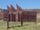
Roxborough State Park
Encyclopedia
Roxborough State Park is a Colorado State Park
known for dramatic red sandstone formations. Located in Douglas County
25 miles (40.2 km) south of Denver, Colorado
, the 3339 acres (13.5 km²) park was established in 1975. In 1980 it was recognized as a National Natural Landmark
.
, a 3339 acres (13.5 km²) Colorado State Park
, is known for dramatic red sandstone formations. Located in Douglas County
25 miles (40.2 km) south of Denver, Colorado
. In 1980 it was recognized as a National Natural Landmark
because of the number of ecological systems and geological formations. It is also a State Historic Site and National Cultural District because of the number of archaeological sites.
for its 300 million year old red sandstone Fountain Formation
that tilt at a 60 degree angle. The park includes great examples of exposed Precambrian to Late Mesozoic hogback, monolithic and spire formations from the Permian
, Pennsylvanian
and Cretaceous
age. Carpenter Peak's exposed granite is from Precambrian
era.
There are six hiking trails in Roxborough State Park, a network of easy to moderate trails that also connect to Douglas County trail system, Pike National Forest
and Waterton Canyon trails.
Colorado State Parks
Colorado State Parks manages the Colorado state parks system. The system administers 42 parks.-History:*1937. The state legislature appointed a land board to create the first State Parks Board....
known for dramatic red sandstone formations. Located in Douglas County
Douglas County, Colorado
Douglas County is the eighth most populous of the 64 counties of the state of Colorado, in the United States. The county is located midway between Colorado's two largest cities: Denver and Colorado Springs...
25 miles (40.2 km) south of Denver, Colorado
Denver, Colorado
The City and County of Denver is the capital and the most populous city of the U.S. state of Colorado. Denver is a consolidated city-county, located in the South Platte River Valley on the western edge of the High Plains just east of the Front Range of the Rocky Mountains...
, the 3339 acres (13.5 km²) park was established in 1975. In 1980 it was recognized as a National Natural Landmark
National Natural Landmark
The National Natural Landmark program recognizes and encourages the conservation of outstanding examples of the natural history of the United States. It is the only natural areas program of national scope that identifies and recognizes the best examples of biological and geological features in...
.
Geography
Roxborough State ParkRoxborough State Park
Roxborough State Park is a Colorado State Park known for dramatic red sandstone formations. Located in Douglas County south of Denver, Colorado, the park was established in 1975. In 1980 it was recognized as a National Natural Landmark.-Geography:...
, a 3339 acres (13.5 km²) Colorado State Park
Colorado State Parks
Colorado State Parks manages the Colorado state parks system. The system administers 42 parks.-History:*1937. The state legislature appointed a land board to create the first State Parks Board....
, is known for dramatic red sandstone formations. Located in Douglas County
Douglas County, Colorado
Douglas County is the eighth most populous of the 64 counties of the state of Colorado, in the United States. The county is located midway between Colorado's two largest cities: Denver and Colorado Springs...
25 miles (40.2 km) south of Denver, Colorado
Denver, Colorado
The City and County of Denver is the capital and the most populous city of the U.S. state of Colorado. Denver is a consolidated city-county, located in the South Platte River Valley on the western edge of the High Plains just east of the Front Range of the Rocky Mountains...
. In 1980 it was recognized as a National Natural Landmark
National Natural Landmark
The National Natural Landmark program recognizes and encourages the conservation of outstanding examples of the natural history of the United States. It is the only natural areas program of national scope that identifies and recognizes the best examples of biological and geological features in...
because of the number of ecological systems and geological formations. It is also a State Historic Site and National Cultural District because of the number of archaeological sites.
Geology
Roxborough State Park is a designated Colorado Natural Area and National Natural LandmarkNational Natural Landmark
The National Natural Landmark program recognizes and encourages the conservation of outstanding examples of the natural history of the United States. It is the only natural areas program of national scope that identifies and recognizes the best examples of biological and geological features in...
for its 300 million year old red sandstone Fountain Formation
Fountain Formation
The Fountain Formation is a Pennsylvanian bedrock unit consisting primarily of conglomerate, sandstone, or arkose, in the states of Colorado and Wyoming in the USA, along the east side of the Front Range of the Rocky Mountains, and along the west edge of the Denver Basin.-Origin of name:The...
that tilt at a 60 degree angle. The park includes great examples of exposed Precambrian to Late Mesozoic hogback, monolithic and spire formations from the Permian
Permian
The PermianThe term "Permian" was introduced into geology in 1841 by Sir Sir R. I. Murchison, president of the Geological Society of London, who identified typical strata in extensive Russian explorations undertaken with Edouard de Verneuil; Murchison asserted in 1841 that he named his "Permian...
, Pennsylvanian
Pennsylvanian
The Pennsylvanian is, in the ICS geologic timescale, the younger of two subperiods of the Carboniferous Period. It lasted from roughly . As with most other geochronologic units, the rock beds that define the Pennsylvanian are well identified, but the exact date of the start and end are uncertain...
and Cretaceous
Cretaceous
The Cretaceous , derived from the Latin "creta" , usually abbreviated K for its German translation Kreide , is a geologic period and system from circa to million years ago. In the geologic timescale, the Cretaceous follows the Jurassic period and is followed by the Paleogene period of the...
age. Carpenter Peak's exposed granite is from Precambrian
Precambrian
The Precambrian is the name which describes the large span of time in Earth's history before the current Phanerozoic Eon, and is a Supereon divided into several eons of the geologic time scale...
era.
Flora and fauna
The park consists of forests of ponderosa pine and Douglas fir, prairie land, and woodlands that support many forms of wildlife. There are 145 bird, over 50 butterfly and moth, and 11 amphibian and reptile species. Animals commonly found in the park include black bear, coyote, deer, elk, fox, prairie dog, and rabbit. Sources of water include Little Willow Creek, Willow Creek and Mill Gulch. Elevations range from 5900 to 7280 ft (1,798.3 to 2,218.9 m).Visitors
The park has visitors center with exhibits, a bookstore, and restrooms.There are six hiking trails in Roxborough State Park, a network of easy to moderate trails that also connect to Douglas County trail system, Pike National Forest
Pike National Forest
The Pike National Forest is located in the Front Range of Colorado, USA, west of Colorado Springs and including Pikes Peak. The forest encompasses 1,106,604 acres within Clear Creek, Teller, Park, Jefferson, Douglas and El Paso counties. The major rivers draining the forest are the South Platte...
and Waterton Canyon trails.