
.gif)
Route 162 (Connecticut)
Encyclopedia
Route 162 is a state highway
in southern Connecticut
running for 10.34 miles (16.6 km) from Milford to the West Haven–Orange town line. Because it is located along the Atlantic coast it serves as a more scenic alternate route to US 1
, where it both begins and ends.
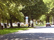 The western terminus of Route 162 is in Milford, where its name is South Broad Street, and from which it tracks east. After passing through downtown Milford, the name changes to New Haven Avenue. Just northeast of the West Haven
town line, it becomes Jones Hill Road. A little over two miles (3 km) farther to the northeast, it becomes Platt Avenue. Less than a mile farther, it becomes Main Street for just 1000 feet (304.8 m). Following Main Street northeast, a driver would then have to turn left onto Wagner Place in order to remain on Route 162. Wagner Place becomes Sawmill Road, which curves left and backtracks to the southwest. After about 1 miles (1.6 km), a driver would encounter a curve right, at which point the name changes again to Bull Hill Lane. Bull Hill Lane continues to the northwest until ending at US 1 after less than a mile.
as a five-mile (8 km) road from Route 1 near the Orange-West Haven line to the junction between Jones Hill Road and Ocean Avenue near the Milford-West Haven line. The portion in Milford was originally numbered as part of Route 122
. This segment was removed from Route 122 and reassigned to an extended Route 162 in 1966.
State highway
State highway, state road or state route can refer to one of three related concepts, two of them related to a state or provincial government in a country that is divided into states or provinces :#A...
in southern Connecticut
Connecticut
Connecticut is a state in the New England region of the northeastern United States. It is bordered by Rhode Island to the east, Massachusetts to the north, and the state of New York to the west and the south .Connecticut is named for the Connecticut River, the major U.S. river that approximately...
running for 10.34 miles (16.6 km) from Milford to the West Haven–Orange town line. Because it is located along the Atlantic coast it serves as a more scenic alternate route to US 1
U.S. Route 1 in Connecticut
In the U.S. state of Connecticut, U.S. Route 1 is a major east–west state highway along Long Island Sound. It has been replaced by Interstate 95 as a through route, which it closely parallels, and now primarily serves as a local business route...
, where it both begins and ends.
Route description
West Haven, Connecticut
West Haven is a city in New Haven County, Connecticut, United States. According to 2006 Census Bureau estimates, the population of the city is 52,721.-History:...
town line, it becomes Jones Hill Road. A little over two miles (3 km) farther to the northeast, it becomes Platt Avenue. Less than a mile farther, it becomes Main Street for just 1000 feet (304.8 m). Following Main Street northeast, a driver would then have to turn left onto Wagner Place in order to remain on Route 162. Wagner Place becomes Sawmill Road, which curves left and backtracks to the southwest. After about 1 miles (1.6 km), a driver would encounter a curve right, at which point the name changes again to Bull Hill Lane. Bull Hill Lane continues to the northwest until ending at US 1 after less than a mile.
History
Route 162 was created in the 1932 state highway renumbering1932 state highway renumbering (Connecticut)
In 1932, the Highway Department of the U.S. state of Connecticut , decided to completely renumber all its state highways. The only exceptions were the U.S. Highways and some of the New England Interstate Routes. Between 1922 and 1932, Connecticut used a state highway numbering system shared with...
as a five-mile (8 km) road from Route 1 near the Orange-West Haven line to the junction between Jones Hill Road and Ocean Avenue near the Milford-West Haven line. The portion in Milford was originally numbered as part of Route 122
Route 122 (Connecticut)
Route 122 is a primary, minor arterial highway beginning at Interstate 95 in West Haven. It runs north of West Haven center and roughly follows the path of the West River. It then enters the Westville neighborhood of New Haven and ends at Route 63...
. This segment was removed from Route 122 and reassigned to an extended Route 162 in 1966.
Junction list
| Town | Road names | Junction | Milepost | Notes |
|---|---|---|---|---|
| Milford Milford, Connecticut Milford is a coastal city in southwestern New Haven County, Connecticut, United States, located between Bridgeport and New Haven. The population was 52,759 at the 2010 census... (5.25 miles) |
Bridgeport Ave., S. Broad St., New Haven Ave. |
0.00 | ||
| SR 737 (South Broad Street/Seaside Avenue) | 0.77 | To Silver Sands State Park Silver Sands State Park Silver Sands State Park is a Connecticut State park in Milford, Connecticut, USA which offers facilities for swimming in the Long Island Sound, picnicking, trails, boardwalks and opportunities for bird-watching. It includes the bird sanctuary of Charles Island, which is rumored to be the site of... |
||
| SR 736 (Buckingham Avenue) | 1.92 | |||
| SR 736 (Merwin Avenue) | 4.49 | |||
| West Haven West Haven, Connecticut West Haven is a city in New Haven County, Connecticut, United States. According to 2006 Census Bureau estimates, the population of the city is 52,721.-History:... (4.71 miles) |
Jones Hill Rd., Platt Ave., W. Main St., Wagner Place, Saw Mill Rd., Bull Hill Ln. |
SR 705 (Ocean Avenue) | 5.32 | Junction is at a roundabout Roundabout A roundabout is the name for a road junction in which traffic moves in one direction around a central island. The word dates from the early 20th century. Roundabouts are common in many countries around the world... |
| SR 705 (Platt Avenue) | 7.42 | |||
| 8.97 | Exit 42 | |||
| Orange Orange, Connecticut Orange is a town in New Haven County, Connecticut, United States. The population was 13,233 at the 2000 census. A 2007 Census Bureau estimate puts the population at 13,813. The town is governed by a Board of Selectmen.-History:... (0.28 miles) |
Bull Hill Lane | 10.34 |