
Romer
Encyclopedia
A Reference Card or "Romer" is a device for increasing the accuracy when reading a grid reference
from a map
. Made from transparent plastic, paper or other materials, they are also found on most baseplate compasses. Essentially, it is a specially marked-out ruler
which matches the scale of the map in use. The scales are laid out in reverse, such that by lining up the numbers given in the grid reference with the gridlines for the square in question, the corner of the romer lies on the location whose grid reference
you wish to read. Some, transparent versions, have a small hole at the origin when this is not at the corner of the Reference Card. this allows access to the map such that the location could be marked with a pencil if using the Reference Card in reverse having been given a grid reference
to start with. They are used in many types of land navigation.
Romers can easily be made yourself; by hand, by using a computer or by finding a website with instructions.
They describe only an approximate location. The larger the scale on the map, the less accurate the romer reading. On 1:25,000 maps, such as the Ordnance Survey Explorer Series, a 6 figure grid reference gives an area of 10,000m2. This is larger than a football pitch. A more popular and accurate device is a Grid Reference Tool.
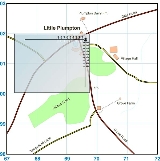
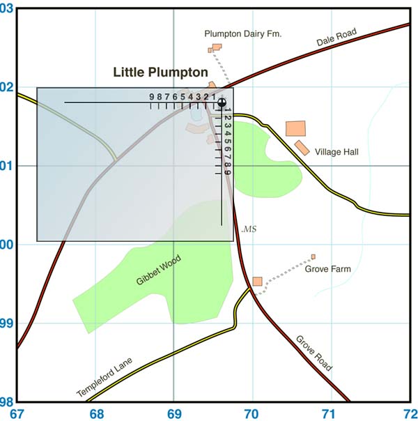
The illustration below shows how the romer is used. Here, we are plotting the reference 696018. The marks corresponding to (6, 8) on the romer are lined up along the gridlines (69, 01). The hole near the corner yields the exact point, the church at Little Plumpton.
Grid reference
Grid references define locations on maps using Cartesian coordinates. Grid lines on maps define the coordinate system, and are numbered to provide a unique reference to features....
from a map
Map
A map is a visual representation of an area—a symbolic depiction highlighting relationships between elements of that space such as objects, regions, and themes....
. Made from transparent plastic, paper or other materials, they are also found on most baseplate compasses. Essentially, it is a specially marked-out ruler
Ruler
A ruler, sometimes called a rule or line gauge, is an instrument used in geometry, technical drawing, printing and engineering/building to measure distances and/or to rule straight lines...
which matches the scale of the map in use. The scales are laid out in reverse, such that by lining up the numbers given in the grid reference with the gridlines for the square in question, the corner of the romer lies on the location whose grid reference
Grid reference
Grid references define locations on maps using Cartesian coordinates. Grid lines on maps define the coordinate system, and are numbered to provide a unique reference to features....
you wish to read. Some, transparent versions, have a small hole at the origin when this is not at the corner of the Reference Card. this allows access to the map such that the location could be marked with a pencil if using the Reference Card in reverse having been given a grid reference
Grid reference
Grid references define locations on maps using Cartesian coordinates. Grid lines on maps define the coordinate system, and are numbered to provide a unique reference to features....
to start with. They are used in many types of land navigation.
Romers can easily be made yourself; by hand, by using a computer or by finding a website with instructions.
They describe only an approximate location. The larger the scale on the map, the less accurate the romer reading. On 1:25,000 maps, such as the Ordnance Survey Explorer Series, a 6 figure grid reference gives an area of 10,000m2. This is larger than a football pitch. A more popular and accurate device is a Grid Reference Tool.
The illustration below shows how the romer is used. Here, we are plotting the reference 696018. The marks corresponding to (6, 8) on the romer are lined up along the gridlines (69, 01). The hole near the corner yields the exact point, the church at Little Plumpton.