
River, Kent
Encyclopedia
River is a village and civil parish
in Kent
, England
, United Kingdom
, situated between the historic town of Dover
and the neighbouring village of Temple Ewell
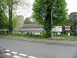
. "Village" is a somewhat loose term for River; it is a community of several thousand and is probably more usefully regarded as a suburb of Dover. After a period of rapid housing development in the 1960s and 1970s, the size and population of River has largely stabilised in recent decades, and little new development is now seen. This is partly because River lies in a steep chalk valley which affords little scope for further expansion. However, it is also true that the Dover area is historically not in the vanguard of high economic growth, being tied almost exclusively to the cross-channel port and various support industries, which have witnessed a gradual decline since the opening of the Channel Tunnel
. In transport terms River is well connected, being close to the A2
and A20 trunk routes, having a railway station at Kearsney
with direct services to London, and of course being only 3 miles (5 km) from the Port of Dover itself.
River is also one of the wards
in the Dover
local government district. The ward also includes the parish of Alkham
, situated west of River.
Geographically speaking, River is situated in a steep wooded valley formed by the River Dour
. At its north-west (upstream) end the valley splits into the Dour Valley, in which Temple Ewell lies, and the Alkham Valley
, which for much of the time is dry but which contains the Drellingore
, a highly seasonal stream characteristic of chalk downland (another example being the nearby Nailbourne
). The confluence of the Dour and Drellingore rivers is situated in Kearsney Abbey near its Lower Road entrance.
At the valley floor, River is on average about 100 feet (30 m) above sea level (there is a mark on the playground wall of River Primary School, Lewisham Road, to indicate the 100-foot level). Along the axis of the Dour, the land slopes gradually down towards the sea about 3 miles (5 km) distant. In valley cross-section, the land slopes steeply updwards and is heavily wooded. The common land areas above Kearsney Abbey afford excellent views down towards Dover and its historic castle
, and much of the area consists of rare and delicate chalk grassland.
River comes under the jurisdiction of Dover District Council and is in the Dover and Deal parliamentary constituency
. River has had its own Parish Council since 1987.
Being a relatively stable community, River has a strong identity and sense of place, even though there is no longer any definable focal point such as a green or pond. The village has a primary school of about 400 pupils, taking almost all of its intake from the village itself. Its population supports a wide variety of local interest groups such as drama (the Dour Dramatic Players), gardening (the River Gardeners), and many others. The Village Hall in Common Lane is the focus for many of these society activities. There are two pubs, the Royal Oak and the Dublin Man 'o' War. Teams from these pubs meet every Boxing Day for a traditional tug of war across the lake in Kearsney Abbey.
There are two significant green areas, the River Recreation Ground (the "Rec") and Kearsney Abbey. Despite its name, Kearsney Abbey was never a monastic estate. "Abbey" was simply the name given to a manor house built by the Fector family in the early 19th century on the Kearsney Manor estate. The house fell into disrepair after World War II and was demolished in about 1960. All that remains of the building today is the billiards room, which now serves as a café.
There are other green spaces nearby, notably Crabble Athletic Ground (home of Dover Athletic F.C.
) situated at the Dover end of Lewisham Road, and Russell Gardens/Bushy Ruff, situated on the Alkham Valley Road beyond Kearsney Abbey.
There are two thriving churches, the Parish Church of St Peter and St Paul in Minnis Lane, and the Methodist Church on Lewisham Road. The parish church celebrated its 800th anniversary in 1995; the Methodist Church its 100th round about the same time.
The nucleus of River (the "older" areas of the village, around Lower Road, Common Lane, River Street and Minnis Lane) dates from the 1800s or earlier. Most of the development post-dates this; Lewisham Road, Valley Road, Byllan Road and surroundings probably from the 1930s, and "the estate" around The Ridgeway and Crabble Lane, plus the floodplain developments of Riverdale and Kingston Close, from the 1960s and 1970s.
In its heyday, River had a number of shops, but most of these have gradually closed over the years. While the village presently has three grocery-type shops, the Co-op on Lower Road, a greengrocer on Common Lane, and Coxhill Stores on Lewisham Road, right up to the 1970s there were at least four others: Waterfall Stores on Minnis Lane, Simmons' on River Street, Stoker's hardware store on Lower Road, and Harris's on Lewisham Road. There was also a butcher next to the Co-op. The increasing ease of transport links into Dover, and nearby Folkestone
and Canterbury
, and the growth of out-of-town developments around Whitfield, have, as with so many other places, squeezed the market for small local shops to the point of unsustainability. River retains its post office.
River has a park called Kearsney Abbey, and another two adjacent parks called Russell Gardens and Bushy Ruff.
. The River Dour, which runs through the village and along which Lower Road is built, once supported several water-powered flour and paper mills. One of them, formerly known as Mannering's Mill but now known as Crabble Corn Mill (built in 1812), survives in working form. It now promotes itself as a visitor attraction, offering a pleasant lakeside setting and restaurant as well as educational and historical resources. The site of the other major mill within "old" River is now long since disused and forms an attractive and atmospheric landmark at the downstream end of Kearsney Abbey, known locally as "The Ruins". It forms excellent habitat for water-loving birds such as grey wagtails and kingfishers. Other mills existed further downstream but all have now been either demolished or converted for other industry or housing.
Civil parish
In England, a civil parish is a territorial designation and, where they are found, the lowest tier of local government below districts and counties...
in Kent
Kent
Kent is a county in southeast England, and is one of the home counties. It borders East Sussex, Surrey and Greater London and has a defined boundary with Essex in the middle of the Thames Estuary. The ceremonial county boundaries of Kent include the shire county of Kent and the unitary borough of...
, England
England
England is a country that is part of the United Kingdom. It shares land borders with Scotland to the north and Wales to the west; the Irish Sea is to the north west, the Celtic Sea to the south west, with the North Sea to the east and the English Channel to the south separating it from continental...
, United Kingdom
United Kingdom
The United Kingdom of Great Britain and Northern IrelandIn the United Kingdom and Dependencies, other languages have been officially recognised as legitimate autochthonous languages under the European Charter for Regional or Minority Languages...
, situated between the historic town of Dover
Dover
Dover is a town and major ferry port in the home county of Kent, in South East England. It faces France across the narrowest part of the English Channel, and lies south-east of Canterbury; east of Kent's administrative capital Maidstone; and north-east along the coastline from Dungeness and Hastings...
and the neighbouring village of Temple Ewell
Temple Ewell
Temple Ewell is a civil parish and historic village in the county of Kent, England. The village is part of the Dover district of Kent, and forms part of the Dover urban area, it is situated three miles North West of the town of Dover....
. "Village" is a somewhat loose term for River; it is a community of several thousand and is probably more usefully regarded as a suburb of Dover. After a period of rapid housing development in the 1960s and 1970s, the size and population of River has largely stabilised in recent decades, and little new development is now seen. This is partly because River lies in a steep chalk valley which affords little scope for further expansion. However, it is also true that the Dover area is historically not in the vanguard of high economic growth, being tied almost exclusively to the cross-channel port and various support industries, which have witnessed a gradual decline since the opening of the Channel Tunnel
Channel Tunnel
The Channel Tunnel is a undersea rail tunnel linking Folkestone, Kent in the United Kingdom with Coquelles, Pas-de-Calais near Calais in northern France beneath the English Channel at the Strait of Dover. At its lowest point, it is deep...
. In transport terms River is well connected, being close to the A2
A2 road (Great Britain)
The A2 is a major road in southern England, connecting London with the English Channel port of Dover in Kent. This route has always been of importance as a connection between the British capital of London and sea trade routes to Continental Europe...
and A20 trunk routes, having a railway station at Kearsney
Kearsney railway station
Kearsney railway station serves Kearsney in Kent. It is served by Southeastern.The station and the line it serves were built by the London, Chatham and Dover Railway as the station for Temple Ewell and the parish of River. The community of Kearsney grew around the Railway Bell Hotel which was on...
with direct services to London, and of course being only 3 miles (5 km) from the Port of Dover itself.
River is also one of the wards
Wards of the United Kingdom
A ward in the United Kingdom is an electoral district at sub-national level represented by one or more councillors. It is the primary unit of British administrative and electoral geography .-England:...
in the Dover
Dover (district)
Dover is a local government district in Kent, England. Dover is its administrative centre. It was formed on 1 April 1974 by the merger of the boroughs of Deal, Dover, and Sandwich along with Dover Rural District and most of Eastry Rural District...
local government district. The ward also includes the parish of Alkham
Alkham
Alkham is a village and civil parish in the Dover district of Kent, England, about five miles west of Dover, on the B2060 secondary road. Within the parish are the settlements of Chalksole and Ewell Minnis; the parish population was 691 people...
, situated west of River.
Geographically speaking, River is situated in a steep wooded valley formed by the River Dour
River Dour, Kent
The River Dour is a river in the county of Kent, in England. It flows from the villages of Temple Ewell and River, through the village of Kearsney, to Dover. It is roughly 4km long....
. At its north-west (upstream) end the valley splits into the Dour Valley, in which Temple Ewell lies, and the Alkham Valley
Alkham Valley
The Alkham Valley is in the Kent Downs , an Area of Outstanding Natural Beauty, in South East Kent, England. The valley, a lies between Folkestone and Dover....
, which for much of the time is dry but which contains the Drellingore
Drellingore
Drellingore is a village in South East Kent, England. It lies in the Alkham Valley an area of outstanding natural beauty between Folkestone and Dover. Although the Alkham Valley is a dry valley most of the surrounding land forms a water catchment area. Water is extracted from the chalk aquifer for...
, a highly seasonal stream characteristic of chalk downland (another example being the nearby Nailbourne
Little Stour
The Little Stour is one of the tributaries of the River Stour in the English county of Kent. The upper reaches of the river are better known as the Nailbourne, whilst the lower reaches were once known as the Seaton Navigation....
). The confluence of the Dour and Drellingore rivers is situated in Kearsney Abbey near its Lower Road entrance.
At the valley floor, River is on average about 100 feet (30 m) above sea level (there is a mark on the playground wall of River Primary School, Lewisham Road, to indicate the 100-foot level). Along the axis of the Dour, the land slopes gradually down towards the sea about 3 miles (5 km) distant. In valley cross-section, the land slopes steeply updwards and is heavily wooded. The common land areas above Kearsney Abbey afford excellent views down towards Dover and its historic castle
Dover Castle
Dover Castle is a medieval castle in the town of the same name in the English county of Kent. It was founded in the 12th century and has been described as the "Key to England" due to its defensive significance throughout history...
, and much of the area consists of rare and delicate chalk grassland.
River comes under the jurisdiction of Dover District Council and is in the Dover and Deal parliamentary constituency
Dover (UK Parliament constituency)
Dover is a constituency represented in the House of Commons of the Parliament of the United Kingdom. It elects one Member of Parliament by the first past the post system of election.-Boundaries:...
. River has had its own Parish Council since 1987.
Being a relatively stable community, River has a strong identity and sense of place, even though there is no longer any definable focal point such as a green or pond. The village has a primary school of about 400 pupils, taking almost all of its intake from the village itself. Its population supports a wide variety of local interest groups such as drama (the Dour Dramatic Players), gardening (the River Gardeners), and many others. The Village Hall in Common Lane is the focus for many of these society activities. There are two pubs, the Royal Oak and the Dublin Man 'o' War. Teams from these pubs meet every Boxing Day for a traditional tug of war across the lake in Kearsney Abbey.
There are two significant green areas, the River Recreation Ground (the "Rec") and Kearsney Abbey. Despite its name, Kearsney Abbey was never a monastic estate. "Abbey" was simply the name given to a manor house built by the Fector family in the early 19th century on the Kearsney Manor estate. The house fell into disrepair after World War II and was demolished in about 1960. All that remains of the building today is the billiards room, which now serves as a café.
There are other green spaces nearby, notably Crabble Athletic Ground (home of Dover Athletic F.C.
Dover Athletic F.C.
Dover Athletic Football Club is an association football team based in the town of Dover, Kent, England. The club was formed in 1983 after the dissolution of the town's previous club, Dover, whose place in the Southern League was taken by the new club...
) situated at the Dover end of Lewisham Road, and Russell Gardens/Bushy Ruff, situated on the Alkham Valley Road beyond Kearsney Abbey.
There are two thriving churches, the Parish Church of St Peter and St Paul in Minnis Lane, and the Methodist Church on Lewisham Road. The parish church celebrated its 800th anniversary in 1995; the Methodist Church its 100th round about the same time.
The nucleus of River (the "older" areas of the village, around Lower Road, Common Lane, River Street and Minnis Lane) dates from the 1800s or earlier. Most of the development post-dates this; Lewisham Road, Valley Road, Byllan Road and surroundings probably from the 1930s, and "the estate" around The Ridgeway and Crabble Lane, plus the floodplain developments of Riverdale and Kingston Close, from the 1960s and 1970s.
In its heyday, River had a number of shops, but most of these have gradually closed over the years. While the village presently has three grocery-type shops, the Co-op on Lower Road, a greengrocer on Common Lane, and Coxhill Stores on Lewisham Road, right up to the 1970s there were at least four others: Waterfall Stores on Minnis Lane, Simmons' on River Street, Stoker's hardware store on Lower Road, and Harris's on Lewisham Road. There was also a butcher next to the Co-op. The increasing ease of transport links into Dover, and nearby Folkestone
Folkestone
Folkestone is the principal town in the Shepway District of Kent, England. Its original site was in a valley in the sea cliffs and it developed through fishing and its closeness to the Continent as a landing place and trading port. The coming of the railways, the building of a ferry port, and its...
and Canterbury
Canterbury
Canterbury is a historic English cathedral city, which lies at the heart of the City of Canterbury, a district of Kent in South East England. It lies on the River Stour....
, and the growth of out-of-town developments around Whitfield, have, as with so many other places, squeezed the market for small local shops to the point of unsustainability. River retains its post office.
River has a park called Kearsney Abbey, and another two adjacent parks called Russell Gardens and Bushy Ruff.
Mills
River owes its early existence to millingWatermill
A watermill is a structure that uses a water wheel or turbine to drive a mechanical process such as flour, lumber or textile production, or metal shaping .- History :...
. The River Dour, which runs through the village and along which Lower Road is built, once supported several water-powered flour and paper mills. One of them, formerly known as Mannering's Mill but now known as Crabble Corn Mill (built in 1812), survives in working form. It now promotes itself as a visitor attraction, offering a pleasant lakeside setting and restaurant as well as educational and historical resources. The site of the other major mill within "old" River is now long since disused and forms an attractive and atmospheric landmark at the downstream end of Kearsney Abbey, known locally as "The Ruins". It forms excellent habitat for water-loving birds such as grey wagtails and kingfishers. Other mills existed further downstream but all have now been either demolished or converted for other industry or housing.