Ranton, Staffordshire
Encyclopedia
Ranton is a small village in Staffordshire
, situated 3.5 miles (5.6 km) west of Stafford
, 2.5 miles (4 km) east of Woodseaves
and 2 miles (3.2 km) northeast of Gnosall
.
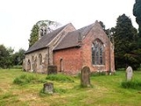
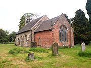
church, Ranton, is a small ancient structure, dating from the 13th century.
 The building was renovated in 1753, when the chancel was built. The east window was probably put in at this time. The bell turret was removed in 1889, but was re-erected in the 1940s in memory of Frank Russell and John Owen Timms, two local men who lost their lives in the Second World War. The new turret was not strong enough to support the bells, which had to be removed and put onto storage until the turret was rebuilt. The church has a small bell-tower at the west end of the nave with two bells, and was repaired and a gallery erected in 1840. The restoration was supervised by Staffordshire
ecclesiastical architect Andrew Capper. The parish registers commence in 1655. The original registers for the period 1655-1993 (Baptisms), 1655-1984 (Marriages) & 1655-1993 (Burials) are deposited at Staffordshire
Record Office. Bishops Transcripts, 1660-1868 (with gaps 1840-1854) are deposited at Lichfield
Record office.
The ruins of both Ranton Abbey
and Abbey house
stand nearby.
Staffordshire
Staffordshire is a landlocked county in the West Midlands region of England. For Eurostat purposes, the county is a NUTS 3 region and is one of four counties or unitary districts that comprise the "Shropshire and Staffordshire" NUTS 2 region. Part of the National Forest lies within its borders...
, situated 3.5 miles (5.6 km) west of Stafford
Stafford
Stafford is the county town of Staffordshire, in the West Midlands region of England. It lies approximately north of Wolverhampton and south of Stoke-on-Trent, adjacent to the M6 motorway Junction 13 to Junction 14...
, 2.5 miles (4 km) east of Woodseaves
Woodseaves
Woodseaves is a village in Staffordshire, England.It lies in the civil parish of High Offley and is situated on the A519 road and lies at the south-west end of the B5405 road, which leads to Great Bridgeford. Nearby are the villages of Gnosall and Norbury, the hamlets of Knightley and High Offley,...
and 2 miles (3.2 km) northeast of Gnosall
Gnosall
Gnosall is a large village in the Borough of Stafford, Staffordshire, England, with a population of approximately 5,000. It lies on the A518, approximately half-way between the towns of Newport and the county town of Staffordshire, Stafford...
.
All Saints church, Ranton
All SaintsAll Saints
All Saints' Day , often shortened to All Saints, is a solemnity celebrated on 1 November by parts of Western Christianity, and on the first Sunday after Pentecost in Eastern Christianity, in honour of all the saints, known and unknown...
church, Ranton, is a small ancient structure, dating from the 13th century.

Staffordshire
Staffordshire is a landlocked county in the West Midlands region of England. For Eurostat purposes, the county is a NUTS 3 region and is one of four counties or unitary districts that comprise the "Shropshire and Staffordshire" NUTS 2 region. Part of the National Forest lies within its borders...
ecclesiastical architect Andrew Capper. The parish registers commence in 1655. The original registers for the period 1655-1993 (Baptisms), 1655-1984 (Marriages) & 1655-1993 (Burials) are deposited at Staffordshire
Staffordshire
Staffordshire is a landlocked county in the West Midlands region of England. For Eurostat purposes, the county is a NUTS 3 region and is one of four counties or unitary districts that comprise the "Shropshire and Staffordshire" NUTS 2 region. Part of the National Forest lies within its borders...
Record Office. Bishops Transcripts, 1660-1868 (with gaps 1840-1854) are deposited at Lichfield
Lichfield
Lichfield is a cathedral city, civil parish and district in Staffordshire, England. One of eight civil parishes with city status in England, Lichfield is situated roughly north of Birmingham...
Record office.
The ruins of both Ranton Abbey
Ranton Abbey
Ranton Abbey or Ranton Priory was an Augustinian Priory in Ranton, Staffordshire, England, built c.1150 by Robert fitz Noel of Ellenhall. Ranton was dissolved by the Act of 1536. Only the 14th century tower and part of the south wall remain, although the cloisters and other parts are known to have...
and Abbey house
Abbey House, Ranton
Abbey House is an early 19th century ruined stately home in Ranton, Staffordshire, England.-History:The red-brick Regency house was built in 1820 by Thomas Anson the 1st Earl of Lichfield as a second seat for his family based at Shugborough Hall. The 300 acre estate is also the site of Ranton...
stand nearby.

