
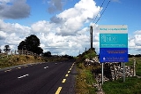
R362 road
Encyclopedia

Regional road
A regional road in Ireland is a class of road not forming a major route , but nevertheless forming a link in the national route network. There are over 11,600 kilometres of regional roads. Regional roads are numbered with three digit route numbers, prefixed by "R" A regional road in Ireland is a...
in Ireland
Republic of Ireland
Ireland , described as the Republic of Ireland , is a sovereign state in Europe occupying approximately five-sixths of the island of the same name. Its capital is Dublin. Ireland, which had a population of 4.58 million in 2011, is a constitutional republic governed as a parliamentary democracy,...
linking Dunmore on the N83
N83 road (Ireland)
The N83 road is a national secondary road in Ireland that runs from its junction with the N17 just south of Ireland West Airport Knock in County Mayo to a point just north of Tuam, County Galway where it rejoins the N17.Total length is ....
(via 5 km of the R360
R360 road
The R360 road is a regional road in County Galway, Ireland. Southeast to northwest the route connects the town of Dunmore to Ballymoe.The road is in Northwest County Galway and is long.-References:* – Department of Transport...
) with the N6 at Athlone. It passes through Glenamaddy
Glenamaddy
Glenamaddy is a small town in County Galway, Ireland. It lies at the crossroads where the R362 and R364 regional roads intersect.Glenamaddy is the most important town in the northeastern corner of County Galway. It became the musical capital of Connacht during the 1960s when the Showband craze...
, Creggs
Creggs
Creggs is a small village in County Galway, in the west of Ireland, on the R362 regional road between Glenamaddy and Athleague.Although it has a population of only a hundred the village contains three Public Houses and used to contain seven...
, Athleague and Curraghboy
Curraghboy
Curraghboy is a village in County Roscommon, Ireland. It lies northwest of Athlone on the R362 regional road. It has one public house and two grocery shops...
en route.
The road is 55 km (34.2 mi) long.