
Quebec Route 349
Encyclopedia
Route 349 is a provincial highway located in the Mauricie
region of Quebec
. It runs from the junction of Route 138
in Louiseville
to Saint-Didace
at the junction with Route 348
. In Saint-Paulin
it overlaps Route 350
.
Mauricie
Mauricie is a traditional and current administrative region of Quebec. La Mauricie National Park is contained within the region, making it a prime tourist location. The region has a land area of 35,855.22 km² and a 2006 census population of 258,928 residents...
region of Quebec
Quebec
Quebec or is a province in east-central Canada. It is the only Canadian province with a predominantly French-speaking population and the only one whose sole official language is French at the provincial level....
. It runs from the junction of Route 138
Quebec route 138
Route 138 is a major highway in the Canadian province of Quebec, following the entire north shore of the Saint Lawrence River past Montreal to the eastern terminus in Natashquan on the Gulf of Saint Lawrence. The western terminus is in Elgin, at the border with New York State south-west of Montreal...
in Louiseville
Louiseville, Quebec
Louiseville is a town in the Mauricie region of the province of Quebec in Canada. It is located near the mouth of the Wolf River on the north shore of Lac Saint-Pierre....
to Saint-Didace
Saint-Didace, Quebec
Saint-Didace is a parish municipality in the Lanaudière region of Quebec, Canada, part of the D'Autray Regional County Municipality.-Demographics:Population:* Population in 2006: 668 * Population in 2001: 589...
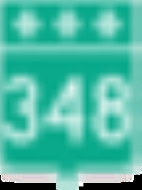
at the junction with Route 348
Quebec Route 348
Route 348 is a provincial highway located in the Lanaudière and Mauricie regions of Quebec. It runs from the junction of Route 125 just west of Rawdon and ends at Route 138 in Louiseville...
. In Saint-Paulin
Saint-Paulin, Quebec
Saint-Paulin is a municipality in the Mauricie region of the province of Quebec in Canada.-Demographics:Population trend:* Population in 2006: 1622 * Population in 2001: 1576* Population in 1996: 1599...
it overlaps Route 350
Quebec Route 350
Route 350 is a provincial highway located in the Mauricie region of Quebec. It runs from the junction of Route 348 in Saint-Édouard-de-Maskinongé to the junction of Route 153 west of Saint-Boniface-de-Shawinigan...
.
Towns located along Route 349
- Saint-Didace
- Saint-Alexis-des-MontsSaint-Alexis-des-Monts, QuebecSaint-Alexis-des-Monts is a parish municipality in the Mauricie region of the province of Quebec in Canada.It is located in the Laurentian Mountains, having a topography that is characterized by valleys and rounded hills, with an altitude varying between to . There are more than 600 lakes, 400...
- Sainte-Angèle-de-PrémontSainte-Angèle-de-Prémont, QuebecSainte-Angèle-de-Prémont is a municipality in the Mauricie region of the province of Quebec in Canada.-References:...
- Saint-Paulin
- Saint-Léon
- Louiseville
Major Intersections
| RCM or ET | Municipality | Km | Road | Notes |
|---|---|---|---|---|
| Maskinongé Maskinongé Regional County Municipality, Quebec Maskinongé is a county regional municipality of Quebec in central Quebec, Canada in the Mauricie region. The seat is in Louiseville. It is located adjacent on the west of Trois-Rivières on the Saint Lawrence River.... |
Louiseville Louiseville, Quebec Louiseville is a town in the Mauricie region of the province of Quebec in Canada. It is located near the mouth of the Wolf River on the north shore of Lac Saint-Pierre.... |
0.0 | ||
| Saint-Léon-le-Grand Saint-Léon-le-Grand, Quebec Saint-Léon-le-Grand, Quebec may refer to:*Saint-Léon-le-Grand, Mauricie, Quebec, in Matawinie Regional County Municipality*Saint-Léon-le-Grand, Bas-Saint-Laurent, Quebec, in La Matapédia Regional County Municipality... |
6.7 | Rue de la Fabrique | To Saint-Léon-le-Grand Saint-Léon-le-Grand, Quebec Saint-Léon-le-Grand, Quebec may refer to:*Saint-Léon-le-Grand, Mauricie, Quebec, in Matawinie Regional County Municipality*Saint-Léon-le-Grand, Bas-Saint-Laurent, Quebec, in La Matapédia Regional County Municipality... |
|
| Saint-Paulin Saint-Paulin, Quebec Saint-Paulin is a municipality in the Mauricie region of the province of Quebec in Canada.-Demographics:Population trend:* Population in 2006: 1622 * Population in 2001: 1576* Population in 1996: 1599... |
18.0 | Southern terminus of Route 349 / Route 350 overlap | ||
| 21.3 | Southern terminus of Route 349 / Route 350 overlapRue Lafleche to Hunterstown | |||
| Saint-Alexis-des-Monts Saint-Alexis-des-Monts, Quebec Saint-Alexis-des-Monts is a parish municipality in the Mauricie region of the province of Quebec in Canada.It is located in the Laurentian Mountains, having a topography that is characterized by valleys and rounded hills, with an altitude varying between to . There are more than 600 lakes, 400... |
36.2 | Rue Notre-Dame | To Saint-Alexis-des-Monts Saint-Alexis-des-Monts, Quebec Saint-Alexis-des-Monts is a parish municipality in the Mauricie region of the province of Quebec in Canada.It is located in the Laurentian Mountains, having a topography that is characterized by valleys and rounded hills, with an altitude varying between to . There are more than 600 lakes, 400... |
|
| D'Autray D'Autray Regional County Municipality, Quebec 300px|rightD'Autray is a regional county municipality in central Quebec, Canada. The regional county municipality seat is Berthierville. The municipality has a land area of 1,246.68 km² and a 2006 census population of 40,321 inhabitants. Its largest community is the city of Lavaltrie.-Cities... |
Saint-Didace Saint-Didace, Quebec Saint-Didace is a parish municipality in the Lanaudière region of Quebec, Canada, part of the D'Autray Regional County Municipality.-Demographics:Population:* Population in 2006: 668 * Population in 2001: 589... |
59.7 |
External links
- Official Transport Quebec Map
- http://maps.google.com/maps?f=d&saddr=RTE-349+%4046.335455,+-73.270417&daddr=46.408511,-73.089294+to:Rue+Notre-Dame+N%2FRTE-349+%4046.257470,+-72.939240&hl=en&geocode=11276705390517060780,46.335455,-73.270417%3B357000966753631140,46.257470,-72.939240&mra=dpe&mrcr=0&mrsp=1&sz=10&via=1&dirflg=h&sll=46.315636,-72.854462&sspn=0.436315,1.235962&ie=UTF8&ll=46.358776,-73.082428&spn=0.217986,0.617981&z=11Route 349] on Google Maps