Quebec Route 327
Encyclopedia

Quebec
Quebec or is a province in east-central Canada. It is the only Canadian province with a predominantly French-speaking population and the only one whose sole official language is French at the provincial level....
. The 90-kilometer highway runs from St-André-d'Argenteuil at the junction of Route 344
Quebec route 344
Route 344 is an east/west highway on the north shore of the Ottawa River in Quebec, Canada. Its western terminus is in Grenville-sur-la-Rouge at the junction of Route 148, and its eastern terminus is in L'Assomption at the junction of Route 343...
to Mont-Tremblant just west of the Provincial Park of the same name. The route serves as the main connection between Argenteuil county and the popular tourist region of the Upper Laurentides. In Lachute it is briefly concurrent with Highway 148 (across a bridge). It is also concurrent with Route 364
Quebec Route 364
Route 364 is a Quebec provincial highway located in the Laurentides region. It runs from the junction of Autoroute 15 in the village of Saint-Sauveur, one of the major touristic villages in the Laurentides and ends in Amherst at the junction of Route 323. It overlaps Route 329 in Morin Heights and...
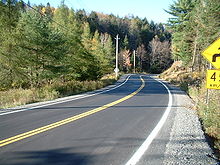
between Weir and Arundel. Significant portions of this highway are meandering and have a maximum speed limit of 70 km/h.
Municipalities along Route 327
- Saint-Andre-d'ArgenteuilSaint-André-d'Argenteuil, QuebecSaint-André-d'Argenteuil is a municipality in the Laurentides region of Quebec, Canada, part of the Argenteuil Regional County Municipality. It is located along the Ottawa River, just south of Lachute.-History:...
- Lachute
- Brownsburg-Chatham
- Grenville-sur-la-RougeGrenville-sur-la-Rouge, QuebecGrenville-sur-la-Rouge is a municipality in the Argenteuil Regional County Municipality, Quebec, Canada. It is a predominantly Francophone municipality situated along the southern border of Quebec between Montreal and Ottawa...
- HarringtonHarrington, QuebecHarrington is a township municipality in the Laurentides region of Quebec, Canada, part of the Argenteuil Regional County Municipality. It is located in the Laurentian Mountains, about north-west of Lachute....
- ArundelArundel, QuebecArundel is a township in Quebec, Canada, located south of Mont Tremblant.Arundel was settled by Scottish and Irish immigrants in the mid-19th century who established subsistence farming operations and worked the forests in winter....
(WeirWeir, QuebecWeir is an unincorporated village in the municipality of Montcalm, Quebec in the Les Laurentides Regional County Municipality. Weir is served by Quebec Route 364. A satellite earth station for VSNL International Canada is located in Weir....
) - Mont-Tremblant
Major intersections
| RCM or ET | Municipality | Km | Junction | Notes |
|---|---|---|---|---|
| Argenteuil Argenteuil Regional County Municipality, Quebec Argenteuil Regional County Municipality is located in southern Quebec, Canada, part of the Laurentides region. The Regional County Municipality seat is Lachute.-History:... |
Saint-André-d'Argenteuil | 0.0 | 344 WEST: to Brownsburg-Chatham 344 EAST: to Saint-Placide Saint-Placide, Quebec Saint-Placide is a municipality in the Laurentides region of Quebec, Canada, part of the Deux-Montagnes Regional County Municipality, along the north shore of the Ottawa River.-History:... |
|
| Lachute | 6.8 7.3 |
50 EAST: to Mirabel Mirabel, Quebec Mirabel is a city in Quebec, Canada. It is an off-island suburb north-west of Montreal.Mirabel is also the name of a territory equivalent to a regional county municipality and census division of Quebec, coextensive with the city of Mirabel. Its geographical code is 74.Mirabel's population was... 50 WEST: to Brownsburg-Chatham |
||
| 11.0 11.2 |
(Overlap 0.2km) | 148 EAST: to Mirabel 148 WEST: to Brownsburg-Chatham |
||
| Les Laurentides Les Laurentides Regional County Municipality, Quebec Les Laurentides is a Regional County Municipality in southwestern Quebec, Canada, in the Laurentides region. The seat is in Saint-Faustin-Lac-Carré and it is named after the Laurentian Mountains... |
Arundel | 61.1 68.6 |
(Overlap 7.5km) | 364 EAST: to Lac-des-Seize-Îles Lac-des-Seize-Îles, Quebec Lac-des-Seize-Îles is a village and municipality in the Laurentides region of Quebec, Canada, part of the Les Pays-d'en-Haut Regional County Municipality... 364 WEST: to Huberdeau Huberdeau, Quebec Huberdeau is a village and municipality in the Laurentides region of Quebec, Canada, part of the Les Laurentides Regional County Municipality. It is located along the western banks of the Rouge River.-Demographics:Population:... |
| Mont-Tremblant | 86.9 87.2 |
117 SOUTH: to Saint-Faustin–Lac-Carré Saint-Faustin–Lac-Carré, Quebec Saint-Faustin–Lac-Carré is a municipality in the Laurentides region of Quebec, Canada, part of the Les Laurentides Regional County Municipality.-Demographics:Population:* Population in 2006: 2985... 117 NORTH: to La Conception La Conception, Quebec La Conception is a village and municipality in the Laurentides region of Quebec, Canada, part of the Les Laurentides Regional County Municipality.-Demographics:Population:* Population in 2006: 1283... |
||
| 102.8 | Chemin des Voyageurs | EAST: to Lac-Supérieur Lac-Supérieur, Quebec Lac-Supérieur is a municipality in the Laurentides region of Quebec, Canada, part of the Les Laurentides Regional County Municipality. It is named after Lake Superior which is located in the Laurentian Mountains, due east of Mont Tremblant Resort. The community of Lac-Supérieur is just south of... |
||
External links
- Official Road Network Map (Transports Quebec)
- http://maps.google.com/maps?f=d&saddr=Route+des+Seigneurs%2FRTE-327+%4045.562806,+-74.336065&daddr=Route+du+Lac-Rond+S%2FRTE-327+%4045.931920,+-74.568625+to:Rue+Labelle+%4046.160903,+-74.585308+to:46.195636,-74.62532+to:Chemin+du+Village+%4046.207725,+-74.595747&hl=en&geocode=10306670054009835216,45.562806,-74.336065%3B12935726728527306592,45.931920,-74.568625%3B10212299851913660652,46.160903,-74.585308%3B5385497637516516932,46.207725,-74.595747&mra=dpe&mrcr=0&mrsp=3&sz=13&via=1,2,3&dirflg=h&sll=46.173531,-74.570217&sspn=0.054681,0.154495&ie=UTF8&ll=45.937781,-74.248352&spn=0.878638,2.471924&z=9Route 327] on Google Maps

