
Quebec Route 251
Encyclopedia
Route 251 is a north/south highway on the south shore of the St. Lawrence River. Its northern terminus is at Route 108
in Cookshire-Eaton
, and its southern terminus is at Route 141
, in Saint-Herménégilde
.
Quebec route 108
Route 108 is a two-lane east/west highway on the south shore of the Saint Lawrence River in the Eastern Townships and Chaudière-Appalaches regions of Quebec, Canada...
in Cookshire-Eaton
Cookshire-Eaton, Quebec
Cookshire-Eaton is a ville in the Estrie region in Quebec. It was formed in 2002 by the amalgamation of the villages of Cookshire and Sawyerville, and the township of Eaton. It is the seat of Le Haut-Saint-François Regional County Municipality....
, and its southern terminus is at Route 141
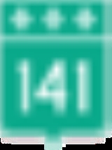
Quebec route 141
Route 141 is a north/south highway in Quebec on the south shore of the Saint Lawrence River. Its northern terminus is in Magog at the junction of Route 112 and Autoroute 10, and the southern terminus is in Saint-Herménégilde at the United States border in Canaan, Vermont.-Municipalities along Route...
, in Saint-Herménégilde
Saint-Herménégilde, Quebec
Saint-Herménégilde is a municipality in Quebec....
.
Municipalities along Route 251
- Saint-HerménégildeSaint-Herménégilde, QuebecSaint-Herménégilde is a municipality in Quebec....
- Sainte-Edwidge-de-CliftonSainte-Edwidge-de-Clifton, QuebecSainte-Edwidge-de-Clifton is a township in the Canadian province of Quebec, located within the Coaticook Regional County Municipality. The township had a population of 440 in the Canada 2006 Census....
- MartinvilleMartinville, QuebecMartinville is a municipality in Quebec. The population was 467 in 2006....
- Cookshire-EatonCookshire-Eaton, QuebecCookshire-Eaton is a ville in the Estrie region in Quebec. It was formed in 2002 by the amalgamation of the villages of Cookshire and Sawyerville, and the township of Eaton. It is the seat of Le Haut-Saint-François Regional County Municipality....
External links
- http://maps.google.com/maps?f=d&saddr=45.361795,-71.797371&daddr=RTE-251+%4045.179751,+-71.663014+to:RTE-251+%4045.124169,+-71.672632+to:Rue+Principale%2FRTE-251+%4045.105557,+-71.673347+to:Rue+Principale%2FRTE-251+%4045.103292,+-71.702512&hl=en&geocode=5327002872219810578,45.343459,-71.790160%3B4932299931109841953,45.179751,-71.663014%3B6548249436044264259,45.124169,-71.672632%3B8716763675849682990,45.105557,-71.673347%3B10880474674758136998,45.103292,-71.702512&mra=dme&mrcr=0&mrsp=0&sz=12&via=1,2,3&sll=45.34732,-71.749992&sspn=0.110993,0.30899&ie=UTF8&ll=45.213971,-71.71875&spn=0.445018,1.235962&z=10Route 251] on Google Maps
- Provincial Route Map (Courtesy of the Quebec Ministry of Transportation)