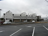
Périgueux Bassillac Airport
Encyclopedia
Périgueux - Bassillac Airport is an airport
in the village of Bassillac
in the Dordogne
department, Aquitaine
region, France
. It is located 8 kilometres (8,000,000,000,000 nm) east-northeast of the town of Périgueux
, which manages the airport.
of 328 feet (100 m) above mean sea level. It has one paved runway
designated 11/29 which measures 1750 by 30 m (5,741.5 by 98.4 ). It also has a parallel unpaved runway with a grass
surface measuring 845 by 80 m (2,772.3 by 262.5 ).
Airport
An airport is a location where aircraft such as fixed-wing aircraft, helicopters, and blimps take off and land. Aircraft may be stored or maintained at an airport...
in the village of Bassillac
Bassillac
Bassillac is a commune in the Dordogne department in southwestern France.-Population:-References:*...
in the Dordogne
Dordogne
Dordogne is a départment in south-west France. The départment is located in the region of Aquitaine, between the Loire valley and the High Pyrénées named after the great river Dordogne that runs through it...
department, Aquitaine
Aquitaine
Aquitaine , archaic Guyenne/Guienne , is one of the 27 regions of France, in the south-western part of metropolitan France, along the Atlantic Ocean and the Pyrenees mountain range on the border with Spain. It comprises the 5 departments of Dordogne, :Lot et Garonne, :Pyrénées-Atlantiques, Landes...
region, France
France
The French Republic , The French Republic , The French Republic , (commonly known as France , is a unitary semi-presidential republic in Western Europe with several overseas territories and islands located on other continents and in the Indian, Pacific, and Atlantic oceans. Metropolitan France...
. It is located 8 kilometres (8,000,000,000,000 nm) east-northeast of the town of Périgueux
Périgueux
Périgueux is a commune in the Dordogne department in Aquitaine in southwestern France.Périgueux is the prefecture of the department and the capital of the region...
, which manages the airport.
Facilities
The airport resides at an elevationElevation
The elevation of a geographic location is its height above a fixed reference point, most commonly a reference geoid, a mathematical model of the Earth's sea level as an equipotential gravitational surface ....
of 328 feet (100 m) above mean sea level. It has one paved runway
Runway
According to ICAO a runway is a "defined rectangular area on a land aerodrome prepared for the landing and take-off of aircraft." Runways may be a man-made surface or a natural surface .- Orientation and dimensions :Runways are named by a number between 01 and 36, which is generally one tenth...
designated 11/29 which measures 1750 by 30 m (5,741.5 by 98.4 ). It also has a parallel unpaved runway with a grass
Grass
Grasses, or more technically graminoids, are monocotyledonous, usually herbaceous plants with narrow leaves growing from the base. They include the "true grasses", of the Poaceae family, as well as the sedges and the rushes . The true grasses include cereals, bamboo and the grasses of lawns ...
surface measuring 845 by 80 m (2,772.3 by 262.5 ).
List of the users based on the platform
- ASSAP - Périgueux Aéroclub (Piloting Lesson)
- GenAIRation Antonov Association (Antonov An-2Antonov An-2The Antonov An-2 is a single-engine biplane utility/agricultural aircraft designed in the USSR in 1946...
exploitation) - CVVP - parachuting center Périgord
- Périgord Air Job
External links
- Aéroport de Bassillac - Périgueux, official website

