
Port Orchard, Washington
Encyclopedia
County seat
A county seat is an administrative center, or seat of government, for a county or civil parish. The term is primarily used in the United States....
of Kitsap County
Kitsap County, Washington
Kitsap County is a county located in the U.S. state of Washington, named after Chief Kitsap of the Suquamish tribe. As of 2011 state estimate, its population was 253,900. Its county seat is at Port Orchard, and its largest city is Bremerton....
, Washington, United States
United States
The United States of America is a federal constitutional republic comprising fifty states and a federal district...
. It is located 13 miles due west of West Seattle
West Seattle, Seattle, Washington
West Seattle comprises two of Seattle, Washington's thirteen districts, Delridge and Southwest and encompasses all of Seattle west of the Duwamish River. It was incorporated as an independent town in 1902 and was annexed by Seattle in 1907. Among the area's attractions are its saltwater beach parks...
and connected to Seattle
Seattle, Washington
Seattle is the county seat of King County, Washington. With 608,660 residents as of the 2010 Census, Seattle is the largest city in the Northwestern United States. The Seattle metropolitan area of about 3.4 million inhabitants is the 15th largest metropolitan area in the country...
and Vashon Island via the Washington State Ferries
Washington State Ferries
Washington State Ferries is a passenger and automobile ferry service owned and operated by the Washington State Department of Transportation that serves communities on Puget Sound and in the San Juan Islands. It is the most used ferry system in the world and the largest passenger and automobile...
run to Southworth
Southworth, Washington
Southworth is an unincorporated community on Puget Sound in Kitsap County, Washington, United States. It is best known for being the west end of the Fauntleroy-Vashon Island-Southworth Washington State Ferries run. Landmarks include Southworth Grocery, a US Post Office, ferry terminal, clay cliffs...
. It is named after Port Orchard
Port Orchard
Port Orchard, part of Washington state's Puget Sound, is the strait that separates Bainbridge Island on the east from the Kitsap Peninsula on the west. It extends from Liberty Bay and Agate Pass in the north to Sinclair Inlet and Rich Passage in the south...
, the strait that separates Bainbridge Island from the Kitsap Peninsula
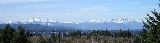
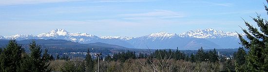
Kitsap Peninsula
The Kitsap Peninsula is an arm of land that is part of the larger Olympic Peninsula in Washington state that lies west of Seattle across Puget Sound. Hood Canal separates Kitsap Peninsula from the rest of the Olympic Peninsula...
.
The population was 11,144 at the 2010
census.
History
The Port Orchard area was first settled in 1854 by Wiliam Renton and Daniel Howard, who set up a saw mill there. The town that was to become Port Orchard was originally platted in 1886 by Frederick Stevens, who named the new location after his father, Sidney. The town of SidneySidney
Sidney may refer to:-United States:* Sidney, Arkansas* Sidney, Illinois* Sidney, Indiana* Sidney, Iowa* Sidney, Kentucky* Sidney, Maine* Sidney, Montana* Sidney, Nebraska* Sidney , New York** Sidney , New York* Sidney, Ohio...
was incorporated September 15, 1890, and was the first in Kitsap County to be both platted and incorporated. Shortly thereafter, the U.S. Navy sought a suitable location for another installation on the west coast, and found it with the assistance of Sidney's residents in Orchard Bay (this installation would later become the Puget Sound Naval Shipyard
Puget Sound Naval Shipyard
Puget Sound Naval Shipyard and Intermediate Maintenance Facility is a United States Navy shipyard covering 179 acres on Puget Sound at Bremerton, Washington...
).
The county seat was originally in Port Madison
Port Madison
Port Madison, sometimes called Port Madison Bay, is a deep water bay located on the west shore of Puget Sound in western Washington. It is bounded on the north by Indianola, on the west by Suquamish, and on the south by Bainbridge Island. Port Madison connects to Port Orchard via the Agate Pass...
, but moved after a popular vote to Sidney in 1892. In December of that same year, the residents of Sidney petitioned both the state legislature and the Post Office Department to rename the city to "Port Orchard." The legislature refused, as Charleston (now West Bremerton) had also requested that name. The Post Office Department, however, went through with the name change, and as a result the Port Orchard post office ended up in Sidney, and the Charleston post office ended up in Port Orchard. It wasn't until 1903 that local politician Will Thompson convinced the state legislature to correct this confusing situation, and relocated the Charleston post office to Charleston, at the same time renaming Sidney to "Port Orchard," as we know it today.
Geography
Port Orchard is located at 47°31′54"N 122°38′18"W (47.531563, -122.638405).According to the United States Census Bureau
United States Census Bureau
The United States Census Bureau is the government agency that is responsible for the United States Census. It also gathers other national demographic and economic data...
, the city has a total area of 4.9 square miles (12.7 km²), of which, 4.0 square miles (10.4 km²) of it is land and 0.9 square miles (2.3 km²) of it (17.92%) is water.
Demographics
As of the censusCensus
A census is the procedure of systematically acquiring and recording information about the members of a given population. It is a regularly occurring and official count of a particular population. The term is used mostly in connection with national population and housing censuses; other common...
of 2010, there were 11,144 people, 2,901 households, and 1,772 families residing in the city. The population density
Population density
Population density is a measurement of population per unit area or unit volume. It is frequently applied to living organisms, and particularly to humans...
was 1,912.1 people per square mile (738.9/km²). There were 3,178 housing units at an average density of 789.9 per square mile (305.2/km²). The racial makeup of the city was 82.22% White, 4.00% African American, 1.49% Native American, 3.69% Asian, 1.05% Pacific Islander, 1.38% from other races
Race (United States Census)
Race and ethnicity in the United States Census, as defined by the Federal Office of Management and Budget and the United States Census Bureau, are self-identification data items in which residents choose the race or races with which they most closely identify, and indicate whether or not they are...
, and 6.16% from two or more races. Hispanic or Latino of any race were 5.13% of the population.
There were 2,901 households out of which 34.5% had children under the age of 18 living with them, 40.5% were married couples
Marriage
Marriage is a social union or legal contract between people that creates kinship. It is an institution in which interpersonal relationships, usually intimate and sexual, are acknowledged in a variety of ways, depending on the culture or subculture in which it is found...
living together, 16.0% had a female householder with no husband present, and 38.9% were non-families. 30.6% of all households were made up of individuals and 11.0% had someone living alone who was 65 years of age or older. The average household size was 2.40 and the average family size was 2.99.
In the city the population was spread out with 25.6% under the age of 18, 13.2% from 18 to 24, 33.3% from 25 to 44, 16.6% from 45 to 64, and 11.3% who were 65 years of age or older. The median age was 31 years. For every 100 females there were 105.8 males. For every 100 females age 18 and over, there were 105.1 males.
The median income for a household in the city was $34,020, and the median income for a family was $41,946. Males had a median income of $33,610 versus $25,739 for females. The per capita income
Per capita income
Per capita income or income per person is a measure of mean income within an economic aggregate, such as a country or city. It is calculated by taking a measure of all sources of income in the aggregate and dividing it by the total population...
for the city was $16,382. About 10.9% of families and 12.9% of the population were below the poverty line, including 17.2% of those under age 18 and 9.1% of those age 65 or over.
External links
- City of Port Orchard official website
- The Port Orchard Chamber of Commerce
- Kitsap Peninsula Visitor & Convention Bureau - Port Orchard Page
- History of Port Orchard at HistoryLinkHistoryLinkHistoryLink is a website that is an encyclopedia of Washington State history. The site has more than 4,500 stories. There are 500 biographies and more than 14,000 images....