

Pere Marquette State Forest
Encyclopedia
The Pere Marquette State Forest encompasses lands in Michigan
’s northern Lower Peninsula
, on the western side of the state. Counties within the Pere Marquette are: Leelanau
, Benzie
, Grand Traverse
, Kalkaska
, Manistee
, Wexford
, Missaukee
, Mason
, Lake
, Osceola
, Oceana
, Newaygo
and Mecosta
.
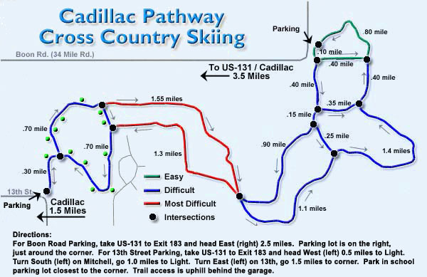
There are several trail-ways in the Pere Marquette, the longest of which are the Muncie Lake Pathway, at 11.5 miles (18.5 km) in length; the VASA Pathway, at 16.7 miles (26.9 km); and the Cadillac Pathway, at 11.3 miles (18.2 km). The trails are well suited to biking, hiking and cross country skiing.
The North Country Trail
includes 65 miles (104.6 km) within the Pere Marquette, and over 1500 miles (2,414 km) in Michigan as a whole.
Michigan
Michigan is a U.S. state located in the Great Lakes Region of the United States of America. The name Michigan is the French form of the Ojibwa word mishigamaa, meaning "large water" or "large lake"....
’s northern Lower Peninsula
Lower Peninsula of Michigan
The Lower Peninsula of Michigan is the southern of the two major landmasses of the U.S. state of Michigan. It is surrounded by water on all sides except its southern border, which it shares with Ohio and Indiana. Geographically, the Lower Peninsula has a recognizable shape that many people...
, on the western side of the state. Counties within the Pere Marquette are: Leelanau
Leelanau County, Michigan
-History:The county's name is said to be a Native American word meaning "delight of life", but it is a neologism made up by Indian agent and ethnographer Henry Schoolcraft, who sometimes gave the name "Leelinau" to Native American women in his tales. He created many faux Indian place names in...
, Benzie
Benzie County, Michigan
-Demographics:As of the 2000 census, there were 15,998 people, 6,500 households, and 4,595 families residing in the county. The population density was 50 people per square mile . There were 10,312 housing units at an average density of 32 per square mile...
, Grand Traverse
Grand Traverse County, Michigan
-Air service:*Grand Traverse County is served by Cherry Capital Airport, which is located near Traverse City.-Demographics:As of the census of 2000, there were 77,654 people, 30,396 households, and 20,730 families residing in the county. The population density was 167 people per square mile . ...
, Kalkaska
Kalkaska County, Michigan
-Demographics:As of the census of 2000, there were 16,571 people, 6,428 households, and 4,634 families residing in the county. The population density was 30 people per square mile . There were 10,822 housing units at an average density of 19 per square mile...
, Manistee
Manistee County, Michigan
-Demographics:As of the census of 2000, there were 24,527 people, 9,860 households, and 6,714 families residing in the county. The population density was 45 people per square mile . There were 14,272 housing units at an average density of 26 per square mile...
, Wexford
Wexford County, Michigan
-Tourism:There are many attractions and hot spots in Wexford county to check out. The Manistee National Forest is a great recreation site. The Manistee River is great for fisherman, kayakers and canoers, and other outdoor lovers.-Demographics:...
, Missaukee
Missaukee County, Michigan
-Demographics:As of the census of 2000, there were 14,478 people, 5,450 households, and 4,043 families residing in the county. The population density was 26 people per square mile . There were 8,621 housing units at an average density of 15 per square mile...
, Mason
Mason County, Michigan
Mason County is a county in the U.S. state of Michigan. As of the 2010 census, the population was 28,705. The county seat is Ludington.-History:...
, Lake
Lake County, Michigan
-Highways:* US 10* M-37-Demographics:As of the census of 2000, there were 11,333 people, 4,704 households, and 3,052 families residing in the county. The population density was 20 people per square mile . There were 13,498 housing units at an average density of 24 per square mile...
, Osceola
Osceola County, Michigan
-Demographics:As of the census of 2000, there were 23,197 people, 8,861 households, and 6,415 families residing in the county. The population density was 41 people per square mile . There were 12,853 housing units at an average density of 23 per square mile...
, Oceana
Oceana County, Michigan
-US highways:* US-31* US 31 Business Route is a spur serving downtown Hart.* US 31 Business Route loops through downtown Pentwater, returning to mainline US-31 at both ends.-Michigan State Trunklines:* M-20* M-120-Intercounty Highways:*B-15...
, Newaygo
Newaygo County, Michigan
Newaygo County is a county in the U.S. state of Michigan. It is part of the Grand Rapids–Wyoming, MI, Metropolitan Statistical Area. As of the 2010 census, the population was 48,460. The county seat is White Cloud. Newaygo County was either named for an Ojibwe leader who signed the Saginaw...
and Mecosta
Mecosta County, Michigan
Mecosta County is a county in the U.S. state of Michigan. The county is named after Chief Mecosta, the leader of the Potawatomi Native American tribe that once traveled the local waterways in search of fish and game. Chief Mecosta was one of the signers the Treaty of Washington in 1836. The easily...
.
There are several trail-ways in the Pere Marquette, the longest of which are the Muncie Lake Pathway, at 11.5 miles (18.5 km) in length; the VASA Pathway, at 16.7 miles (26.9 km); and the Cadillac Pathway, at 11.3 miles (18.2 km). The trails are well suited to biking, hiking and cross country skiing.
The North Country Trail
North Country Trail
The North Country National Scenic Trail , which stretches approximately from Crown Point in eastern New York to Lake Sakakawea in central North Dakota in the United States, is the longest of the eleven National Scenic Trails authorized by Congress...
includes 65 miles (104.6 km) within the Pere Marquette, and over 1500 miles (2,414 km) in Michigan as a whole.