
Parker, Pennsylvania
Encyclopedia
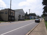
Parker is a city located in Armstrong County
, Pennsylvania
, United States
. It is located in the extreme northwestern portion of the county. The population was 799 at the 2000 census. The city was named for John Parker, a lead surveyor of Lawrenceburg.
Parker is sometimes referred to as the "Smallest City in the U.S.A.". Parker was incorporated as a city on March 1, 1873 by special state legislation in the midst of the northwestern Pennsylvania oil boom. The new municipality was called "Parker" and was made up of the earlier villages of Parker's Landing (on the Allegheny River) and Lawrenceburg (on the bluff above the river). Residents assumed that Parker would quickly become a major population center, and, at the height of the oil boom, the population of Parker grew to over 20,000. The boom quickly went bust, however, and by the 1880s the "city" returned to its historic, small village size, and a population of approximately 1,000.
There are two highways that pass through Parker. From the east, PA 268
goes right through downtown, then proceeds north towards Foxburg
, and Emlenton
. There is also an intersection with PA 368
at the Parker Bridge
.
The Allegheny River
, at this point is not used to transport goods and materials, but is still a navigable waterway for boating
. The first lock (Allegheny River Lock and Dam No. 9) is located south of Parker, just past the borough of East Brady
.
According to the United States Census Bureau
, the city has a total area of 1.1 square miles (2.8 km²), all of it land.
of 2000, there were 799 people, 309 households, and 221 families residing in the city. The population density
was 728.6 people per square mile (280.5/km²). There were 356 housing units at an average density of 324.6 per square mile (125.0/km²). The racial makeup of the city was 98.12% White and 1.88% African American.
There were 309 households out of which 32.4% had children under the age of 18 living with them, 58.9% were married couples
living together, 8.7% had a female householder with no husband present, and 28.2% were non-families. 25.2% of all households were made up of individuals and 15.9% had someone living alone who was 65 years of age or older. The average household size was 2.59 and the average family size was 3.09.
In the city the population was spread out with 26.0% under the age of 18, 10.1% from 18 to 24, 26.0% from 25 to 44, 21.2% from 45 to 64, and 16.6% who were 65 years of age or older. The median age was 36 years. For every 100 females there were 95.4 males. For every 100 females age 18 and over, there were 89.4 males.
The median income for a household in the city was $29,844, and the median income for a family was $35,250. Males had a median income of $28,750 versus $21,875 for females. The per capita income
for the city was $14,627. About 10.2% of families and 9.8% of the population were below the poverty line, including 9.7% of those under age 18 and 9.0% of those age 65 or over.
Armstrong County, Pennsylvania
Armstrong County is a county located in the U.S. state of Pennsylvania. As of the 2010 census, the population was 68,941. It is located northeast of Pittsburgh and Allegheny County. Armstrong County was added to the Pittsburgh Metropolitan Statistical Area in 2003.The county seat is Kittanning...
, Pennsylvania
Pennsylvania
The Commonwealth of Pennsylvania is a U.S. state that is located in the Northeastern and Mid-Atlantic regions of the United States. The state borders Delaware and Maryland to the south, West Virginia to the southwest, Ohio to the west, New York and Ontario, Canada, to the north, and New Jersey to...
, United States
United States
The United States of America is a federal constitutional republic comprising fifty states and a federal district...
. It is located in the extreme northwestern portion of the county. The population was 799 at the 2000 census. The city was named for John Parker, a lead surveyor of Lawrenceburg.
Parker is sometimes referred to as the "Smallest City in the U.S.A.". Parker was incorporated as a city on March 1, 1873 by special state legislation in the midst of the northwestern Pennsylvania oil boom. The new municipality was called "Parker" and was made up of the earlier villages of Parker's Landing (on the Allegheny River) and Lawrenceburg (on the bluff above the river). Residents assumed that Parker would quickly become a major population center, and, at the height of the oil boom, the population of Parker grew to over 20,000. The boom quickly went bust, however, and by the 1880s the "city" returned to its historic, small village size, and a population of approximately 1,000.
Transportation
- Roads
There are two highways that pass through Parker. From the east, PA 268
Pennsylvania Route 268
Pennsylvania Route 268 is a long state highway located in Armstrong, Butler, and Venango counties in Pennsylvania. The southern terminus is at US 422 in West Kittanning. The northern terminus is at PA 38/PA 208 in Emlenton.-Route description:...
goes right through downtown, then proceeds north towards Foxburg
Foxburg, Pennsylvania
Foxburg is a borough in Clarion County, Pennsylvania, United States. It is located along the east bank of the Allegheny River, about two miles north of its confluence with the Clarion River.-History:...
, and Emlenton
Emlenton, Pennsylvania
Emlenton is a borough located mostly in Venango County, in the southeastern corner of the county, with a small portion located in Clarion County in Pennsylvania. The population was 784 at the 2000 census...
. There is also an intersection with PA 368
Pennsylvania Route 368
Pennsylvania Route 368 is an long state highway located in Armstrong and Clarion counties in Pennsylvania. The western terminus is at PA 268 in Parker. The eastern terminus is at PA 58 in Callensburg...
at the Parker Bridge
Parker Bridge
Parker Bridge is a truss bridge in the city of Parker, Pennsylvania in the United States. The bridge, constructed in 1934, carries motor vehicles, and pedestrians over the Allegheny River.- External links :*...
.
- Waterways
The Allegheny River
Allegheny River
The Allegheny River is a principal tributary of the Ohio River; it is located in the Eastern United States. The Allegheny River joins with the Monongahela River to form the Ohio River at the "Point" of Point State Park in Downtown Pittsburgh, Pennsylvania...
, at this point is not used to transport goods and materials, but is still a navigable waterway for boating
Boating
Boating is the leisurely activity of travelling by boat, or the recreational use of a boat whether powerboats, sailboats, or man-powered vessels , focused on the travel itself, as well as sports activities, such as fishing or water skiing...
. The first lock (Allegheny River Lock and Dam No. 9) is located south of Parker, just past the borough of East Brady
East Brady, Pennsylvania
East Brady is a borough in Clarion County, Pennsylvania, United States and is part of the Pittsburgh DMA. The population was 1,038 at the 2000 census.-History:East Brady is named after Captain Samuel Brady, who fought with Native Americans at that location....
.
Geography
Parker is located at 41°5′39"N 79°40′58"W (41.094151, -79.682771).According to the United States Census Bureau
United States Census Bureau
The United States Census Bureau is the government agency that is responsible for the United States Census. It also gathers other national demographic and economic data...
, the city has a total area of 1.1 square miles (2.8 km²), all of it land.
Demographics
As of the censusCensus
A census is the procedure of systematically acquiring and recording information about the members of a given population. It is a regularly occurring and official count of a particular population. The term is used mostly in connection with national population and housing censuses; other common...
of 2000, there were 799 people, 309 households, and 221 families residing in the city. The population density
Population density
Population density is a measurement of population per unit area or unit volume. It is frequently applied to living organisms, and particularly to humans...
was 728.6 people per square mile (280.5/km²). There were 356 housing units at an average density of 324.6 per square mile (125.0/km²). The racial makeup of the city was 98.12% White and 1.88% African American.
There were 309 households out of which 32.4% had children under the age of 18 living with them, 58.9% were married couples
Marriage
Marriage is a social union or legal contract between people that creates kinship. It is an institution in which interpersonal relationships, usually intimate and sexual, are acknowledged in a variety of ways, depending on the culture or subculture in which it is found...
living together, 8.7% had a female householder with no husband present, and 28.2% were non-families. 25.2% of all households were made up of individuals and 15.9% had someone living alone who was 65 years of age or older. The average household size was 2.59 and the average family size was 3.09.
In the city the population was spread out with 26.0% under the age of 18, 10.1% from 18 to 24, 26.0% from 25 to 44, 21.2% from 45 to 64, and 16.6% who were 65 years of age or older. The median age was 36 years. For every 100 females there were 95.4 males. For every 100 females age 18 and over, there were 89.4 males.
The median income for a household in the city was $29,844, and the median income for a family was $35,250. Males had a median income of $28,750 versus $21,875 for females. The per capita income
Per capita income
Per capita income or income per person is a measure of mean income within an economic aggregate, such as a country or city. It is calculated by taking a measure of all sources of income in the aggregate and dividing it by the total population...
for the city was $14,627. About 10.2% of families and 9.8% of the population were below the poverty line, including 9.7% of those under age 18 and 9.0% of those age 65 or over.