
Paint Rock, Alabama
Encyclopedia
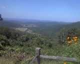
Paint Rock is a town in Jackson County
, Alabama
, United States
, along the Paint Rock River
, and is included in the Huntsville-Decatur Combined Statistical Area
. As of the 2000 census, the population of the town is 185.
This was the location where the Scottsboro Boys
were arrested.
According to the U.S. Census Bureau, the town has a total area of 0.4 square miles (1 km²), all land.
of 2000, there were 185 people, 81 households, and 57 families residing in the town. The population density
was 415.9 people per square mile (162.3/km²). There were 94 housing units at an average density of 211.3 per square mile (82.5/km²). The racial makeup of the town was 96.76% White
, 0.54% Native American
, and 2.70% from two or more races.
There were 81 households out of which 27.2% had children under the age of 18 living with them, 54.3% were married couples
living together, 11.1% had a female householder with no husband present, and 29.6% were non-families. 29.6% of all households were made up of individuals and 13.6% had someone living alone who was 65 years of age or older. The average household size was 2.28 and the average family size was 2.77.
In the town the population was spread out with 18.4% under the age of 18, 14.1% from 18 to 24, 24.9% from 25 to 44, 24.9% from 45 to 64, and 17.8% who were 65 years of age or older. The median age was 38 years. For every 100 females there were 92.7 males. For every 100 females age 18 and over, there were 98.7 males.
The median income for a household in the town was $35,521, and the median income for a family was $36,875. Males had a median income of $28,750 versus $16,719 for females. The per capita income
for the town was $15,551. About 8.3% of families and 10.8% of the population were below the poverty line, including none of those under the age of eighteen or sixty five or over.
Jackson County, Alabama
Jackson County is a county of the U.S. state of Alabama. Its name is in honor of Andrew Jackson, general in the United States Army and President of the United States of America. As of 2010, the population was 53,227. The county seat is Scottsboro. Jackson County is a prohibition or dry county,...
, Alabama
Alabama
Alabama is a state located in the southeastern region of the United States. It is bordered by Tennessee to the north, Georgia to the east, Florida and the Gulf of Mexico to the south, and Mississippi to the west. Alabama ranks 30th in total land area and ranks second in the size of its inland...
, United States
United States
The United States of America is a federal constitutional republic comprising fifty states and a federal district...
, along the Paint Rock River
Paint Rock River
The Paint Rock River is a tributary of the Tennessee River in northern Alabama in the United States. Its tributaries also drain a portion of south-central Tennessee....
, and is included in the Huntsville-Decatur Combined Statistical Area
Huntsville-Decatur Combined Statistical Area
The Huntsville-Decatur Combined Statistical Area is the most populated sub-region of North Alabama, and is the second fastest growing region in the State of Alabama, with 510,088 living within the CSA...
. As of the 2000 census, the population of the town is 185.
This was the location where the Scottsboro Boys
Scottsboro Boys
The Scottsboro Boys were nine black teenage boys accused of rape in Alabama in 1931. The landmark set of legal cases from this incident dealt with racism and the right to a fair trial...
were arrested.
Geography
Paint Rock is located at 34°39′37"N 86°19′41"W (34.660172, -86.328018).According to the U.S. Census Bureau, the town has a total area of 0.4 square miles (1 km²), all land.
Demographics
As of the censusCensus
A census is the procedure of systematically acquiring and recording information about the members of a given population. It is a regularly occurring and official count of a particular population. The term is used mostly in connection with national population and housing censuses; other common...
of 2000, there were 185 people, 81 households, and 57 families residing in the town. The population density
Population density
Population density is a measurement of population per unit area or unit volume. It is frequently applied to living organisms, and particularly to humans...
was 415.9 people per square mile (162.3/km²). There were 94 housing units at an average density of 211.3 per square mile (82.5/km²). The racial makeup of the town was 96.76% White
Race (United States Census)
Race and ethnicity in the United States Census, as defined by the Federal Office of Management and Budget and the United States Census Bureau, are self-identification data items in which residents choose the race or races with which they most closely identify, and indicate whether or not they are...
, 0.54% Native American
Race (United States Census)
Race and ethnicity in the United States Census, as defined by the Federal Office of Management and Budget and the United States Census Bureau, are self-identification data items in which residents choose the race or races with which they most closely identify, and indicate whether or not they are...
, and 2.70% from two or more races.
There were 81 households out of which 27.2% had children under the age of 18 living with them, 54.3% were married couples
Marriage
Marriage is a social union or legal contract between people that creates kinship. It is an institution in which interpersonal relationships, usually intimate and sexual, are acknowledged in a variety of ways, depending on the culture or subculture in which it is found...
living together, 11.1% had a female householder with no husband present, and 29.6% were non-families. 29.6% of all households were made up of individuals and 13.6% had someone living alone who was 65 years of age or older. The average household size was 2.28 and the average family size was 2.77.
In the town the population was spread out with 18.4% under the age of 18, 14.1% from 18 to 24, 24.9% from 25 to 44, 24.9% from 45 to 64, and 17.8% who were 65 years of age or older. The median age was 38 years. For every 100 females there were 92.7 males. For every 100 females age 18 and over, there were 98.7 males.
The median income for a household in the town was $35,521, and the median income for a family was $36,875. Males had a median income of $28,750 versus $16,719 for females. The per capita income
Per capita income
Per capita income or income per person is a measure of mean income within an economic aggregate, such as a country or city. It is calculated by taking a measure of all sources of income in the aggregate and dividing it by the total population...
for the town was $15,551. About 8.3% of families and 10.8% of the population were below the poverty line, including none of those under the age of eighteen or sixty five or over.