
Niseko, Hokkaido
Encyclopedia
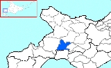
is a town
located in Abuta District
, Shiribeshi
, Hokkaidō, Japan
. To the Japanese people, Niseko principally refers to a mountain range and a municipal area. However, overseas the name has come to refer to a wider area of ski resorts encompassing Hokkaido's Mount Yōtei
, often referred to as the "Mt. Fuji of Hokkaido", and Annupuri ranges. The name Niseko derives from the Ainu language and means "a cliff jutting over a riverbank deep in the mountains". Its main industries are agriculture and tourism.
of 4,667 as of 2008 and a density
of 23.7 persons per km². The total number of visitors during the 2009 winter season was 201,000. The total area is 197.13 km².
Niseko Mt. Resort Grand Hirafu
, refers to the combined areas of Hirafu and Hanazono. Both of these and Weiss are within the municipality of nearby Kutchan
. The other three resorts are within the adjacent municipality of Niseko.
Of these six ski areas, the main four (Annupuri, Higashiyama, Hirafu, and Hanazono) are sequentially interconnected and may be skied on one ski pass. The lift systems are owned respectively by the Chuo Bus company, YTL Resorts (which purchased Niseko Village from Citigroup in 2010), Tokyu Corporation and Pacific Century Premium Developments. Together they form 2191 acres (8.9 km²) skiable of what is known as the Niseko United. The lift system comprises 38 gondolas and lifts connecting 61 ski runs. Kutchan's sister city is St. Moritz, Switzerland in a relationship established in 1964. Niseko Moiwa, adjacent to Annupuri, can be skied to from Annupuri but is not currently connected by the lift system. Niseko Weiss has not operated its lifts for decades, but people can still ski in this area, being taken uphill by snow cats.
Niseko also has back-country ski-courses that are unofficially on the maps. To the furthest right of Annupuri lies Sannozaka, an area prone to avalanche but with high quality snow. To the far right of Hirafu lies Higashi One, also prone to avalanche but with a challenging back-country terrain. Near the lower half of Hanazono is a forest route called Strawberry Fields, which is perhaps the most famous run in Niseko. Climbing Mount Yōtei
also provides back country skiing.
For the first time, in March 2008, Niseko was voted into the world's top 10 ski resorts. Coming in at #6 it was the highest ranked of the new entries in the poll.
Originally known primarily for winter sports, Niseko has gradually gained a reputation as a centre for a wide variety of summer activities, including golf, tennis, fishing, horseback riding, sea kayaking, white water rafting, trekking, and bicycling.
rather than from Eastern Japan, although all of Japan--especially the west coast of the main island (see Yukiguni) experiences northwest-to-southeast Siberian winds in the winter. The resort is internationally renowned for its consistently good falls of the lightest powder snow and its long ski season which runs from late November until early May. The snow is not as dry as other areas in Hokkaidō, but the volume is high, with the average snow depth in March reaching 351 cm.
Niseko was named as the world's #2 snowiest resort in December 2007 with annual average snow fall of 595 inches (15.11 m) First place went to the Mt. Baker Ski Area in Washington State with 641 inches (16,281.4 mm).
Counteracting this lack of infrastructure is the high demand for real estate. Foreign-owned companies are developing in the area along with Japanese companies. Purchase demand has expanded from Australian markets to include Hong Kong, Singapore and mainland China.
Nightlife and accommodation can be found at and around the main village of Hirafu. The village is an eclectic mix of the old, new and traditional bars, restaurants, hotels, and lodges. The Japanese dining experience is extremely popular among foreign visitors.
The area has been gazetted for the Hokkaidō Shinkansen
(bullet train) linking Kutchan with Tokyo and Sapporo.
.
Bus is probably the easiest way to get to Niseko for tourists.
Taking a train to Niseko from Sapporo Station
is a longer and more expensive trip requiring a transfer of trains at Otaru Station
. There are only a few daily local trains between Otaru and Niseko Station
.
Towns of Japan
A town is a local administrative unit in Japan. It is a local public body along with prefecture , city , and village...
located in Abuta District
Abuta District, Hokkaido
is a district located in Iburi and Shiribeshi Subprefectures in Hokkaidō, Japan.As of 2004, the district has an estimated population of 31,526 and a density of 28.30 persons per km²...
, Shiribeshi
Shiribeshi Subprefecture
is a subprefecture of Hokkaidō, Japan. The subprefecture's capital is Kutchan. As of July 31, 2004, the estimated population was 256,184 and the area was 4,305.65 km².- Towns and villages by district :* Abuta District** Kimobetsu...
, Hokkaidō, Japan
Japan
Japan is an island nation in East Asia. Located in the Pacific Ocean, it lies to the east of the Sea of Japan, China, North Korea, South Korea and Russia, stretching from the Sea of Okhotsk in the north to the East China Sea and Taiwan in the south...
. To the Japanese people, Niseko principally refers to a mountain range and a municipal area. However, overseas the name has come to refer to a wider area of ski resorts encompassing Hokkaido's Mount Yōtei
Mount Yotei
is an active stratovolcano located in Shikotsu-Toya National Park, Hokkaidō, Japan. It is also called , because it resembles the more famous Mount Fuji. The mountain is also known as and . It is one of the 100 famous mountains in Japan.-Geology:...
, often referred to as the "Mt. Fuji of Hokkaido", and Annupuri ranges. The name Niseko derives from the Ainu language and means "a cliff jutting over a riverbank deep in the mountains". Its main industries are agriculture and tourism.
Town
The town had an estimated populationPopulation
A population is all the organisms that both belong to the same group or species and live in the same geographical area. The area that is used to define a sexual population is such that inter-breeding is possible between any pair within the area and more probable than cross-breeding with individuals...
of 4,667 as of 2008 and a density
Population density
Population density is a measurement of population per unit area or unit volume. It is frequently applied to living organisms, and particularly to humans...
of 23.7 persons per km². The total number of visitors during the 2009 winter season was 201,000. The total area is 197.13 km².
Resort
Niseko is composed of six ski areas, in order of size:- Niseko Hirafu.
- Niseko Higashiyama (also known as Niseko Village).
- Niseko Annupuri.
- Niseko Hanazono.
- Niseko Moiwa.
- Niseko Weiss.
Niseko Mt. Resort Grand Hirafu
Niseko Mt. Resort Grand Hirafu
is a ski resort located in the Hirafu area of Kutchan, Abuta District, Hokkaidō, Hokkaidō, Japan. It is a vast snow resort stretching from Niseko Annupuri’s summit to its base, and it is famous for its fine-quality powder snow...
, refers to the combined areas of Hirafu and Hanazono. Both of these and Weiss are within the municipality of nearby Kutchan
Kutchan, Hokkaido
-Neighboring municipalities:*Shiribeshi**Abuta District: Kyōgoku, Niseko**Isoya District: Rankoshi**Iwanai District: Kyōwa**Yoichi District: Niki, Akaigawa**Kimobetsu and Makkari of the Abuta District lie on the southern side of Mount Yōtei.-History:...
. The other three resorts are within the adjacent municipality of Niseko.
Of these six ski areas, the main four (Annupuri, Higashiyama, Hirafu, and Hanazono) are sequentially interconnected and may be skied on one ski pass. The lift systems are owned respectively by the Chuo Bus company, YTL Resorts (which purchased Niseko Village from Citigroup in 2010), Tokyu Corporation and Pacific Century Premium Developments. Together they form 2191 acres (8.9 km²) skiable of what is known as the Niseko United. The lift system comprises 38 gondolas and lifts connecting 61 ski runs. Kutchan's sister city is St. Moritz, Switzerland in a relationship established in 1964. Niseko Moiwa, adjacent to Annupuri, can be skied to from Annupuri but is not currently connected by the lift system. Niseko Weiss has not operated its lifts for decades, but people can still ski in this area, being taken uphill by snow cats.
Niseko also has back-country ski-courses that are unofficially on the maps. To the furthest right of Annupuri lies Sannozaka, an area prone to avalanche but with high quality snow. To the far right of Hirafu lies Higashi One, also prone to avalanche but with a challenging back-country terrain. Near the lower half of Hanazono is a forest route called Strawberry Fields, which is perhaps the most famous run in Niseko. Climbing Mount Yōtei
Mount Yotei
is an active stratovolcano located in Shikotsu-Toya National Park, Hokkaidō, Japan. It is also called , because it resembles the more famous Mount Fuji. The mountain is also known as and . It is one of the 100 famous mountains in Japan.-Geology:...
also provides back country skiing.
For the first time, in March 2008, Niseko was voted into the world's top 10 ski resorts. Coming in at #6 it was the highest ranked of the new entries in the poll.
Originally known primarily for winter sports, Niseko has gradually gained a reputation as a centre for a wide variety of summer activities, including golf, tennis, fishing, horseback riding, sea kayaking, white water rafting, trekking, and bicycling.
Weather
Because of its northern location, Niseko is fed more by weather fronts that come from SiberiaSiberia
Siberia is an extensive region constituting almost all of Northern Asia. Comprising the central and eastern portion of the Russian Federation, it was part of the Soviet Union from its beginning, as its predecessor states, the Tsardom of Russia and the Russian Empire, conquered it during the 16th...
rather than from Eastern Japan, although all of Japan--especially the west coast of the main island (see Yukiguni) experiences northwest-to-southeast Siberian winds in the winter. The resort is internationally renowned for its consistently good falls of the lightest powder snow and its long ski season which runs from late November until early May. The snow is not as dry as other areas in Hokkaidō, but the volume is high, with the average snow depth in March reaching 351 cm.
Niseko was named as the world's #2 snowiest resort in December 2007 with annual average snow fall of 595 inches (15.11 m) First place went to the Mt. Baker Ski Area in Washington State with 641 inches (16,281.4 mm).
Infrastructure and development
Niseko, although a growing area, does lack public and private infrastructure in certain areas. Simple public items such as rubbish bins, street lighting and winter footpath clearing are left wanting in comparison to other international ski resorts. Private infrastructure includes shopping and retail areas from which both are still in growth phase. These facilities, along with entertainment and a wide range of nightlife, are best accessed in Kutchan a short 7 minute drive away. Significant infrastructure development - initially focused on the road heating and redevelopment of the main street "Hirafu-zaka" - has been approved and is slated to begin in the summer of 2012.Counteracting this lack of infrastructure is the high demand for real estate. Foreign-owned companies are developing in the area along with Japanese companies. Purchase demand has expanded from Australian markets to include Hong Kong, Singapore and mainland China.
Nightlife and accommodation can be found at and around the main village of Hirafu. The village is an eclectic mix of the old, new and traditional bars, restaurants, hotels, and lodges. The Japanese dining experience is extremely popular among foreign visitors.
The area has been gazetted for the Hokkaidō Shinkansen
Hokkaido Shinkansen
The is a high-speed rail line currently under construction between Aomori and Hokkaido through the Seikan Tunnel. Construction started in May 2005, and the initial Shin-Aomori to Shin-Hakodate section is projected to open in 2015. There are long-term plans to extend the line to Sapporo...
(bullet train) linking Kutchan with Tokyo and Sapporo.
Transportation
Niseko is located in the southwestern part of Hokkaido. The nearest airport is New Chitose AirportNew Chitose Airport
, is an airport located south southeast of Chitose and Tomakomai, Hokkaidō, Japan, serving the Sapporo metropolitan area. By land area, it is the largest airport in Hokkaidō....
.
Bus is probably the easiest way to get to Niseko for tourists.
Taking a train to Niseko from Sapporo Station
Sapporo Station
is a train station located in Kita-ku and Chūō-ku, Sapporo, Hokkaidō, Japan. It is served by Hakodate Main Line and other lines of Hokkaido Railway Company , and is also connected to the Sapporo Subway. The JR Hokkaido part is in Kita-ku while the Sapporo Subway part is in Chūō-ku.Sapporo Station...
is a longer and more expensive trip requiring a transfer of trains at Otaru Station
Otaru Station
is a railway station on the JR Hokkaido Hakodate Main Line. It is located in Otaru, Hokkaidō, Japan.-Station structure:* 2-way, 4-track, above-ground station.Platforms...
. There are only a few daily local trains between Otaru and Niseko Station
Niseko Station
is a railway station on the JR Hokkaido Hakodate Main Line. It is located in Niseko, Hokkaidō, Japan.-Station structure:The station has two platforms serving two tracks on the ground level.Platforms...
.
See also
- Niseko Mt. Resort Grand HirafuNiseko Mt. Resort Grand Hirafuis a ski resort located in the Hirafu area of Kutchan, Abuta District, Hokkaidō, Hokkaidō, Japan. It is a vast snow resort stretching from Niseko Annupuri’s summit to its base, and it is famous for its fine-quality powder snow...
- Shikotsu-Tōya National ParkShikotsu-Toya National Parkis a national park in the central part of the island of Hokkaidō, Japan. Named after the volcanic caldera lakes of Lake Shikotsu and Lake Tōya, it has a total area of 993.02 square kilometers...
- Niseko-Shakotan-Otaru Kaigan Quasi-National ParkNiseko-Shakotan-Otaru Kaigan Quasi-National Parkis a quasi-national park in Hokkaidō, Japan. On the coast of the Sea of Japan, there is a Marine Protected Area covering the west and north coast of Shakotan peninsula from Kamoenai to Otaru...