

Newbury, New Hampshire
Encyclopedia
Newbury is a town in Merrimack County
, New Hampshire
, United States
. The population was 2,072 at the 2010 census. Newbury is home to part of Lake Sunapee
, including Mount Sunapee State Park Beach. Mount Sunapee Resort
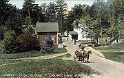
, a ski area in Mount Sunapee State Park, is in the west. The town includes the village of Blodgett Landing
.
 Situated at the south end of Lake Sunapee, this town has gone through numerous name changes. It started in 1753 as "Dantzic", after the Baltic
seaport. The first provincial grant in 1754 named the town "Hereford", in honor of Edward Devereaux, Viscount Hereford
. Colonial
Governor John Wentworth
renewed the grant in 1772 under the name "Fishersfield", for his brother-in-law, John Fisher. The town was finally incorporated as "Newbury" in 1837, as suggested by settlers originally from Newbury
, Massachusetts
.
The Fells Historic Site
, located adjacent to the John Hay National Wildlife Refuge, is part of 876 acres (3.5 km²) protected of a forest country estate. Protection efforts have enabled Lake Sunapee to consistently be named one of the cleanest lakes in the state.
, the town has a total area of 38.1 square miles (98.7 km²), of which 35.8 sq mi (92.7 km²) is land and 2.3 sq mi (6 km²) is water, comprising 6.01% of the town. Mount Sunapee
, the highest point in town, has an elevation of 2726 feet (830.9 m) above sea level
.
 As of the census
of 2000, there were 1,702 people, 691 households, and 507 families residing in the town. The population density
was 47.5 people per square mile (18.4/km²). There were 1,311 housing units at an average density of 36.6 per square mile (14.1/km²). The racial makeup of the town was 98.35% White, 0.41% African American, 0.06% Native American, 0.12% Asian, 0.29% from other races
, and 0.76% from two or more races. Hispanic or Latino of any race were 1.18% of the population.
There were 691 households out of which 30.7% had children under the age of 18 living with them, 63.5% were married couples
living together, 6.9% had a female householder with no husband present, and 26.5% were non-families. 20.7% of all households were made up of individuals and 8.0% had someone living alone who was 65 years of age or older. The average household size was 2.46 and the average family size was 2.84.
 In the town the population was spread out with 22.8% under the age of 18, 4.8% from 18 to 24, 28.3% from 25 to 44, 28.0% from 45 to 64, and 16.2% who were 65 years of age or older. The median age was 42 years. For every 100 females there were 102.9 males. For every 100 females age 18 and over, there were 97.3 males.
The median income for a household in the town was $58,026, and the median income for a family was $61,389. Males had a median income of $42,031 versus $29,022 for females. The per capita income
for the town was $29,521. None of the families and 1.8% of the population were living below the poverty line, including no under eighteens and none of those over 64.
Merrimack County, New Hampshire
-Demographics:As of the census of 2000, there were 136,225 people, 51,843 households, and 35,460 families residing in the county. The population density was 146 people per square mile . There were 56,244 housing units at an average density of 60 per square mile...
, New Hampshire
New Hampshire
New Hampshire is a state in the New England region of the northeastern United States of America. The state was named after the southern English county of Hampshire. It is bordered by Massachusetts to the south, Vermont to the west, Maine and the Atlantic Ocean to the east, and the Canadian...
, United States
United States
The United States of America is a federal constitutional republic comprising fifty states and a federal district...
. The population was 2,072 at the 2010 census. Newbury is home to part of Lake Sunapee
Lake Sunapee
Lake Sunapee is located within Sullivan County and Merrimack County in western New Hampshire, the United States. It is the fifth-largest lake located entirely in New Hampshire....
, including Mount Sunapee State Park Beach. Mount Sunapee Resort
Mount Sunapee Resort
-History:Mount Sunapee's history as a ski area dates back to as early as 1940, when in response to the success of a tram at Cannon Mountain a survey was made for a similar tram on Mount Sunapee. The following year, the state of New Hampshire passed the Mt...
, a ski area in Mount Sunapee State Park, is in the west. The town includes the village of Blodgett Landing
Blodgett Landing, New Hampshire
Blodgett Landing is a census-designated place in the town of Newbury in Merrimack County, New Hampshire. It had a population of 101 at the 2010 census....
.
History
Baltic Sea
The Baltic Sea is a brackish mediterranean sea located in Northern Europe, from 53°N to 66°N latitude and from 20°E to 26°E longitude. It is bounded by the Scandinavian Peninsula, the mainland of Europe, and the Danish islands. It drains into the Kattegat by way of the Øresund, the Great Belt and...
seaport. The first provincial grant in 1754 named the town "Hereford", in honor of Edward Devereaux, Viscount Hereford
Viscount Hereford
Viscount Hereford is a title in the Peerage of England. It was created in 1550 for Walter Devereux, 9th Baron Ferrers of Chartley. The Devereux family is of Norman descent and came to England after the Norman conquest in 1066, and settled in Lyonshall and Bodenham, Herefordshire. Sir Walter...
. Colonial
Colony
In politics and history, a colony is a territory under the immediate political control of a state. For colonies in antiquity, city-states would often found their own colonies. Some colonies were historically countries, while others were territories without definite statehood from their inception....
Governor John Wentworth
John Wentworth (governor)
Sir John Wentworth, 1st Baronet was the British colonial governor of New Hampshire at the time of the American Revolution. He was later also Lieutenant-Governor of Nova Scotia.-Early life:...
renewed the grant in 1772 under the name "Fishersfield", for his brother-in-law, John Fisher. The town was finally incorporated as "Newbury" in 1837, as suggested by settlers originally from Newbury
Newbury, Massachusetts
Newbury is a town in Essex County, Massachusetts, United States. The population was 6,666 at the 2010 census. Newbury includes the villages of Old Town , Plum Island and Byfield, home of The Governor's Academy , a private preparatory school.- History :Newbury Plantation was settled and incorporated...
, Massachusetts
Massachusetts
The Commonwealth of Massachusetts is a state in the New England region of the northeastern United States of America. It is bordered by Rhode Island and Connecticut to the south, New York to the west, and Vermont and New Hampshire to the north; at its east lies the Atlantic Ocean. As of the 2010...
.
The Fells Historic Site
The Fells
The Fells, in Newbury, New Hampshire, was originally the summer home of John Milton Hay, a 19th-century American statesman.-History:John Hay served the United States in various capacities in a career that lasted over 40 years. He was Abraham Lincoln's private secretary during the Civil War and...
, located adjacent to the John Hay National Wildlife Refuge, is part of 876 acres (3.5 km²) protected of a forest country estate. Protection efforts have enabled Lake Sunapee to consistently be named one of the cleanest lakes in the state.
Geography
According to the United States Census BureauUnited States Census Bureau
The United States Census Bureau is the government agency that is responsible for the United States Census. It also gathers other national demographic and economic data...
, the town has a total area of 38.1 square miles (98.7 km²), of which 35.8 sq mi (92.7 km²) is land and 2.3 sq mi (6 km²) is water, comprising 6.01% of the town. Mount Sunapee
Mount Sunapee
Mount Sunapee is a -long mountain ridge in the towns of Newbury and Goshen in western New Hampshire. Its highest peak, at the north end of the mountain, is above sea level. The mountain has three secondary peaks, White Ledges at ; North Peak at ; and South Peak at...
, the highest point in town, has an elevation of 2726 feet (830.9 m) above sea level
Sea level
Mean sea level is a measure of the average height of the ocean's surface ; used as a standard in reckoning land elevation...
.
Demographics
Census
A census is the procedure of systematically acquiring and recording information about the members of a given population. It is a regularly occurring and official count of a particular population. The term is used mostly in connection with national population and housing censuses; other common...
of 2000, there were 1,702 people, 691 households, and 507 families residing in the town. The population density
Population density
Population density is a measurement of population per unit area or unit volume. It is frequently applied to living organisms, and particularly to humans...
was 47.5 people per square mile (18.4/km²). There were 1,311 housing units at an average density of 36.6 per square mile (14.1/km²). The racial makeup of the town was 98.35% White, 0.41% African American, 0.06% Native American, 0.12% Asian, 0.29% from other races
Race (United States Census)
Race and ethnicity in the United States Census, as defined by the Federal Office of Management and Budget and the United States Census Bureau, are self-identification data items in which residents choose the race or races with which they most closely identify, and indicate whether or not they are...
, and 0.76% from two or more races. Hispanic or Latino of any race were 1.18% of the population.
There were 691 households out of which 30.7% had children under the age of 18 living with them, 63.5% were married couples
Marriage
Marriage is a social union or legal contract between people that creates kinship. It is an institution in which interpersonal relationships, usually intimate and sexual, are acknowledged in a variety of ways, depending on the culture or subculture in which it is found...
living together, 6.9% had a female householder with no husband present, and 26.5% were non-families. 20.7% of all households were made up of individuals and 8.0% had someone living alone who was 65 years of age or older. The average household size was 2.46 and the average family size was 2.84.
The median income for a household in the town was $58,026, and the median income for a family was $61,389. Males had a median income of $42,031 versus $29,022 for females. The per capita income
Per capita income
Per capita income or income per person is a measure of mean income within an economic aggregate, such as a country or city. It is calculated by taking a measure of all sources of income in the aggregate and dividing it by the total population...
for the town was $29,521. None of the families and 1.8% of the population were living below the poverty line, including no under eighteens and none of those over 64.
Sites of interest
- Bell Cove Historic CabooseCabooseA caboose is a manned North American rail transport vehicle coupled at the end of a freight train. Although cabooses were once used on nearly every freight train, their use has declined and they are seldom seen on trains, except on locals and smaller railroads.-Function:The caboose provided the...
Museum - The Fells Historic SiteThe FellsThe Fells, in Newbury, New Hampshire, was originally the summer home of John Milton Hay, a 19th-century American statesman.-History:John Hay served the United States in various capacities in a career that lasted over 40 years. He was Abraham Lincoln's private secretary during the Civil War and...
- Chicken Farmer I Still Love You