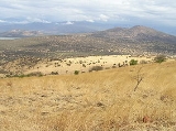
Nechisar National Park
Overview
Ethiopia
Ethiopia , officially known as the Federal Democratic Republic of Ethiopia, is a country located in the Horn of Africa. It is the second-most populous nation in Africa, with over 82 million inhabitants, and the tenth-largest by area, occupying 1,100,000 km2...
. Located in the Southern Nations, Nationalities, and Peoples Region (SNNPR) immediately to the east of Arba Minch
Arba Minch
Arba Minch is a city in southern Ethiopia; less common names for this city include Ganta Garo and Minghi. Located in the Gamo Gofa Zone of the Southern Nations, Nationalities, and Peoples Region about 500 kilometers south of Addis Ababa, at an elevation of 1285 meters above sea level...
, its 514 square kilometers of territory include the "Bridge of God" (an isthmus
Isthmus
An isthmus is a narrow strip of land connecting two larger land areas usually with waterforms on either side.Canals are often built through isthmuses where they may be particularly advantageous to create a shortcut for marine transportation...
between Lakes Abaya
Lake Abaya
Lake Abaya is a lake in the Southern Nations, Nationalities, and Peoples Region of Ethiopia. It was named Lake Margherita by the Italian explorer Vittorio Bottego, the first European commonly thought to visit the lake, to honor the wife of king Umberto I of Italy, Queen Margherita...
and Chamo
Lake Chamo
Lake Chamo is a lake in the Southern Nations, Nationalities, and Peoples Region of southern Ethiopia. It is located in the Great Rift Valley at an elevation of 1,110 meters. It is just to the south of Lake Abaya and the city of Arba Minch, and east of the Guge Mountains.The lake's northern end...
), and the Nechisar (white grass) plains east of the lakes. Park elevations range between 1108 and 1650 meters above sea level.
Unanswered Questions

