
Nebraska Highway 56
Encyclopedia
Nebraska Highway 56 is a highway in central Nebraska
. It is an east–west highway which has a length of 35 miles (56.3 km). The western terminus is near Greeley
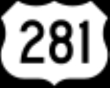
at U.S. Highway 281, and the eastern terminus is at Nebraska Highway 39
just west of St. Edward
.
, where it meets Nebraska Highway 52
. The two highway run concurrent east of Cedar Rapids for about a mile, then separate. After going northeast briefly, the highway continues east towards St. Edward, passing Nebraska Highway 14
and ending about a mile west of St. Edward at Highway 39.
Nebraska
Nebraska is a state on the Great Plains of the Midwestern United States. The state's capital is Lincoln and its largest city is Omaha, on the Missouri River....
. It is an east–west highway which has a length of 35 miles (56.3 km). The western terminus is near Greeley
Greeley, Nebraska
Greeley Center, often shortened to simply Greeley, is a village in and the county seat of Greeley County, Nebraska, United States. The population was 531 at the 2000 census.-Geography:Greeley Center is located at ....
at U.S. Highway 281, and the eastern terminus is at Nebraska Highway 39
Nebraska Highway 39
Nebraska Highway 39 is a highway in central Nebraska. It runs for a length of . It has a southern terminus west of Osceola at an intersection with Nebraska Highway 92. Its northern terminus is at an intersection with Nebraska Highway 14 southeast of Albion....
just west of St. Edward
St. Edward, Nebraska
St. Edward is a city in Boone County, Nebraska, United States. The population was 796 at the 2000 census.-Geography:St. Edward is located at ....
.
Route description
Nebraska Highway 56 begins less than a mile south of Greeley at U.S. 281. It runs east through farmland to Cedar RapidsCedar Rapids, Nebraska
Cedar Rapids is a village in Boone County, Nebraska, United States. The population was 407 at the 2000 census.-Geography:Cedar Rapids is located at ....
, where it meets Nebraska Highway 52
Nebraska Highway 52
Nebraska Highway 52 is a highway in central Nebraska. It is in length and runs at a southeast-to-northwest angle, though signed north–south. The south terminus is at an intersection with Nebraska Highway 14 north of Fullerton...
. The two highway run concurrent east of Cedar Rapids for about a mile, then separate. After going northeast briefly, the highway continues east towards St. Edward, passing Nebraska Highway 14
Nebraska Highway 14
Nebraska Highway 14 is a highway in Nebraska. It has a southern terminus at the Kansas border southwest of Superior and a northern terminus east of Niobrara at the South Dakota border.-Route description:...
and ending about a mile west of St. Edward at Highway 39.
Major intersections
| County | Location | Mile | Junction | Notes |
|---|---|---|---|---|
| Greeley Greeley County, Nebraska -History:Greeley County was formed in 1871. It was named after Horace Greeley, a newspaper editor and politician of the mid-19th century.-Demographics:... |
Greeley Greeley, Nebraska Greeley Center, often shortened to simply Greeley, is a village in and the county seat of Greeley County, Nebraska, United States. The population was 531 at the 2000 census.-Geography:Greeley Center is located at .... |
0.00 | Western terminus | |
| Boone Boone County, Nebraska -Demographics:As of the census of 2000, there were 6,259 people, 2,454 households, and 1,700 families residing in the county. The population density was 9 people per square mile . There were 2,733 housing units at an average density of 4 per square mile... |
Cedar Rapids Cedar Rapids, Nebraska Cedar Rapids is a village in Boone County, Nebraska, United States. The population was 407 at the 2000 census.-Geography:Cedar Rapids is located at .... |
20.99 | West end of NE 52 overlap | |
| 22.25 | East end of NE 52 overlap | |||
| 30.06 | ||||
| St. Edward St. Edward, Nebraska St. Edward is a city in Boone County, Nebraska, United States. The population was 796 at the 2000 census.-Geography:St. Edward is located at .... |
35.28 | Eastern terminus |