

Navigational Algorithms
Encyclopedia
Navigational Algorithms is a source of information whose purpose is to make available the scientific part of the art of navigation, containing specialized articles and software that implements the various procedures of calculus. The topics covered are:
Run under Windows XP, (maybe under 95/98/2000/NT)
The algorithms implemented are:
For n = 2 observations
For n ≥ 2 observations
- Celestial navigation: Sight Reduction, Line Of Position, Fix...
- Positional astronomy: RA, GHA, Dec
- Coastal navigation: Range, Bearing, Horizontal angles, IALA...
- Sailings: Rhumbs, Loxodromic, Orthodromic, Meridional parts...
- Weather, tides
- Software PC- PDA: Nautical Almanac, Sailings, Variation, Sextant corrections
Advanced navigation
Include articles about piloting and astronavigation: Corrections for sextant altitude, Sight Reduction with calculator-Form & Plotting sheet for celestial LoPs, Celestial Fix - 2 LoPs, Celestial Fix - n LoPs NA Sight Reduction algorithm, Vector equation of the Circle of Position, Vector Solution for the intersection of two Circles of Equal Altitude, Sight Reduction - Matrix solution.Basic marine navigation
Include papers about introduction to navigation, tides, naval kinematics, weather and oceanographyNavigation shareware
This section gives a brief description of the free programs available for navigation.Run under Windows XP, (maybe under 95/98/2000/NT)
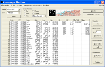
Nautical Almanac
Ephemerides of the celestial bodies used in navigation.- GHA - Greenwich Hour Angle
- Dec - Declination
- SD - Semidiameter
- HP - Horizontal Parallax
CelestialFix
Astronavigation solution for sight reduction for n observations made with a marine sextant & running fixesThe algorithms implemented are:
For n = 2 observations
- An analytical solution of the two star sight problem of celestial navigation, James A. Van Allen.
- Vector Solution for the Intersection of two Circles of Equal Altitude. Andrés Ruiz.
For n ≥ 2 observations
- DeWit/USNO Nautical Almanac/Compac Data, Least squares algorithm for n LOPs
- Kaplan algorithm, USNO. For n ≥ 8 observations, gives the solution for course and SOG.
Magnetic declination
Any measure of course made with a magnetic compass must be corrected because of the magnetic declination or local variation.See also
- NavigationNavigationNavigation is the process of monitoring and controlling the movement of a craft or vehicle from one place to another. It is also the term of art used for the specialized knowledge used by navigators to perform navigation tasks...
- Celestial navigationCelestial navigationCelestial navigation, also known as astronavigation, is a position fixing technique that has evolved over several thousand years to help sailors cross oceans without having to rely on estimated calculations, or dead reckoning, to know their position...
- Nautical almanacNautical almanacA nautical almanac is a publication describing the positions of a selection of celestial bodies for the purpose of enabling navigators to use celestial navigation to determine the position of their ship while at sea...
- Lunar distance (navigation)Lunar distance (navigation)In celestial navigation, lunar distance is the angle between the Moon and another celestial body. A navigator can use a lunar distance and a nautical almanac to calculate Greenwich time...
- SextantSextantA sextant is an instrument used to measure the angle between any two visible objects. Its primary use is to determine the angle between a celestial object and the horizon which is known as the altitude. Making this measurement is known as sighting the object, shooting the object, or taking a sight...
- American Practical Navigator
External links
- Navigational Algorithms
- Vector Solution for the Intersection of Two Circles of Equal Altitude, Andrés Ruiz González. Journal of Navigation, Volume 61, Issue 02, April 2008, pp 355–365
- Journal of Navigation http://journals.cambridge.org/action/displayJournal?jid=NAV
- The Institute of Navigation http://www.ion.org/
- Correction to the sextant altitude http://es.wikipedia.org/wiki/Archivo:CorrecionHs.jpg
- Marcq St Hilaire intercept for the line of position http://es.wikipedia.org/wiki/Archivo:MarcqSaintHilaire.jpg