

National Register of Historic Places listings in West Philadelphia
Encyclopedia
This is intended to be a complete list of the properties and districts on the National Register of Historic Places
National Register of Historic Places
The National Register of Historic Places is the United States government's official list of districts, sites, buildings, structures, and objects deemed worthy of preservation...
in West
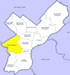
West Philadelphia
West Philadelphia, nicknamed West Philly, is a section of Philadelphia, Pennsylvania. Though there is no official definition of its boundaries, it is generally considered to reach from the western shore of the Schuylkill River, to City Line Avenue to the northwest, Cobbs Creek to the southwest, and...
Philadelphia, Pennsylvania
Pennsylvania
The Commonwealth of Pennsylvania is a U.S. state that is located in the Northeastern and Mid-Atlantic regions of the United States. The state borders Delaware and Maryland to the south, West Virginia to the southwest, Ohio to the west, New York and Ontario, Canada, to the north, and New Jersey to...
, United States
United States
The United States of America is a federal constitutional republic comprising fifty states and a federal district...
. The locations of National Register properties and districts for which the latitude and longitude coordinates are included below, may be seen in a Google map.
There are 532 properties and districts listed on the National Register in Philadelphia, including 67 National Historic Landmarks. West Philadelphia includes 61 of these properties and districts, including 5 National Historic Landmarks; the city's remaining properties and districts are listed elsewhere
National Register of Historic Places listings in Philadelphia, Pennsylvania
This is a list of the National Register of Historic Places listings in Philadelphia, Pennsylvania. There are 532 properties and districts listed on the National Register in Philadelphia, including 67 National Historic Landmarks....
. Two sites are split between West Philadelphia and other parts of the city, and are thus included on multiple lists.
Current listings
| Landmark name | Image | Date listed | Location | Neighborhood | Summary | |
|---|---|---|---|---|---|---|
| 1 | 32nd St. and Lancaster Ave. Philadelphia Armory | Junction of 32nd Street and Lancaster Avenue 39°57′23"N 75°11′19"W |
University City University City, Philadelphia, Pennsylvania University City is the easternmost region of West Philadelphia.The University of Pennsylvania has long been the dominant institution in the area and was instrumental in coining the name University City as part of a 1950s urban-renewal effort... |
|||
| 2 | Dimner Beeber Junior High School | 5901 Malvern Avenue 39°59′11"N 75°14′34"W |
West Parkside Parkside, Philadelphia, Pennsylvania Parkside is a neighborhood in the West Philadelphia section of Philadelphia, Pennsylvania.Much of the Parkside neighborhood was built during the 1876 Centennial Exhibition. It is a National Register of Historic Places Historic District with many examples of Victorian architecture, some... |
|||
| 3 | Bell Telephone Exchange Building | 8–12 North Preston Street 39°57′28"N 75°12′15"W |
Powelton Village Powelton Village, Philadelphia, Pennsylvania Powelton Village is a neighborhood of mostly Victorian, mostly twin homes in the West Philadelphia section of the United States city of Philadelphia, Pennsylvania. It is a national historic district which is part of University City... |
Telephone switching station from about 1900 to 1928 | ||
| 4 | Belmont Avenue Bridge in Philadelphia | Belmont Avenue over Ramp B 39°59′37"N 75°13′4.3"W |
Fairmount Park Fairmount Park Fairmount Park is the municipal park system of Philadelphia, Pennsylvania. It consists of 63 parks, with , all overseen by the Philadelphia Department of Parks and Recreation, successor to the Fairmount Park Commission in 2010.-Fairmount Park proper:... |
|||
| 5 | Belmont School | 4030–4060 Brown Street 39°58′0"N 75°12′18"W |
Belmont | |||
| 6 | Rudolph Blankenburg School | 4600 Girard Avenue 39°58′21"N 75°12′55"W |
Mill Creek Mill Creek, Philadelphia, Pennsylvania Mill Creek is a neighborhood in the West Philadelphia section of Philadelphia, Pennsylvania. It is located north of Market Street, south of Girard Avenue, between 44th and 52nd Streets. It is named for the eponymous creek which was covered by a cistern in the 1880s, although the water underneath... |
|||
| 7 | Breslyn Apartments | 4624–4642 Walnut Street, 201–213 South 47th Street 39°57′20"N 75°12′55"W |
Spruce Hill Spruce Hill, Philadelphia, Pennsylvania Spruce Hill is a neighborhood in the West Philadelphia section of Philadelphia, Pennsylvania. It is between 40th and 46th streets, and it stretches from Market Street south to Woodland Avenue. It has a population of over 16,000. It was built as a streetcar suburb for Center City between 1850 and... |
|||
| 8 | George L. Brooks School | 5629–5643 Haverford Avenue 39°58′6"N 75°14′0"W |
Haddington Haddington, Philadelphia, Pennsylvania Haddington is a neighborhood in the West Philadelphia section of Philadelphia, Pennsylvania. It is arguably located between 52nd Street and 63rd Street, bounded by Chestnut Street and Girard Avenue.... |
|||
| 9 | Lewis C. Cassidy School | 6523–6543 Lansdowne Avenue 39°58′30"N 75°15′3"W |
Morris Park | |||
| 10 | Centennial National Bank Centennial National Bank -History:The bank was chartered on January 19, 1876 to finance the Centennial Exposition.The bank's headquarters building, designed by noted Philadelphia architect Frank Furness, was completed in April 1876. The building's interior was modified in 1893, and again in 1899, when Philadelphia... |
32nd and Market Streets 39°57′18"N 75°11′13"W |
University City University City, Philadelphia, Pennsylvania University City is the easternmost region of West Philadelphia.The University of Pennsylvania has long been the dominant institution in the area and was instrumental in coining the name University City as part of a 1950s urban-renewal effort... |
Frank Furness Frank Furness Frank Heyling Furness was an acclaimed American architect of the Victorian era. He designed more than 600 buildings, most in the Philadelphia area, and is remembered for his eclectic, muscular, often idiosyncratically scaled buildings, and for his influence on the Chicago architect Louis Sullivan... , architect (1875–76). |
||
| 11 | Chamounix | West Fairmount Park on Chamounix Drive 40°0′13.5"N 75°11′46.5"W |
Fairmount Park Fairmount Park Fairmount Park is the municipal park system of Philadelphia, Pennsylvania. It consists of 63 parks, with , all overseen by the Philadelphia Department of Parks and Recreation, successor to the Fairmount Park Commission in 2010.-Fairmount Park proper:... |
|||
| 12 | City Line Avenue Bridge | City Avenue over eastern branch of Indian Creek 39°58′29"N 75°16′50"W |
Overbrook Farms Overbrook Farms, Philadelphia, Pennsylvania Overbrook Farms is a neighborhood on the western edge of the West Philadelphia section of Philadelphia, Pennsylvania, United States. Roughly bounded by City Avenue , 58th Street, Woodbine Avenue, and 66th Street at Morris Park... |
|||
| 13 | Cobbs Creek Automobile Suburb Historic District Cobbs Creek, Philadelphia, Pennsylvania Cobbs Creek is a predominantly African American neighborhood located in the West Philadelphia section of Philadelphia, Pennsylvania, United States . Cobbs Creek is generally bound by Market Street to the north, Baltimore Ave. to the south, 52nd Street to the east, and Cobbs Creek to the west... |
Roughly bounded by Cobbs Creek Parkway, Spruce Street, 62nd Street, and Angora Street 39°57′1"N 75°14′50"W |
Cobbs Creek Cobbs Creek, Philadelphia, Pennsylvania Cobbs Creek is a predominantly African American neighborhood located in the West Philadelphia section of Philadelphia, Pennsylvania, United States . Cobbs Creek is generally bound by Market Street to the north, Baltimore Ave. to the south, 52nd Street to the east, and Cobbs Creek to the west... |
|||
| 14 | College Hall, University of Pennsylvania College Hall (University of Pennsylvania) College Hall is the oldest building on the West Philadelphia campus of the University of Pennsylvania. Prior to its construction, the university was located on Ninth Street in Center City, Philadelphia. The building was designed by Thomas Webb Richards and completed in 1873... |
Bounded by Walnut, Spruce, 34th, and 36th Streets 39°57′5"N 75°11′38"W |
University City University City, Philadelphia, Pennsylvania University City is the easternmost region of West Philadelphia.The University of Pennsylvania has long been the dominant institution in the area and was instrumental in coining the name University City as part of a 1950s urban-renewal effort... |
Thomas W. Richards, architect (1870–72). | ||
| 15 | Drexel Development Historic District | Roughly bounded by Pine, Delancey, 39th and 40th Streets 39°57′3"N 75°12′9"W |
University City University City, Philadelphia, Pennsylvania University City is the easternmost region of West Philadelphia.The University of Pennsylvania has long been the dominant institution in the area and was instrumental in coining the name University City as part of a 1950s urban-renewal effort... |
|||
| 16 | Thomas Dunlap School | 5031 Race Street 39°57′47"N 75°13′18"W |
Haddington Haddington, Philadelphia, Pennsylvania Haddington is a neighborhood in the West Philadelphia section of Philadelphia, Pennsylvania. It is arguably located between 52nd Street and 63rd Street, bounded by Chestnut Street and Girard Avenue.... |
|||
| 17 | Fairmount Park Fairmount Park Fairmount Park is the municipal park system of Philadelphia, Pennsylvania. It consists of 63 parks, with , all overseen by the Philadelphia Department of Parks and Recreation, successor to the Fairmount Park Commission in 2010.-Fairmount Park proper:... |
 |
Both banks of the Schuylkill River Schuylkill River The Schuylkill River is a river in Pennsylvania. It is a designated Pennsylvania Scenic River.The river is about long. Its watershed of about lies entirely within the state of Pennsylvania. The source of its eastern branch is in the Appalachian Mountains at Tuscarora Springs, near Tamaqua in... and the Wissahickon Creek Wissahickon Creek Wissahickon Creek is a stream in southeastern Pennsylvania. Rising in Montgomery County, Pennsylvania, it runs about 23 miles passing through and dividing Northwest Philadelphia before emptying into the Schuylkill River at Philadelphia... , from Spring Garden Street to Northwestern Avenue 39°59′33"N 75°12′19"W |
Fairmount Park Fairmount Park Fairmount Park is the municipal park system of Philadelphia, Pennsylvania. It consists of 63 parks, with , all overseen by the Philadelphia Department of Parks and Recreation, successor to the Fairmount Park Commission in 2010.-Fairmount Park proper:... |
Extends into North National Register of Historic Places listings in North Philadelphia This is a list of the National Register of Historic Places listings in North Philadelphia.This is intended to be a complete list of the properties and districts on the National Register of Historic Places in North Philadelphia, Pennsylvania, United States... and Northwest National Register of Historic Places listings in Northwest Philadelphia This is a list of the National Register of Historic Places listings in Northwest Philadelphia.This is intended to be a complete list of the properties and districts on the National Register of Historic Places in Northwest Philadelphia, Pennsylvania, United States... Philadelphia |
|
| 18 | Furness Library Fisher Fine Arts Library The Anne & Jerome Fisher Fine Arts Library, also known as the Furness Library, is located on the campus of the University of Pennsylvania, on the east side of College Green... |
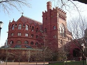 |
34th Street below Walnut on the University of Pennsylvania University of Pennsylvania The University of Pennsylvania is a private, Ivy League university located in Philadelphia, Pennsylvania, United States. Penn is the fourth-oldest institution of higher education in the United States,Penn is the fourth-oldest using the founding dates claimed by each institution... campus 39°57′6"N 75°11′34"W |
West Philadelphia West Philadelphia West Philadelphia, nicknamed West Philly, is a section of Philadelphia, Pennsylvania. Though there is no official definition of its boundaries, it is generally considered to reach from the western shore of the Schuylkill River, to City Line Avenue to the northwest, Cobbs Creek to the southwest, and... |
Frank Furness Frank Furness Frank Heyling Furness was an acclaimed American architect of the Victorian era. He designed more than 600 buildings, most in the Philadelphia area, and is remembered for his eclectic, muscular, often idiosyncratically scaled buildings, and for his influence on the Chicago architect Louis Sullivan... , architect (1888–91). |
|
| 19 | Garden Court Historic District Garden Court, Philadelphia, Pennsylvania Garden Court is a neighborhood in the West Philadelphia section of Philadelphia, Pennsylvania. It is located west of Spruce Hill, north of Cedar Park, east of Cobbs Creek, and south of Walnut Hill.... |
Roughly bounded by Larchwood Avenue, 46th, 50th, and Pine Streets; also 4526–4534 and 4537–4539 Osage Avenue 39°57′6.5"N 75°13′7"W |
Garden Court Garden Court, Philadelphia, Pennsylvania Garden Court is a neighborhood in the West Philadelphia section of Philadelphia, Pennsylvania. It is located west of Spruce Hill, north of Cedar Park, east of Cobbs Creek, and south of Walnut Hill.... |
|||
| 20 | Haddington Historic District Haddington, Philadelphia, Pennsylvania Haddington is a neighborhood in the West Philadelphia section of Philadelphia, Pennsylvania. It is arguably located between 52nd Street and 63rd Street, bounded by Chestnut Street and Girard Avenue.... |
6000 blocks of Market Market Street (Philadelphia) Market Street, originally known as High Street, is a major east–west street in Philadelphia, Pennsylvania. For the majority of its length, it serves as Pennsylvania Route 3.... , Ludlow and Chestnut Chestnut Street (Philadelphia) Chestnut Street is a major historic street in Philadelphia, Pennsylvania. Originally named Wynne Street because Thomas Wynne's home was there. William Penn renamed it Chestnut Street in 1684. It runs east–west from the Delaware River waterfront in downtown Philadelphia through Center City and West... Streets 39°57′41"N 75°14′31"W |
Haddington Haddington, Philadelphia, Pennsylvania Haddington is a neighborhood in the West Philadelphia section of Philadelphia, Pennsylvania. It is arguably located between 52nd Street and 63rd Street, bounded by Chestnut Street and Girard Avenue.... |
|||
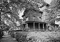
| 21 | Hanson Haines House Hanson Haines House The flamboyant Hanson Haines House, sometimes known simply as the Castle, located at 4801 Springfield Avenue in the Spruce Hill neighborhood of West Philadelphia, was built in 1902-03 for Quaker banker Hanson Haines by Quaker architect Charles Balderston in a German Medieval Revival style on the... |
4801 Springfield Avenue 39°56′46"N 75°13′1"W |
Spruce Hill Spruce Hill, Philadelphia, Pennsylvania Spruce Hill is a neighborhood in the West Philadelphia section of Philadelphia, Pennsylvania. It is between 40th and 46th streets, and it stretches from Market Street south to Woodland Avenue. It has a population of over 16,000. It was built as a streetcar suburb for Center City between 1850 and... |
|||
| 22 | Hajoca Corporation Headquarters and Showroom | 3025 Walnut Street Walnut Street (Philadelphia) Walnut Street is located in downtown Philadelphia and extends from the city's Delaware River waterfront through Center City and West Philadelphia. Walnut Street has been characterized as "the city's premier shopping district"... 39°57′7.5"N 75°11′6.5"W |
University City University City, Philadelphia, Pennsylvania University City is the easternmost region of West Philadelphia.The University of Pennsylvania has long been the dominant institution in the area and was instrumental in coining the name University City as part of a 1950s urban-renewal effort... |
|||
| 23 | Hamilton Family Estate | 4039–4041 Baltimore Avenue and 4000–4018 Pine Street 39°57′0"N 75°12′18"W |
Spruce Hill Spruce Hill, Philadelphia, Pennsylvania Spruce Hill is a neighborhood in the West Philadelphia section of Philadelphia, Pennsylvania. It is between 40th and 46th streets, and it stretches from Market Street south to Woodland Avenue. It has a population of over 16,000. It was built as a streetcar suburb for Center City between 1850 and... |
|||
| 24 | William B. Hanna School | 5720–5738 Media Street 39°58′28"N 75°14′10"W |
Carroll Park Carroll Park, Philadelphia, Pennsylvania Carroll Park is a neighborhood in West Philadelphia. Its boundaries are Lansdowne Avenue to the north, West Girard Avenue to the south, North 63rd Street to the west, and North 52nd Street to the east.... |
|||
| 25 | Holmes Junior High School | 5429–5455 Chestnut Street 39°57′34.5"N 75°13′50.5"W |
Cobbs Creek Cobbs Creek, Philadelphia, Pennsylvania Cobbs Creek is a predominantly African American neighborhood located in the West Philadelphia section of Philadelphia, Pennsylvania, United States . Cobbs Creek is generally bound by Market Street to the north, Baltimore Ave. to the south, 52nd Street to the east, and Cobbs Creek to the west... |
|||
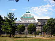
| 26 | Institute of the Pennsylvania Hospital Pennsylvania Hospital Pennsylvania Hospital is a hospital in Center City, Philadelphia, affiliated with the University of Pennsylvania Health System . Founded on May 11, 1751 by Benjamin Franklin and Thomas Bond, it was the first hospital in the United States... |
111 North 49th Street 39°57′42"N 75°13′2"W |
Mill Creek Mill Creek, Philadelphia, Pennsylvania Mill Creek is a neighborhood in the West Philadelphia section of Philadelphia, Pennsylvania. It is located north of Market Street, south of Girard Avenue, between 44th and 52nd Streets. It is named for the eponymous creek which was covered by a cistern in the 1880s, although the water underneath... |
Samuel Sloan, architect (1856–59). | ||
| 27 | La Blanche Apartments La Blanche Apartments The La Blanche Apartments is a historic building in West Philadelphia built in 1910 in the Georgian Revival style. It was part of the second wave of a housing boom in West Philadelphia that started with the completion of the Market Street Elevated line in 1907... |
5100 Walnut Street Walnut Street (Philadelphia) Walnut Street is located in downtown Philadelphia and extends from the city's Delaware River waterfront through Center City and West Philadelphia. Walnut Street has been characterized as "the city's premier shopping district"... 39°57′23"N 75°13′25"W |
Walnut Hill Walnut Hill, Philadelphia, Pennsylvania Walnut Hill is a neighborhood in the West Philadelphia section of Philadelphia, Pennsylvania. It is located between 45th Street and 52nd Street, bounded by Market Street and Spruce Street. Most of the neighborhood is in the northwestern part of the University City District... |
|||
| 28 | Henry C. Lea School of Practice | 242 South 47th Street 39°57′16"N 75°12′59"W |
Walnut Hill Walnut Hill, Philadelphia, Pennsylvania Walnut Hill is a neighborhood in the West Philadelphia section of Philadelphia, Pennsylvania. It is located between 45th Street and 52nd Street, bounded by Market Street and Spruce Street. Most of the neighborhood is in the northwestern part of the University City District... |
|||
| 29 | William Mann School | 1835–1869 North 54th Street 39°59′8"N 75°13′53"W |
Wynnefield Wynnefield, Philadelphia, Pennsylvania Wynnefield is a predominantly African-American, middle-classneighborhood in West Philadelphia. Its borders are 53rd Street at Jefferson to the south, Philadelphia's Fairmount Park to the east, City Avenue to the north and the Amtrak Main Line tracks to the west.Surrounding neighborhoods include... |
|||
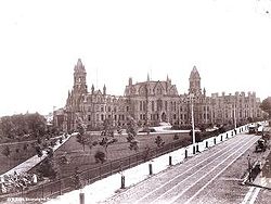
| 30 | Memorial Hall Memorial Hall (Philadelphia) Memorial Hall, designed by Herman J. Schwarzmann for the 1876 Centennial Exposition in Philadelphia, Pennsylvania, is an early example of monumental Beaux-Arts architecture in the United States. Schwarzmann, the chief engineer of the Fairmount Park Commission, also designed the temporary... |
 |
North Concourse Drive 39°58′46"N 75°12′35"W |
Fairmount Park Fairmount Park Fairmount Park is the municipal park system of Philadelphia, Pennsylvania. It consists of 63 parks, with , all overseen by the Philadelphia Department of Parks and Recreation, successor to the Fairmount Park Commission in 2010.-Fairmount Park proper:... |
Herman J. Schwarzmann Herman J. Schwarzmann Herman J. Schwarzmann , also known as Hermann J. Schwarzmann or H. J. Schwarzmann, was a German-born American architect who practiced in Philadelphia and later in New York City.-Early life:... , architect (1874–76). |
|
| 31 | Monte Vista | 917–931 North 63rd Street, 6154–6160 Oxford Street, 6151–6157 Nassau Street 39°58′46"N 75°14′44"W |
Overbrook Overbrook, Philadelphia, Pennsylvania Overbrook is a neighborhood northwest of West Philadelphia, Philadelphia, Pennsylvania. The area contains an assortment of housing from large, old homes to row homes to 3-4 story apartment buildings.-Physical setting:... |
|||
| 32 | Overbrook Farms Overbrook Farms, Philadelphia, Pennsylvania Overbrook Farms is a neighborhood on the western edge of the West Philadelphia section of Philadelphia, Pennsylvania, United States. Roughly bounded by City Avenue , 58th Street, Woodbine Avenue, and 66th Street at Morris Park... |
Roughly bounded by City Line Avenue, 58th Street, Woodbine Avenue and 64th Street 39°59′17"N 75°14′55"W |
Overbrook Farms Overbrook Farms, Philadelphia, Pennsylvania Overbrook Farms is a neighborhood on the western edge of the West Philadelphia section of Philadelphia, Pennsylvania, United States. Roughly bounded by City Avenue , 58th Street, Woodbine Avenue, and 66th Street at Morris Park... |
|||
| 33 | Overbrook High School Overbrook High School (Philadelphia) Overbrook High School is an inner-city, public, four-year secondary school in the Overbrook section of West Philadelphia, Philadelphia, Pennsylvania, United States.-School:... |
59th and Lancaster Ave. 39°58′51.5"N 75°14′18.5"W |
Overbrook Overbrook, Philadelphia, Pennsylvania Overbrook is a neighborhood northwest of West Philadelphia, Philadelphia, Pennsylvania. The area contains an assortment of housing from large, old homes to row homes to 3-4 story apartment buildings.-Physical setting:... |
|||
| 34 | Overbrook School | 6201–6231 Lebanon Avenue 39°58′55"N 75°14′44"W |
Overbrook Overbrook, Philadelphia, Pennsylvania Overbrook is a neighborhood northwest of West Philadelphia, Philadelphia, Pennsylvania. The area contains an assortment of housing from large, old homes to row homes to 3-4 story apartment buildings.-Physical setting:... |
|||
| 35 | Parkside Historic District Parkside, Philadelphia, Pennsylvania Parkside is a neighborhood in the West Philadelphia section of Philadelphia, Pennsylvania.Much of the Parkside neighborhood was built during the 1876 Centennial Exhibition. It is a National Register of Historic Places Historic District with many examples of Victorian architecture, some... |
Bounded by Penn Central railroad tracks, 38th Street, Girard, Parkside and Belmont Avenues 39°58′24"N 75°12′23"W |
Parkside Parkside, Philadelphia, Pennsylvania Parkside is a neighborhood in the West Philadelphia section of Philadelphia, Pennsylvania.Much of the Parkside neighborhood was built during the 1876 Centennial Exhibition. It is a National Register of Historic Places Historic District with many examples of Victorian architecture, some... |
|||
| 36 | Pennsylvania Railroad Freight Building | 3118–3198 Chestnut Street Chestnut Street (Philadelphia) Chestnut Street is a major historic street in Philadelphia, Pennsylvania. Originally named Wynne Street because Thomas Wynne's home was there. William Penn renamed it Chestnut Street in 1684. It runs east–west from the Delaware River waterfront in downtown Philadelphia through Center City and West... 39°57′12.5"N 75°11′13"W |
University City University City, Philadelphia, Pennsylvania University City is the easternmost region of West Philadelphia.The University of Pennsylvania has long been the dominant institution in the area and was instrumental in coining the name University City as part of a 1950s urban-renewal effort... |
|||
| 37 | Pennsylvania Railroad Office Building | 3175 John F. Kennedy Blvd. 39°57′22"N 75°11′15"W |
University City University City, Philadelphia, Pennsylvania University City is the easternmost region of West Philadelphia.The University of Pennsylvania has long been the dominant institution in the area and was instrumental in coining the name University City as part of a 1950s urban-renewal effort... |
|||
| 38 | Pinehurst Apartments | 4511–4523 Pine and 324–334 South 45th Streets 39°57′7"N 75°12′46.5"W |
Spruce Hill Spruce Hill, Philadelphia, Pennsylvania Spruce Hill is a neighborhood in the West Philadelphia section of Philadelphia, Pennsylvania. It is between 40th and 46th streets, and it stretches from Market Street south to Woodland Avenue. It has a population of over 16,000. It was built as a streetcar suburb for Center City between 1850 and... |
|||
| 39 | Poth and Schmidt Development Houses | 3306–3316 Arch Street 39°57′27"N 75°11′24"W |
University City University City, Philadelphia, Pennsylvania University City is the easternmost region of West Philadelphia.The University of Pennsylvania has long been the dominant institution in the area and was instrumental in coining the name University City as part of a 1950s urban-renewal effort... |
|||
| 40 | Frederick A. Poth Houses | 3301–3311, 3315 Powelton Avenue 39°57′37"N 75°11′25"W |
Powelton Village Powelton Village, Philadelphia, Pennsylvania Powelton Village is a neighborhood of mostly Victorian, mostly twin homes in the West Philadelphia section of the United States city of Philadelphia, Pennsylvania. It is a national historic district which is part of University City... |
|||
| 41 | Powelton Historic District Powelton Village, Philadelphia, Pennsylvania Powelton Village is a neighborhood of mostly Victorian, mostly twin homes in the West Philadelphia section of the United States city of Philadelphia, Pennsylvania. It is a national historic district which is part of University City... |
Roughly bounded by Brandywine Street, 32nd to 39th Streets and Lancaster Avenue 39°57′41"N 75°11′32"W |
Powelton Village Powelton Village, Philadelphia, Pennsylvania Powelton Village is a neighborhood of mostly Victorian, mostly twin homes in the West Philadelphia section of the United States city of Philadelphia, Pennsylvania. It is a national historic district which is part of University City... |
|||
| 42 | The Powelton | 3500–3520 Powelton Avenue, 214–218 35th Street, and 215–221 36th Street 39°57′35"N 75°11′25"W |
Powelton Village Powelton Village, Philadelphia, Pennsylvania Powelton Village is a neighborhood of mostly Victorian, mostly twin homes in the West Philadelphia section of the United States city of Philadelphia, Pennsylvania. It is a national historic district which is part of University City... |
|||
| 43 | Protestant Episcopal Church of the Saviour Protestant Episcopal Church of the Saviour Protestant Episcopal Church of the Saviour is a historic church on Ludlow Street and 3723-3725 Chestnut Street in Philadelphia, Pennsylvania.It was built in 1898 and rebuilt after a fire in 1906. In 1992 it became the cathedral of the Episcopal Diocese of Pennsylvania and is now called the... |
Ludlow Street and 3723–3725 Chestnut Street Chestnut Street (Philadelphia) Chestnut Street is a major historic street in Philadelphia, Pennsylvania. Originally named Wynne Street because Thomas Wynne's home was there. William Penn renamed it Chestnut Street in 1684. It runs east–west from the Delaware River waterfront in downtown Philadelphia through Center City and West... 39°57′20.5"N 75°11′52.5"W |
University City University City, Philadelphia, Pennsylvania University City is the easternmost region of West Philadelphia.The University of Pennsylvania has long been the dominant institution in the area and was instrumental in coining the name University City as part of a 1950s urban-renewal effort... |
Charles M. Burns, architect (1889, rebuilt after 1902 fire). | ||
| 44 | Richards and Goddard Buildings | 3700–3710 Hamilton Walk 39°56′59"N 75°11′53"W |
University City University City, Philadelphia, Pennsylvania University City is the easternmost region of West Philadelphia.The University of Pennsylvania has long been the dominant institution in the area and was instrumental in coining the name University City as part of a 1950s urban-renewal effort... |
On the University of Pennsylvania University of Pennsylvania The University of Pennsylvania is a private, Ivy League university located in Philadelphia, Pennsylvania, United States. Penn is the fourth-oldest institution of higher education in the United States,Penn is the fourth-oldest using the founding dates claimed by each institution... campus; Louis Kahn Louis Kahn Louis Isadore Kahn was an American architect, based in Philadelphia, Pennsylvania, United States. After working in various capacities for several firms in Philadelphia, he founded his own atelier in 1935... , architect (1957–61). |
||
| 45 | Paul Robeson House | 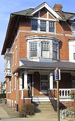 |
4951 Walnut Street Walnut Street (Philadelphia) Walnut Street is located in downtown Philadelphia and extends from the city's Delaware River waterfront through Center City and West Philadelphia. Walnut Street has been characterized as "the city's premier shopping district"... 39°57′29"N 75°13′17"W |
Spruce Hill Spruce Hill, Philadelphia, Pennsylvania Spruce Hill is a neighborhood in the West Philadelphia section of Philadelphia, Pennsylvania. It is between 40th and 46th streets, and it stretches from Market Street south to Woodland Avenue. It has a population of over 16,000. It was built as a streetcar suburb for Center City between 1850 and... |
||
| 46 | St. Anthony Hall House | 3637 Locust Walk, University of Pennsylvania University of Pennsylvania The University of Pennsylvania is a private, Ivy League university located in Philadelphia, Pennsylvania, United States. Penn is the fourth-oldest institution of higher education in the United States,Penn is the fourth-oldest using the founding dates claimed by each institution... 39°57′8.5"N 75°11′47"W |
University City University City, Philadelphia, Pennsylvania University City is the easternmost region of West Philadelphia.The University of Pennsylvania has long been the dominant institution in the area and was instrumental in coining the name University City as part of a 1950s urban-renewal effort... |
|||
| 47 | Sansom Row Sansom Row Sansom Row is a row of historic houses at 3402 to 3436 Sansom Street in the University City neighborhood of Philadelphia, Pennsylvania.Built in 1869 to 1871, the rowhouses are constructed in matching three-story pairs, with brownstone facades and slate mansard roofs... |
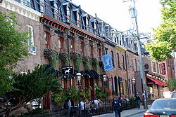 |
3402–3436 Sansom St. 39°57′13"N 75°11′34"W |
University City University City, Philadelphia, Pennsylvania University City is the easternmost region of West Philadelphia.The University of Pennsylvania has long been the dominant institution in the area and was instrumental in coining the name University City as part of a 1950s urban-renewal effort... |
||
| 48 | John Shedwick Development Houses | 3433–3439 Lancaster Avenue 39°57′28.5"N 75°11′31"W |
Powelton Village Powelton Village, Philadelphia, Pennsylvania Powelton Village is a neighborhood of mostly Victorian, mostly twin homes in the West Philadelphia section of the United States city of Philadelphia, Pennsylvania. It is a national historic district which is part of University City... |
|||
| 49 | William Shoemaker Junior High School | 1464–1488 North 53rd Street 39°58′34"N 75°13′42"W |
Carroll Park Carroll Park, Philadelphia, Pennsylvania Carroll Park is a neighborhood in West Philadelphia. Its boundaries are Lansdowne Avenue to the north, West Girard Avenue to the south, North 63rd Street to the west, and North 52nd Street to the east.... |
|||
| 50 | Mayer Sulzberger Junior High School | 701–741 North 48th Street 39°57′53"N 75°12′58"W |
Mill Creek Mill Creek, Philadelphia, Pennsylvania Mill Creek is a neighborhood in the West Philadelphia section of Philadelphia, Pennsylvania. It is located north of Market Street, south of Girard Avenue, between 44th and 52nd Streets. It is named for the eponymous creek which was covered by a cistern in the 1880s, although the water underneath... |
|||
| 51 | Thirtieth Street Station 30th Street Station 30th Street Station is the main railroad station in Philadelphia, Pennsylvania, and one of the five stations in SEPTA's Center City fare zone. It is also a major stop on Amtrak's Northeast and Keystone Corridors... |
West River Drive, Market Street Market Street (Philadelphia) Market Street, originally known as High Street, is a major east–west street in Philadelphia, Pennsylvania. For the majority of its length, it serves as Pennsylvania Route 3.... , 30th, and Arch Streets 39°57′20"N 75°10′55"W |
University City University City, Philadelphia, Pennsylvania University City is the easternmost region of West Philadelphia.The University of Pennsylvania has long been the dominant institution in the area and was instrumental in coining the name University City as part of a 1950s urban-renewal effort... |
Graham, Anderson, Probst & White, architects (1929–34). | ||
| 52 | United States Post Office-Main Branch | 2970 Market Street 39°57′14"N 75°10′57.5"W |
University City University City, Philadelphia, Pennsylvania University City is the easternmost region of West Philadelphia.The University of Pennsylvania has long been the dominant institution in the area and was instrumental in coining the name University City as part of a 1950s urban-renewal effort... |
|||
| 53 | University Avenue Bridge University Avenue Bridge The University Avenue Bridge is a double-leaf bascule bridge crossing the Schuylkill River in Philadelphia, Pennsylvania. The four-lane bridge links University Avenue in West Philadelphia with South 34th Street in the Grays Ferry section of South Philadelphia... |
South University Avenue over the Schuylkill River Schuylkill River The Schuylkill River is a river in Pennsylvania. It is a designated Pennsylvania Scenic River.The river is about long. Its watershed of about lies entirely within the state of Pennsylvania. The source of its eastern branch is in the Appalachian Mountains at Tuscarora Springs, near Tamaqua in... 39°56′34"N 75°11′49"W |
University City University City, Philadelphia, Pennsylvania University City is the easternmost region of West Philadelphia.The University of Pennsylvania has long been the dominant institution in the area and was instrumental in coining the name University City as part of a 1950s urban-renewal effort... |
Extends into South Philadelphia National Register of Historic Places listings in South Philadelphia This is a list of the National Register of Historic Places listings in South Philadelphia.This is intended to be a complete list of the properties and districts on the National Register of Historic Places in South Philadelphia, Pennsylvania, United States... |
||
| 54 | University of Pennsylvania Campus Historic District University of Pennsylvania Campus Historic District The University of Pennsylvania Campus Historic District is listed on the National Register of Historic Places as a historic district on the campus of the University of Pennsylvania in Philadelphia, Pennsylvania, eastern USA... |
 |
Roughly bounded by Hamilton Walk, South, 32nd, Walnut, 36th, Spruce, and 39th Streets 39°57′8"N 75°11′40"W |
University City University City, Philadelphia, Pennsylvania University City is the easternmost region of West Philadelphia.The University of Pennsylvania has long been the dominant institution in the area and was instrumental in coining the name University City as part of a 1950s urban-renewal effort... |
||
| 55 | Walnut Park Plaza Hotel | 6232–6250 Walnut Street 39°57′33.5"N 75°14′49"W |
Cobbs Creek Cobbs Creek, Philadelphia, Pennsylvania Cobbs Creek is a predominantly African American neighborhood located in the West Philadelphia section of Philadelphia, Pennsylvania, United States . Cobbs Creek is generally bound by Market Street to the north, Baltimore Ave. to the south, 52nd Street to the east, and Cobbs Creek to the west... |
|||
| 56 | West Philadelphia High School West Philadelphia High School West Philadelphia High School is a secondary school located in the West Philadelphia section of Philadelphia, Pennsylvania.The school was completed on November 1, 1912. and occupies an entire city block between 47th and 48th streets, between Walnut Street and Locust Street... |
4700 Walnut St. 39°57′19"N 75°13′1"W |
Spruce Hill Spruce Hill, Philadelphia, Pennsylvania Spruce Hill is a neighborhood in the West Philadelphia section of Philadelphia, Pennsylvania. It is between 40th and 46th streets, and it stretches from Market Street south to Woodland Avenue. It has a population of over 16,000. It was built as a streetcar suburb for Center City between 1850 and... |
|||
| 57 | West Philadelphia Streetcar Suburb Historic District West Philadelphia Streetcar Suburb Historic District The West Philadelphia Streetcar Suburb Historic District is an area of West Philadelphia listed on the National Register of Historic Places because it represents the transformation of Philadelphia's rural farmland into urban residential development, made possible by the streetcar, which provided... |
 |
Roughly bounded by the University of Pennsylvania University of Pennsylvania The University of Pennsylvania is a private, Ivy League university located in Philadelphia, Pennsylvania, United States. Penn is the fourth-oldest institution of higher education in the United States,Penn is the fourth-oldest using the founding dates claimed by each institution... campus, Woodlands Cemetery, Poweltown Avenue, 52nd Street, and Woodland Avenue 39°57′1"N 75°12′45"W |
Spruce Hill Spruce Hill, Philadelphia, Pennsylvania Spruce Hill is a neighborhood in the West Philadelphia section of Philadelphia, Pennsylvania. It is between 40th and 46th streets, and it stretches from Market Street south to Woodland Avenue. It has a population of over 16,000. It was built as a streetcar suburb for Center City between 1850 and... |
||
| 58 | WFIL Studio WFIL WFIL is a radio station and a former television station serving the city of Philadelphia, Pennsylvania. Its transmitter is located in Lafayette Hill, Pennsylvania.... |
4548 Market Street Market Street (Philadelphia) Market Street, originally known as High Street, is a major east–west street in Philadelphia, Pennsylvania. For the majority of its length, it serves as Pennsylvania Route 3.... 39°57′29.5"N 75°12′45"W |
Spruce Hill Spruce Hill, Philadelphia, Pennsylvania Spruce Hill is a neighborhood in the West Philadelphia section of Philadelphia, Pennsylvania. It is between 40th and 46th streets, and it stretches from Market Street south to Woodland Avenue. It has a population of over 16,000. It was built as a streetcar suburb for Center City between 1850 and... |
|||
| 59 | Woodland Terrace Woodland Terrace, Philadelphia, Pennsylvania Woodland Terrace is a street name and a small neighborhood of Italianate twin mansions in the West Philadelphia section of Philadelphia, Pennsylvania... |
 |
501–519, 500–520 Woodland Terrace 39°56′58"N 75°12′16.5"W |
University City University City, Philadelphia, Pennsylvania University City is the easternmost region of West Philadelphia.The University of Pennsylvania has long been the dominant institution in the area and was instrumental in coining the name University City as part of a 1950s urban-renewal effort... |
Samuel Sloan, architect. | |
| 60 | The Woodlands | 40th Street and Woodland Avenue 39°56′50"N 75°12′10"W |
University City University City, Philadelphia, Pennsylvania University City is the easternmost region of West Philadelphia.The University of Pennsylvania has long been the dominant institution in the area and was instrumental in coining the name University City as part of a 1950s urban-renewal effort... |
Built ca. 1742, expanded 1787-90. | ||
| 61 | Wynnestay Wynnestay Wynnestay is a historic home in Philadelphia, Pennsylvania. The two-and-a-half-story house was first built in 1689 as the residence of Dr. Thomas Wynne, Pennsylvania founder William Penn's personal physician and first Speaker of the Pennsylvania Provincial Assembly.The house was extensively... |
5125 Woodbine Avenue 39°59′38.5"N 75°13′49.5"W |
Wynnefield Wynnefield, Philadelphia, Pennsylvania Wynnefield is a predominantly African-American, middle-classneighborhood in West Philadelphia. Its borders are 53rd Street at Jefferson to the south, Philadelphia's Fairmount Park to the east, City Avenue to the north and the Amtrak Main Line tracks to the west.Surrounding neighborhoods include... |
Built 1689, expanded 1700. |
See also
- List of National Historic Landmarks in Philadelphia
- National Register of Historic Places listings in Philadelphia, PennsylvaniaNational Register of Historic Places listings in Philadelphia, PennsylvaniaThis is a list of the National Register of Historic Places listings in Philadelphia, Pennsylvania. There are 532 properties and districts listed on the National Register in Philadelphia, including 67 National Historic Landmarks....