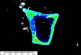
Namdrik Atoll
Encyclopedia

Marshallese language
The Marshallese language is a Malayo-Polynesian language of the Marshall Islands, and the principal language of the country...
: , n) is a coral atoll of two islands in the Pacific Ocean, and forms a legislative district of the Ralik Chain
Ralik Chain
The Ralik Chain is a chain of islands within the island nation of the Marshall Islands. Ralik means "sunset". It lies just to the west of the country's other island chain, the Ratak Chain...
of the Marshall Islands
Marshall Islands
The Republic of the Marshall Islands , , is a Micronesian nation of atolls and islands in the middle of the Pacific Ocean, just west of the International Date Line and just north of the Equator. As of July 2011 the population was 67,182...
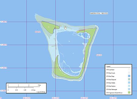
. Its total land area is only 2.8 square kilometres (1.1 sq mi), but it encloses a lagoon with an area of 8.4 square kilometres (3.2 sq mi).
Namdrik Atoll is located approximately 145 kilometres (90.1 mi) west-southwest of Jaluit, and 117 kilometres (72.7 mi) northwest of Ebon Atoll
Ebon Atoll
Ebon Atoll is a coral atoll of 22 islands in the Pacific Ocean, and forms a legislative district of the Ralik Chain of the Marshall Islands. Its total land area is only , but it encloses a deep lagoon with an area of . A passage leads to the lagoon from the southwest edge of the atoll. The...
. The atoll consists of two large wooded islets. The larger (also called Namorik) wraps around the central lagoon from the southwest to the northeast, while the smaller island closes off the northwest corner of the lagoon. A coral islet stands between them on the reef, with numerous black boulders. The very shallow lagoon is cut off from the sea by the drying coral reef. Boats can cross the reef with difficulty, at high water
High Water
High Water is an album by hip hop artist El-P, released on March 9, 2004 through Thirsty Ear Recordings.Made in conjunction with jazz pianist Matthew Shipp and the group for which he is artistic director, The Blue Series Continuum, the album is a striking departure from El-P's usual style, almost...
on the west side of the atoll.
Landing near the west side of Namorik Islet can be effected about 90 meters south of it. There is no shelter during northeast winds, and it is dangerous with strong southwest winds when there is a heavy sea. There is a fringing reef which extends about 135 meters in the vicinity of the landing place. There is depth of about 1.2 meters and there are rocks in places. Two stranded wrecks lie about 90 meters off the south shore along the reef line. (Sailing Directions Pub-153)
History
Namdrik Atoll was claimed by the Empire of Germany along with the rest of the Marshall Islands in 1884. After World War I, the island came under the South Pacific MandateSouth Pacific Mandate
The was the Japanese League of Nations mandate consisting of several groups of islands in the Pacific Ocean which came under the administration of Japan after the defeat of the German Empire in World War I.-Early history:Under the terms of the Anglo-Japanese Alliance, after the start of World...
of the Empire of Japan
Empire of Japan
The Empire of Japan is the name of the state of Japan that existed from the Meiji Restoration on 3 January 1868 to the enactment of the post-World War II Constitution of...
. Following the end of World War II, it came under the control of the United States as part of the Trust Territory of the Pacific Islands
Trust Territory of the Pacific Islands
The Trust Territory of the Pacific Islands was a United Nations trust territory in Micronesia administered by the United States from 1947 to 1986.-History:...
until the independence of the Marshall Islands in 1986.
Namorik Atoll has a population of 800+. It is small and out of the way. During WW-II there was fighting up at Kwagalen Atoll. According to sources Namorik Atoll required limited resources to retake it from the Japanese.

