
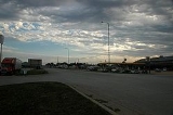
Murdo, South Dakota
Encyclopedia
Murdo is a city in Jones County
, South Dakota
, United States
. The population was 488 at the 2010 census
. It is the county seat
of Jones County
. Murdo is named for Murdo MacKenzie
, a Texas cattleman, and was the hometown of current Republican U.S. Senator John Thune
.
According to the United States Census Bureau
, the city has a total area of 0.6 square miles (1.6 km²), all of it land.
Murdo has been assigned the ZIP code
57559 and the FIPS place code 44260.
, there were 612 people, 271 households and 160 families residing in the city. The population density
was 964.5 per square mile (375.1/km²). There were 315 housing units at an average density of 496.4 per square mile (193.1/km²). The racial makeup of the city was 95.92% White, 2.94% Native American, and 1.14% from two or more races. Hispanic or Latino of any race were 0.49% of the population.
There were 271 households of which 28.0% had children under the age of 18 living with them, 44.6% were married couples
living together, 11.4% had a female householder with no husband present, and 40.6% were non-families. 37.6% of all households were made up of individuals and 19.2% had someone living alone who was 65 years of age or older. The average household size was 2.26 and the average family size was 2.99.
Age distribution was 26.8% under the age of 18, 6.9% from 18 to 24, 25.2% from 25 to 44, 21.9% from 45 to 64, and 19.3% who were 65 years of age or older. The median age was 40 years. For every 100 females there were 94.9 males. For every 100 females age 18 and over, there were 85.9 males.
The median household income
was $30,104, and the median family income was $40,000. Males had a median income of $24,196 versus $17,917 for females. The per capita income
for the city was $16,008. About 10.5% of families and 12.1% of the population were below the poverty line, including 15.3% of those under age 18 and 11.1% of those age 65 or over.
Jones County, South Dakota
As of the census of 2000, there were 1,193 people, 509 households, and 327 families residing in the county. The population density was 1 people per square mile . There were 614 housing units at an average density of 1 per square mile...
, South Dakota
South Dakota
South Dakota is a state located in the Midwestern region of the United States. It is named after the Lakota and Dakota Sioux American Indian tribes. Once a part of Dakota Territory, South Dakota became a state on November 2, 1889. The state has an area of and an estimated population of just over...
, United States
United States
The United States of America is a federal constitutional republic comprising fifty states and a federal district...
. The population was 488 at the 2010 census
United States Census, 2010
The Twenty-third United States Census, known as Census 2010 or the 2010 Census, is the current national census of the United States. National Census Day was April 1, 2010 and is the reference date used in enumerating individuals...
. It is the county seat
County seat
A county seat is an administrative center, or seat of government, for a county or civil parish. The term is primarily used in the United States....
of Jones County
Jones County, South Dakota
As of the census of 2000, there were 1,193 people, 509 households, and 327 families residing in the county. The population density was 1 people per square mile . There were 614 housing units at an average density of 1 per square mile...
. Murdo is named for Murdo MacKenzie
Murdo MacKenzie
Murdo Mackenzie was twice manager of the Scots-owned Matador Land and Cattle Company, and founding president of the American Stock Growers Association, for whom he testified before congress and the Interstate Commerce Commission...
, a Texas cattleman, and was the hometown of current Republican U.S. Senator John Thune
John Thune
John Randolph Thune is the junior U.S. Senator from South Dakota and a member of the Republican Party. He previously served as a U.S. Representative for .-Early Life, Education:...
.
Geography
Murdo is located at 43°53′17"N 100°42′40"W (43.888173, -100.711109).According to the United States Census Bureau
United States Census Bureau
The United States Census Bureau is the government agency that is responsible for the United States Census. It also gathers other national demographic and economic data...
, the city has a total area of 0.6 square miles (1.6 km²), all of it land.
Murdo has been assigned the ZIP code
ZIP Code
ZIP codes are a system of postal codes used by the United States Postal Service since 1963. The term ZIP, an acronym for Zone Improvement Plan, is properly written in capital letters and was chosen to suggest that the mail travels more efficiently, and therefore more quickly, when senders use the...
57559 and the FIPS place code 44260.
Demographics
At the 2000 censusCensus
A census is the procedure of systematically acquiring and recording information about the members of a given population. It is a regularly occurring and official count of a particular population. The term is used mostly in connection with national population and housing censuses; other common...
, there were 612 people, 271 households and 160 families residing in the city. The population density
Population density
Population density is a measurement of population per unit area or unit volume. It is frequently applied to living organisms, and particularly to humans...
was 964.5 per square mile (375.1/km²). There were 315 housing units at an average density of 496.4 per square mile (193.1/km²). The racial makeup of the city was 95.92% White, 2.94% Native American, and 1.14% from two or more races. Hispanic or Latino of any race were 0.49% of the population.
There were 271 households of which 28.0% had children under the age of 18 living with them, 44.6% were married couples
Marriage
Marriage is a social union or legal contract between people that creates kinship. It is an institution in which interpersonal relationships, usually intimate and sexual, are acknowledged in a variety of ways, depending on the culture or subculture in which it is found...
living together, 11.4% had a female householder with no husband present, and 40.6% were non-families. 37.6% of all households were made up of individuals and 19.2% had someone living alone who was 65 years of age or older. The average household size was 2.26 and the average family size was 2.99.
Age distribution was 26.8% under the age of 18, 6.9% from 18 to 24, 25.2% from 25 to 44, 21.9% from 45 to 64, and 19.3% who were 65 years of age or older. The median age was 40 years. For every 100 females there were 94.9 males. For every 100 females age 18 and over, there were 85.9 males.
The median household income
Median household income
The median household income is commonly used to generate data about geographic areas and divides households into two equal segments with the first half of households earning less than the median household income and the other half earning more...
was $30,104, and the median family income was $40,000. Males had a median income of $24,196 versus $17,917 for females. The per capita income
Per capita income
Per capita income or income per person is a measure of mean income within an economic aggregate, such as a country or city. It is calculated by taking a measure of all sources of income in the aggregate and dividing it by the total population...
for the city was $16,008. About 10.5% of families and 12.1% of the population were below the poverty line, including 15.3% of those under age 18 and 11.1% of those age 65 or over.