
Mount Matthews
Encyclopedia
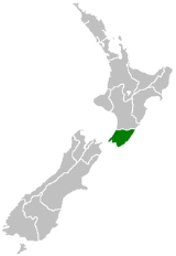
Rimutaka Range
The Rimutaka Range is one of several mountain ranges in the North Island of New Zealand which form a ridge running parallel with the east coast of the island between East Cape and Wellington.The ridge is at its most pronounced in the southern part of the island, where it consists of the Ruahine,...
s to the east of Wellington Harbour
Wellington Harbour
Wellington Harbour is the large natural harbour at the southern tip of New Zealand's North Island. New Zealand's capital, Wellington, is on the western side of Wellington Harbour. The harbour was officially named Port Nicholson until it assumed its current name in the 1980s.In Māori the harbour is...
and the Wellington Region
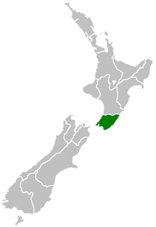
Wellington Region
The Wellington region of New Zealand occupies the southern end of the North Island.-Governance:The official Wellington Region, as administered by the Wellington Regional Council covers the conurbation around the capital city, Wellington, and the cities of Lower Hutt, Porirua, and Upper Hutt, each...
in general. Mt Matthews reaches a height of 940 metres and although not special on that account, it has significance in regard to its distinctive aspect as seen from Wellington
Wellington
Wellington is the capital city and third most populous urban area of New Zealand, although it is likely to have surpassed Christchurch due to the exodus following the Canterbury Earthquake. It is at the southwestern tip of the North Island, between Cook Strait and the Rimutaka Range...
the capital city of New Zealand
New Zealand
New Zealand is an island country in the south-western Pacific Ocean comprising two main landmasses and numerous smaller islands. The country is situated some east of Australia across the Tasman Sea, and roughly south of the Pacific island nations of New Caledonia, Fiji, and Tonga...
; it is the highest peak that can be seen on the sky line east of the city. The mountain reaches just above the bushline and can be climbed as a day hike without mountaineering equipment but is nevertheless a strenuous and steep climb and a full day should be allowed by the time access to the feet of the ranges is included. Access is gained either from the Wairarapa
Wairarapa
Wairarapa is a geographical region of New Zealand. It occupies the south-eastern corner of the North Island, east of metropolitan Wellington and south-west of the Hawke's Bay region. It is lightly populated, having several rural service towns, with Masterton being the largest...
(eastern) side of the Rimutakas or from the Orongorongo River
Orongorongo River
The Orongorongo River runs southwest through the Orongorongo Valley in the southern Rimutaka Ranges of the North Island of New Zealand. The river and its associated catchments lie within the bounds of the Rimutaka forest park, which is administered by the Department of Conservation For much of its...
that lies between Wellington and the ranges.