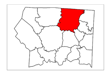
Mount Airy Township, Surry County, North Carolina
Encyclopedia

Surry County, North Carolina
Surry County is a county located in the U.S. state of North Carolina. As of 2010, the population was 73,673. Its county seat is Dobson.- History :The county was formed in 1771 from Rowan County...
. The township had a population of 24,828 according to the 2000 census
United States Census, 2000
The Twenty-second United States Census, known as Census 2000 and conducted by the Census Bureau, determined the resident population of the United States on April 1, 2000, to be 281,421,906, an increase of 13.2% over the 248,709,873 persons enumerated during the 1990 Census...
.
Geographically, Mount Airy Township occupies 43.1 square miles (111.6 km²) in northern Surry County, with its northern border being with the state of Virginia
Virginia
The Commonwealth of Virginia , is a U.S. state on the Atlantic Coast of the Southern United States. Virginia is nicknamed the "Old Dominion" and sometimes the "Mother of Presidents" after the eight U.S. presidents born there...
. Mount Airy Township is the most populated township of Surry County, accounting for nearly 35% of the total county population. The only incorporated municipality within Mount Airy Township is the City of Mount Airy
Mount Airy, North Carolina
Mount Airy is a city in Surry County, North Carolina, United States. As of the 2010 census, the city population was 10,388.-History:Mount Airy was settled in the 1750s as a stagecoach stop on the road between Winston-Salem and Galax, Virginia. It was named for a nearby plantation...
. Additionally, there are several smaller, unincorporated communities located here, including, Bannertown
Bannertown, North Carolina
Bannertown is an unincorporated community in Surry County, North Carolina just outside the city of Mount Airy . The community is centered around the intersection of Business U.S. Highway 52 and North Carolina Highway 89...
, Boones Hill
Boones Hill, North Carolina
Boones Hill is a small unincorporated community in the Mount Airy Township of northern Surry County, North Carolina, on the outskirts of the city of Mount Airy near Bannertown. The community is centered around the intersection of Business U.S. Highway 52 and U.S. Highway 52 Bypass south of...
, Flat Rock
Flat Rock, Surry County, North Carolina
Flat Rock is a census-designated place in Surry County, North Carolina, United States. The name "Flat Rock" stems from the community's granite quarry...
, Franklin
Franklin, Surry County, North Carolina
Franklin is a small unincorporated community in the Mount Airy Township of Surry County, North Carolina on the outskirts of the city of Mount Airy. The community is located on South Franklin Road just south of Toast. Area landmarks include Franklin Elementary School and Franklin Volunteer Fire...
, Salem
Salem, Surry County, North Carolina
Salem is an unincorporated community located in northern Surry County, North Carolina on the outskirts of the city of Mount Airy. The community generally lies between Lovills Creek the Ararat River . Prominent landmarks include Salem United Methodist Church....
, Sheltontown
Sheltontown, Surry County, North Carolina
Sheltontown is an unincorporated community located along North Carolina Highway 89 in northeast Surry County, North Carolina near the city of Mount Airy, just east of Bannertown. The community generally lies between Rutledge Creek and the Ararat River .-References:...
, Slate Mountain
Slate Mountain, Surry County, North Carolina
Slate Mountain is an unincorporated community located in northeast Surry County, North Carolina between the Ararat River and Archies Creek . The community of Slate Mountain is named for the nearby summit of Slate Mountain which has an elevation 1,966 feet....
, Toast
Toast, North Carolina
Toast is a census-designated place in Surry County, North Carolina, United States, located just west of Mount Airy, North Carolina. The population was 1,922 at the 2000 census.-Geography:Toast is located at ....
, White Plains
White Plains, North Carolina
White Plains is a census-designated place in Surry County, North Carolina, United States. The population was 1,049 at the 2000 census.- Geography :White Plains is located at ....
, and White Sulphur Springs
White Sulphur Springs, North Carolina
White Sulphur Springs is a small unincorporated community in Surry County, North Carolina on the outskirts of the city of Mount Airy near the Virginia state line. The community sits on the Ararat River and once served as a popular late-nineteenth century resort...
.

