

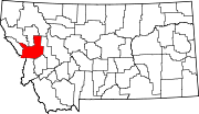
Missoula Metropolitan area
Encyclopedia
Decatur, Illinois
Decatur is the largest city and the county seat of Macon County in the U.S. state of Illinois. The city, sometimes called "the Soybean Capital of the World", was founded in 1823 and is located along the Sangamon River and Lake Decatur in Central Illinois. In 2000 the city population was 81,500,...
and Bismarck, North Dakota
Bismarck, North Dakota
Bismarck is the capital of the U.S. state of North Dakota and the county seat of Burleigh County. It is the second most populous city in North Dakota after Fargo. The city's population was 61,272 at the 2010 census, while its metropolitan population was 108,779...
.
It is one of the largest metropolitan areas between Boise, Idaho
Boise, Idaho
Boise is the capital and most populous city of the U.S. state of Idaho, as well as the county seat of Ada County. Located on the Boise River, it anchors the Boise City-Nampa metropolitan area and is the largest city between Salt Lake City, Utah and Portland, Oregon.As of the 2010 Census Bureau,...
and Calgary, Alberta Canada and Coeur d'Alene, Idaho
Coeur d'Alene, Idaho
Coeur d'Alene is the largest city and county seat of Kootenai County, Idaho, United States. It is the principal city of the Coeur d'Alene Metropolitan Statistical Area. Coeur d'Alene has the second largest metropolitan area in the state of Idaho. As of the 2010 census the population of Coeur...
and Billings, Montana
Billings, Montana
Billings is the largest city in the U.S. state of Montana, and is the principal city of the Billings Metropolitan Area, the largest metropolitan area in over...
.
Places with 1,000 to 10,000 inhabitants
- Bonner-West Riverside (Census-designated place)
- East Missoula (Census-designated place)
- LoloLolo, MontanaLolo is a census-designated place in Missoula County, Montana, United States. It is part of the 'Missoula, Montana Metropolitan Statistical Area'. The population was 3,388 at the 2000 census. It is home to Travelers' Rest State Park, a site where Lewis and Clark camped in 1805 and again in 1806...
(Census-designated places) - Orchard Homes (Census-designated places)
- Seeley LakeSeeley Lake, MontanaSeeley Lake is a census-designated place in Missoula County, Montana, United States. It is part of the 'Missoula, Montana Metropolitan Statistical Area'...
(Census-designated place)
Places with 500 to 1,000 inhabitants
- ClintonClinton, MontanaClinton is a census-designated place in Missoula County, Montana, United States. It is part of the 'Missoula, Montana Metropolitan Statistical Area'. The CDP was named for General Sir Henry Clinton...
(Census-designated place) - FrenchtownFrenchtown, MontanaFrenchtown is a census-designated place in Missoula County, Montana, United States. It is part of the 'Missoula, Montana Metropolitan Statistical Area'. The population was 883 at the 2000 census...
(Census-designated place) - WyeWye, MontanaWye is a census-designated place in Missoula County, Montana, United States. It is part of the 'Missoula, Montana Metropolitan Statistical Area'. The population was 381 at the 2000 census...
(Census-designated place)
Unincorporated places
- CondonCondon, MontanaCondon is an unincorporated community in Missoula County, Montana, United States.Condon is the site of a U.S. post office, using ZIP Code 59826. Mission Mountain School is located in the community and the U.S. Forest Service operates an airport in Condon....
(Unincorporated place) - Lolo Hot Springs, MontanaLolo Hot Springs, MontanaLolo Hot Springs is an unincorporated community in Missoula County, Montana, United States. It is centered around a commercial hot springs. It also contains a hotel and restaurant. It is the westernmost settlement along U.S. Highway 12 in Montana....
(Unincorporated place)
Demographics
As of the census of 2000, there were 95,802 people, 38,439 households, and 23,140 families residing in the county. The population density was 37 people per square mile (14/km²). There were 41,319 housing units at an average density of 16 per square mile (6/km²). The racial makeup of the county was:- 94.02% White
- 0.27% Black or African American
- 2.29% Native AmericanIndigenous peoples of the AmericasThe indigenous peoples of the Americas are the pre-Columbian inhabitants of North and South America, their descendants and other ethnic groups who are identified with those peoples. Indigenous peoples are known in Canada as Aboriginal peoples, and in the United States as Native Americans...
- 1.02% Asian
- 0.08% Pacific IslanderPacific IslanderPacific Islander , is a geographic term to describe the indigenous inhabitants of any of the three major sub-regions of Oceania: Polynesia, Melanesia and Micronesia.According to the Encyclopædia Britannica, these three regions, together with their islands consist of:Polynesia:...
- 0.45% from other races
- 1.86% from two or more races.
Historical Populations
| Census | Pop. | %± |
|---|---|---|
| 1870 | 2,554 | - |
| 1880 | 2,537 | -0.7% |
| 1890 | 14,427 | 468.7% |
| 1900 | 13,964 | −3.2% |
| 1910 | 23,596 | 69.0% |
| 1920 | 24,041 | 1.9% |
| 1930 | 21,782 | −9.4% |
| 1940 | 29,038 | 33.3% |
| 1950 | 35,493 | 22.2% |
| 1960 | 44,663 | 25.8% |
| 1970 | 58,263 | 30.5% |
| 1980 | 76,016 | 30.5% |
| 1990 | 78,687 | 3.5% |
| 2000 | 95,802 | 21.8% |
| 2010 | 109,299 | 14.1% |