Meadowlark Airport
Encyclopedia
Meadowlark Airport was a small general aviation
airport in Southern California
, about a mile east of the Pacific Ocean
in Huntington Beach
. Meadowlark's IATA airport code
was L16. The airport operated privately in the 1940s and operated publicly from the 1950s to 1989.
Yukio "Dick" Nerio, and later by Art Nerio, who could be identified as a lone bicycle-riding figure keeping an eye on things around the eighty-acre airfield.
When the airport opened several other small airfields were listed nearby, including Huntington Beach Airport, a small field with one hangar and fuel facilities built on a peat marsh in east Huntington Beach. Meadowlark Airport was initially a short strip used mostly by students to practice touch and go landings. The runway was first extended to 1750 feet (533.4 m) and paved, and then further extended to 2070 feet (630.9 m) with room for 150 aircraft. A few hangars, a restaurant, and fuel facilities were also added. The airport was between Heil Avenue and Warner Avenue. Plaza Ln. is a small street that runs through where the runway used to be.
Nerio planned to develop the airport into commercial buildings, offices and residential units.
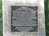
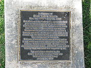
 Occupying the former airport site is the Summerlane community, within which is the Norma Brandell Gibbs Butterfly Park. Visitors to the park will note a plaque commemorating Dick Nerio and Meadowlark Airport.
General aviation
General aviation is one of the two categories of civil aviation. It refers to all flights other than military and scheduled airline and regular cargo flights, both private and commercial. General aviation flights range from gliders and powered parachutes to large, non-scheduled cargo jet flights...
airport in Southern California
Southern California
Southern California is a megaregion, or megapolitan area, in the southern area of the U.S. state of California. Large urban areas include Greater Los Angeles and Greater San Diego. The urban area stretches along the coast from Ventura through the Southland and Inland Empire to San Diego...
, about a mile east of the Pacific Ocean
Pacific Ocean
The Pacific Ocean is the largest of the Earth's oceanic divisions. It extends from the Arctic in the north to the Southern Ocean in the south, bounded by Asia and Australia in the west, and the Americas in the east.At 165.2 million square kilometres in area, this largest division of the World...
in Huntington Beach
Huntington Beach, California
Huntington Beach is a seaside city in Orange County in Southern California. According to the 2010 census, the city population was 189,992; making it the largest beach city in Orange County in terms of population...
. Meadowlark's IATA airport code
IATA airport code
An IATA airport code, also known an IATA location identifier, IATA station code or simply a location identifier, is a three-letter code designating many airports around the world, defined by the International Air Transport Association...
was L16. The airport operated privately in the 1940s and operated publicly from the 1950s to 1989.
History
Meadowlark was privately owned since 1947 by Nisei (Japanese American)Nisei
During the early years of World War II, Japanese Americans were forcibly relocated from their homes in the Pacific coast states because military leaders and public opinion combined to fan unproven fears of sabotage...
Yukio "Dick" Nerio, and later by Art Nerio, who could be identified as a lone bicycle-riding figure keeping an eye on things around the eighty-acre airfield.
When the airport opened several other small airfields were listed nearby, including Huntington Beach Airport, a small field with one hangar and fuel facilities built on a peat marsh in east Huntington Beach. Meadowlark Airport was initially a short strip used mostly by students to practice touch and go landings. The runway was first extended to 1750 feet (533.4 m) and paved, and then further extended to 2070 feet (630.9 m) with room for 150 aircraft. A few hangars, a restaurant, and fuel facilities were also added. The airport was between Heil Avenue and Warner Avenue. Plaza Ln. is a small street that runs through where the runway used to be.
Nerio planned to develop the airport into commercial buildings, offices and residential units.
Meadowlark today


